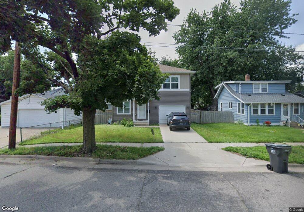
829 Algonquin Ave Saint Paul, MN 55119
Beaver Lake Heights NeighborhoodEstimated Value: $279,000 - $322,329
3
Beds
3
Baths
1,116
Sq Ft
$278/Sq Ft
Est. Value
About This Home
This home is located at 829 Algonquin Ave, Saint Paul, MN 55119 and is currently estimated at $310,332, approximately $278 per square foot. 829 Algonquin Ave is a home located in Ramsey County with nearby schools including Hazel Park Preparatory Academy, Battle Creek Middle School, and Johnson Senior High School.
Ownership History
Date
Name
Owned For
Owner Type
Purchase Details
Closed on
Sep 9, 2020
Sold by
Yang Kevin C and Chen Pei Yu
Bought by
Pezysilla Nickolas and Gorde Frzybilla Theresa
Current Estimated Value
Home Financials for this Owner
Home Financials are based on the most recent Mortgage that was taken out on this home.
Original Mortgage
$262,870
Outstanding Balance
$233,280
Interest Rate
2.9%
Mortgage Type
New Conventional
Estimated Equity
$77,052
Purchase Details
Closed on
Dec 29, 2017
Sold by
J L James Investment Group Llc
Bought by
Yang Kevin C and Chen Pei Yu
Home Financials for this Owner
Home Financials are based on the most recent Mortgage that was taken out on this home.
Original Mortgage
$227,797
Interest Rate
3.95%
Mortgage Type
FHA
Create a Home Valuation Report for This Property
The Home Valuation Report is an in-depth analysis detailing your home's value as well as a comparison with similar homes in the area
Home Values in the Area
Average Home Value in this Area
Purchase History
| Date | Buyer | Sale Price | Title Company |
|---|---|---|---|
| Pezysilla Nickolas | $271,000 | Parnters Title Llc | |
| Yang Kevin C | $232,000 | Partners Title Llc |
Source: Public Records
Mortgage History
| Date | Status | Borrower | Loan Amount |
|---|---|---|---|
| Open | Pezysilla Nickolas | $262,870 | |
| Previous Owner | Yang Kevin C | $227,797 |
Source: Public Records
Tax History
| Year | Tax Paid | Tax Assessment Tax Assessment Total Assessment is a certain percentage of the fair market value that is determined by local assessors to be the total taxable value of land and additions on the property. | Land | Improvement |
|---|---|---|---|---|
| 2025 | $4,992 | $343,900 | $30,000 | $313,900 |
| 2023 | $4,992 | $320,200 | $25,000 | $295,200 |
| 2022 | $4,348 | $311,700 | $25,000 | $286,700 |
| 2021 | $3,734 | $277,400 | $25,000 | $252,400 |
| 2020 | $3,524 | $249,500 | $13,900 | $235,600 |
| 2019 | $3,584 | $222,400 | $13,900 | $208,500 |
| 2018 | $364 | $222,400 | $13,900 | $208,500 |
| 2017 | $13 | $13,900 | $13,900 | $0 |
Source: Public Records
Map
Nearby Homes
- 834 Iroquois Ave
- 2047 Nokomis Ave
- 861 Algonquin Ave
- 2072 Mohawk Ave
- 2067 Nokomis Ave
- 2069 Manitou Ave
- 2034 Stillwater Ave E
- 2036 Stillwater Ave E
- 1978 Utica Ave
- 1981 Minnehaha Ave E
- 2084 Reaney Ave E
- 1954 Case Ave E
- 2156 Bush Ave E
- 1824 & 1822 Stillwater Ave E
- 1824 Sims Ave
- 1365 Howard St N Unit 1
- 1365 Howard St N Unit 3
- 1862 Ames Ave
- 1769 Ross Ave
- 1879 Ames Ave
- 833 Algonquin Ave
- 2011 Nokomis Ave
- 829 Agonquin Ave
- 1999 Nokomis Ave
- 838 Iroquois Ave
- 824 Iroquois Ave
- 832 Algonquin Ave
- 832 832 Algonquin-Avenue-
- 826 Iroquois Ave
- 834 Algonquin Ave
- 830 Algonquin Ave
- 838 Algonquin Ave
- 1985 Nokomis Ave
- 2033 2033 Nokomis-Avenue-
- 2008 Nokomis Ave
- 2033 Nokomis Ave
- 2004 Nokomis Ave
- 848 Iroquois Ave
- 843 Algonquin Ave
- 1990 Nokomis Ave
Your Personal Tour Guide
Ask me questions while you tour the home.