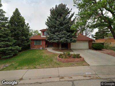
8320 W Calhoun Dr Littleton, CO 80123
Dutch Creek Village NeighborhoodEstimated Value: $651,898 - $714,000
5
Beds
7
Baths
2,185
Sq Ft
$311/Sq Ft
Est. Value
About This Home
This home is located at 8320 W Calhoun Dr, Littleton, CO 80123 and is currently estimated at $680,225, approximately $311 per square foot. 8320 W Calhoun Dr is a home located in Jefferson County with nearby schools including Leawood Elementary School, Ken Caryl Middle School, and Columbine High School.
Ownership History
Date
Name
Owned For
Owner Type
Purchase Details
Closed on
May 26, 1995
Sold by
Lanthorn Peter W and Lanthorn Teresa J
Bought by
Patricca Paul W and Patricca Gloria E
Current Estimated Value
Home Financials for this Owner
Home Financials are based on the most recent Mortgage that was taken out on this home.
Original Mortgage
$146,700
Interest Rate
8.18%
Create a Home Valuation Report for This Property
The Home Valuation Report is an in-depth analysis detailing your home's value as well as a comparison with similar homes in the area
Home Values in the Area
Average Home Value in this Area
Purchase History
| Date | Buyer | Sale Price | Title Company |
|---|---|---|---|
| Patricca Paul W | $163,000 | -- |
Source: Public Records
Mortgage History
| Date | Status | Borrower | Loan Amount |
|---|---|---|---|
| Open | Patricca Paul W | $200,000 | |
| Closed | Patricca Paul W | $170,000 | |
| Closed | Patricca Paul W | $127,000 | |
| Closed | Patricca Paul W | $52,365 | |
| Closed | Patricca Paul W | $49,247 | |
| Closed | Patricca Paul W | $138,458 | |
| Closed | Patricca Paul W | $50,000 | |
| Closed | Patricca Paul W | $146,200 | |
| Closed | Patricca Paul W | $146,700 |
Source: Public Records
Tax History Compared to Growth
Tax History
| Year | Tax Paid | Tax Assessment Tax Assessment Total Assessment is a certain percentage of the fair market value that is determined by local assessors to be the total taxable value of land and additions on the property. | Land | Improvement |
|---|---|---|---|---|
| 2024 | $2,549 | $33,883 | $11,505 | $22,378 |
| 2023 | $2,549 | $33,883 | $11,505 | $22,378 |
| 2022 | $2,356 | $31,593 | $8,683 | $22,910 |
| 2021 | $2,391 | $32,502 | $8,933 | $23,569 |
| 2020 | $2,057 | $29,038 | $7,211 | $21,827 |
| 2019 | $2,030 | $29,038 | $7,211 | $21,827 |
| 2018 | $1,905 | $27,100 | $7,450 | $19,650 |
| 2017 | $1,710 | $27,100 | $7,450 | $19,650 |
| 2016 | $1,447 | $24,212 | $6,803 | $17,409 |
| 2015 | $1,216 | $24,212 | $6,803 | $17,409 |
| 2014 | $1,216 | $20,740 | $5,433 | $15,307 |
Source: Public Records
Map
Nearby Homes
- 8150 W Calhoun Dr
- 6592 S Cody Way
- 8029 W Hoover Place
- 7814 W Ontario Place
- 7906 W Walker Dr
- 6852 S Dover Way
- 7822 W Ottawa Place
- 6434 S Dudley Way
- 6527 S Yarrow Way
- 7825 W Walker Dr
- 8893 W Ontario Ave
- 7753 W Plymouth Place
- 7490 W Coal Mine Ave Unit A
- 8133 W Quarto Ave
- 8436 W Quarles Place
- 6523 S Field Way
- 7600 W Coal Mine Ave Unit B
- 6705 S Field St Unit 801
- 6705 S Field St Unit 822
- 6705 S Field St Unit 803
- 8320 W Calhoun Dr
- 8300 W Calhoun Dr
- 6567 S Brentwood Way
- 6563 S Brentwood Way
- 8270 W Calhoun Dr
- 8319 W Calhoun Dr
- 8339 W Calhoun Dr
- 8279 W Calhoun Dr
- 6557 S Brentwood Way
- 8240 W Calhoun Dr
- 6566 S Brentwood Way
- 6586 S Brentwood Way
- 6556 S Brentwood Way
- 8240 W Hoover Place
- 6669 S Ammons Ct
- 6659 S Ammons Ct
- 6553 S Brentwood Way
- 8210 W Calhoun Dr
- 6596 S Brentwood Way
- 6546 S Brentwood Way