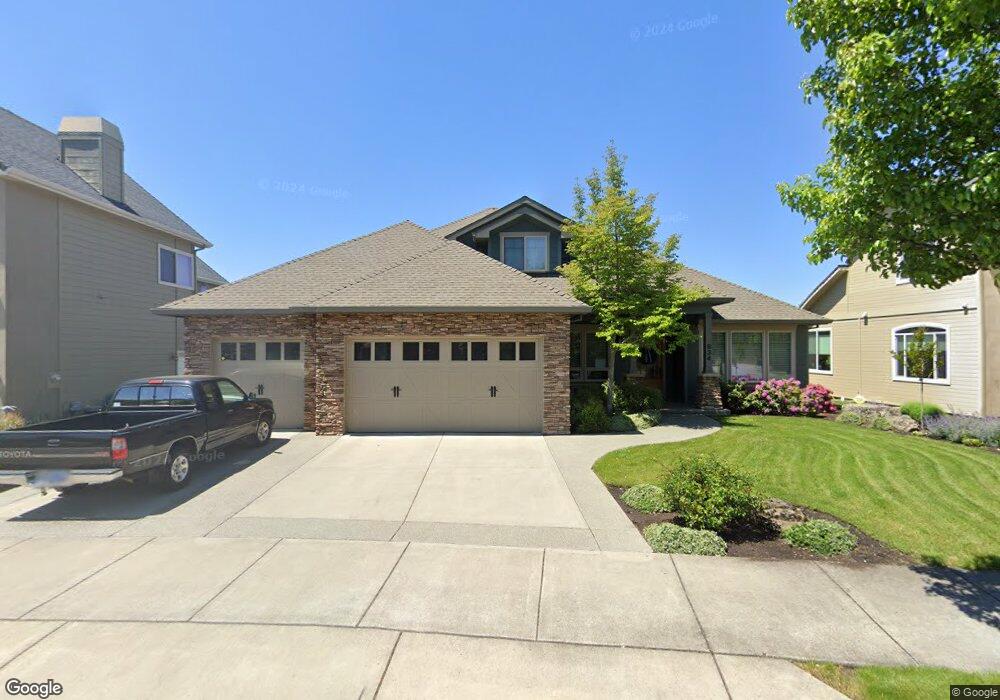
834 St Andrews Way Eagle Point, OR 97524
Estimated Value: $616,356 - $724,000
3
Beds
3
Baths
3,013
Sq Ft
$222/Sq Ft
Est. Value
About This Home
This home is located at 834 St Andrews Way, Eagle Point, OR 97524 and is currently estimated at $667,589, approximately $221 per square foot. 834 St Andrews Way is a home located in Jackson County with nearby schools including Eagle Point Middle School, White Mountain Middle School, and Eagle Point High School.
Ownership History
Date
Name
Owned For
Owner Type
Purchase Details
Closed on
May 12, 2009
Sold by
Howard Steven D and Howard Kristen G
Bought by
Howard Steven D and Howard Kristen G
Current Estimated Value
Home Financials for this Owner
Home Financials are based on the most recent Mortgage that was taken out on this home.
Original Mortgage
$232,000
Interest Rate
5.04%
Mortgage Type
New Conventional
Purchase Details
Closed on
Mar 27, 2009
Sold by
Howard Steven D and Howard Kristen G
Bought by
Howard Steven D and Howard Kristen G
Home Financials for this Owner
Home Financials are based on the most recent Mortgage that was taken out on this home.
Original Mortgage
$232,000
Interest Rate
5.04%
Mortgage Type
New Conventional
Create a Home Valuation Report for This Property
The Home Valuation Report is an in-depth analysis detailing your home's value as well as a comparison with similar homes in the area
Home Values in the Area
Average Home Value in this Area
Purchase History
| Date | Buyer | Sale Price | Title Company |
|---|---|---|---|
| Howard Steven D | -- | First American Title | |
| Howard Steven D | -- | First American Title |
Source: Public Records
Mortgage History
| Date | Status | Borrower | Loan Amount |
|---|---|---|---|
| Closed | Howard Steven D | $232,000 |
Source: Public Records
Tax History
| Year | Tax Paid | Tax Assessment Tax Assessment Total Assessment is a certain percentage of the fair market value that is determined by local assessors to be the total taxable value of land and additions on the property. | Land | Improvement |
|---|---|---|---|---|
| 2026 | $5,070 | $372,640 | -- | -- |
| 2025 | $4,951 | $361,790 | $136,820 | $224,970 |
| 2024 | $4,951 | $351,260 | $132,840 | $218,420 |
| 2023 | $4,783 | $341,030 | $128,970 | $212,060 |
| 2022 | $4,652 | $341,030 | $128,970 | $212,060 |
| 2021 | $4,515 | $331,100 | $125,210 | $205,890 |
| 2020 | $4,796 | $321,460 | $121,570 | $199,890 |
| 2019 | $4,722 | $303,010 | $114,580 | $188,430 |
| 2018 | $4,632 | $294,190 | $111,250 | $182,940 |
| 2017 | $4,519 | $294,190 | $111,250 | $182,940 |
| 2016 | $4,431 | $277,320 | $104,870 | $172,450 |
| 2015 | $4,286 | $277,320 | $104,870 | $172,450 |
| 2014 | $4,163 | $261,410 | $98,850 | $162,560 |
Source: Public Records
Map
Nearby Homes
- 888 Arrowhead Trail
- 964 Pumpkin Ridge
- 936 Arrowhead Trail
- 995 Pumpkin Ridge
- 997 Arrowhead Trail
- 131 Spanish Bay Ct
- 621 S Shasta Ave
- 522 Meadow Ln
- 1043 Arrowhead Trail
- 407 S Shasta Ave
- 421 Stevens Rd Unit 20
- 421 Stevens Rd Unit 14
- 421 Stevens Rd Unit 52
- 74 Eagle View Dr
- 235 Prairie Landing Dr
- 19 Pine Ct
- 0 Echo Way Unit Tax Lot 902
- 0 Echo Way Unit 220215112
- 0 Echo Way Unit Tax Lot 901
- 0 Echo Way Unit Tax Lot 900
- 828 St Andrews Lot 139 Way
- 828 St Andrews Way
- 840 St Andrews Way
- 833 St Andrews Way
- 824 St Andrews Way
- 1099 Oak Grove Ct
- 827 St Andrews Way
- 827 Saint Andrews Way
- 839 Saint Andrews Way
- 820 St Andrews Way
- 1097 Oak Grove Ct
- 821 St Andrews Way
- 41 Aspen Ct
- 845 St Andrews Way
- 816 St Andrews Way Unit L142
- 816 St Andrews Way
- 810 St Andrews Way
- 1091 Oak Grove Ct
- 1094 Oak Grove Ct
- 815 St Andrews Way
Your Personal Tour Guide
Ask me questions while you tour the home.