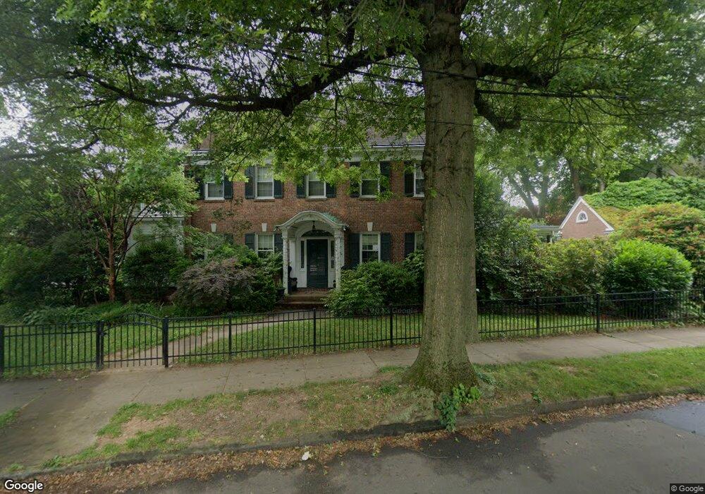
84 E Rock Rd New Haven, CT 06511
East Rock NeighborhoodEstimated Value: $1,208,619 - $1,373,000
4
Beds
5
Baths
2,840
Sq Ft
$460/Sq Ft
Est. Value
About This Home
This home is located at 84 E Rock Rd, New Haven, CT 06511 and is currently estimated at $1,306,540, approximately $460 per square foot. 84 E Rock Rd is a home located in New Haven County with nearby schools including Hamden Hall Country Day School, St. Thomas's Day School, and The Foote School.
Ownership History
Date
Name
Owned For
Owner Type
Purchase Details
Closed on
Aug 10, 2010
Sold by
Cohen Mathew and Cohen Revia
Bought by
Cardin Jessica Anne and Higley Michael
Current Estimated Value
Home Financials for this Owner
Home Financials are based on the most recent Mortgage that was taken out on this home.
Original Mortgage
$581,600
Interest Rate
4.73%
Purchase Details
Closed on
Jun 3, 2008
Sold by
Parker Elise
Bought by
Cohen Matthew and Cohen Revia
Create a Home Valuation Report for This Property
The Home Valuation Report is an in-depth analysis detailing your home's value as well as a comparison with similar homes in the area
Home Values in the Area
Average Home Value in this Area
Purchase History
| Date | Buyer | Sale Price | Title Company |
|---|---|---|---|
| Cardin Jessica Anne | $727,000 | -- | |
| Cohen Matthew | $570,000 | -- |
Source: Public Records
Mortgage History
| Date | Status | Borrower | Loan Amount |
|---|---|---|---|
| Open | Cohen Matthew | $577,500 | |
| Closed | Cohen Matthew | $581,600 | |
| Previous Owner | Cohen Matthew | $215,000 |
Source: Public Records
Tax History
| Year | Tax Paid | Tax Assessment Tax Assessment Total Assessment is a certain percentage of the fair market value that is determined by local assessors to be the total taxable value of land and additions on the property. | Land | Improvement |
|---|---|---|---|---|
| 2025 | $23,567 | $598,150 | $242,550 | $355,600 |
| 2024 | $23,029 | $598,150 | $242,550 | $355,600 |
| 2023 | $22,251 | $598,150 | $242,550 | $355,600 |
| 2022 | $23,776 | $598,150 | $242,550 | $355,600 |
| 2021 | $20,810 | $474,250 | $182,700 | $291,550 |
| 2020 | $20,761 | $473,130 | $182,700 | $290,430 |
| 2019 | $20,335 | $473,130 | $182,700 | $290,430 |
| 2018 | $20,335 | $473,130 | $182,700 | $290,430 |
| 2017 | $18,301 | $473,130 | $182,700 | $290,430 |
| 2016 | $20,287 | $488,250 | $205,590 | $282,660 |
| 2015 | $20,287 | $488,250 | $205,590 | $282,660 |
| 2014 | $20,287 | $488,250 | $205,590 | $282,660 |
Source: Public Records
Map
Nearby Homes
- 15 Edgehill Rd
- 144 Edgehill Rd
- 562 Whitney Ave
- 74 Cold Spring St
- 64 Cold Spring St
- 317 Willow St
- 53 Canner St Unit 4
- 63 Park Rd
- 500 Prospect St Unit 1E
- 53 Park Rd
- 130 Cottage St
- 126 Sheffield Ave
- 26 Lander St
- 622 Winchester Ave
- 133 Blake Rd
- 1002 Winchester Ave
- 245 Edwards St
- 37 Quaker Rd
- 131 Bryden Terrace
- 238 Newhall St
Your Personal Tour Guide
Ask me questions while you tour the home.