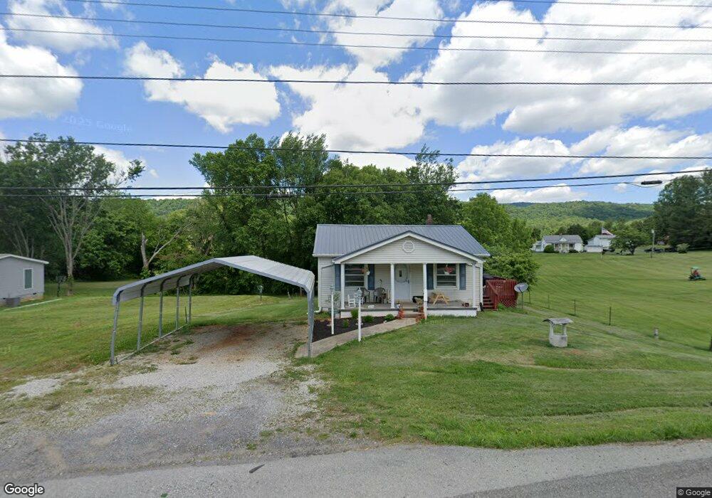
8467 Highway 11 W Rutledge, TN 37861
Estimated Value: $124,859 - $193,000
--
Bed
--
Bath
1,032
Sq Ft
$144/Sq Ft
Est. Value
About This Home
This home is located at 8467 Highway 11 W, Rutledge, TN 37861 and is currently estimated at $148,965, approximately $144 per square foot. 8467 Highway 11 W is a home with nearby schools including Rutledge Primary School, Rutledge Elementary School, and Rutledge Middle School.
Ownership History
Date
Name
Owned For
Owner Type
Purchase Details
Closed on
Aug 16, 2024
Sold by
Enfinger Lee Ella and Whaley Karen Darlene
Bought by
Henson Garrett A and Henson Cassie L
Current Estimated Value
Home Financials for this Owner
Home Financials are based on the most recent Mortgage that was taken out on this home.
Original Mortgage
$121,250
Outstanding Balance
$119,791
Interest Rate
6.95%
Mortgage Type
New Conventional
Estimated Equity
$29,174
Create a Home Valuation Report for This Property
The Home Valuation Report is an in-depth analysis detailing your home's value as well as a comparison with similar homes in the area
Home Values in the Area
Average Home Value in this Area
Purchase History
| Date | Buyer | Sale Price | Title Company |
|---|---|---|---|
| Henson Garrett A | $125,000 | None Listed On Document | |
| Henson Garrett A | $125,000 | None Listed On Document |
Source: Public Records
Mortgage History
| Date | Status | Borrower | Loan Amount |
|---|---|---|---|
| Open | Henson Garrett A | $121,250 | |
| Closed | Henson Garrett A | $121,250 |
Source: Public Records
Tax History Compared to Growth
Tax History
| Year | Tax Paid | Tax Assessment Tax Assessment Total Assessment is a certain percentage of the fair market value that is determined by local assessors to be the total taxable value of land and additions on the property. | Land | Improvement |
|---|---|---|---|---|
| 2025 | -- | $15,375 | $0 | $0 |
| 2024 | -- | $15,375 | $3,300 | $12,075 |
| 2023 | $361 | $15,375 | $3,300 | $12,075 |
| 2022 | $353 | $15,375 | $3,300 | $12,075 |
| 2021 | $353 | $15,375 | $3,300 | $12,075 |
| 2020 | $355 | $15,375 | $3,300 | $12,075 |
| 2019 | $355 | $12,675 | $2,650 | $10,025 |
| 2018 | $307 | $12,675 | $2,650 | $10,025 |
| 2017 | $307 | $12,675 | $2,650 | $10,025 |
| 2016 | $307 | $12,675 | $2,650 | $10,025 |
| 2015 | $335 | $12,675 | $2,650 | $10,025 |
| 2014 | $335 | $13,386 | $0 | $0 |
Source: Public Records
Map
Nearby Homes
- 8445 U S 11w
- 0 Silent Ln Unit 1299563
- 0 Poor Valley Rd Unit 1281719
- 0 Poor Valley Rd Unit 1220825
- 3500 Poor Valley Rd
- 979 Tennessee 92
- 979 Highway 92
- Lot 6 Scenic View Dr
- 1711 Rocky Branch Rd
- 172 W Hills Rd
- 5 Greenlee Rd
- 1264 Highway11 S
- 621 Carrol Greenlee Rd
- Lot 100 Shiloh Springs Rd
- Lot 64 Shiloh Springs Rd
- Lot 141 Tumbleweed Trail
- Lot 11 Pocahontas Ln
- 70 acres+- Perrin Hill Rd
- 0 Avondale Hollow Rd
- 0 Lester Jarnigan Rd Unit 707246
- 8467 U S 11w
- 8474 Highway 11w
- 8458 Highway 11 W
- 8445 Highway 11 W
- 8474 Rutledge Pike
- 179 Cherry St
- 161 Cherry St
- 107 Cherry St
- 8439 Rutledge Pike
- 8485 Highway 11w
- 136 Cherry St
- 8537 Rutledge Pike
- 122 Cherry St
- 112 Cherry St
- 104 Cherry St
- 170 Cherry St
- 146 Cherry St
- 146 Cherry St
- 8549 Rutledge Pike
- 233 Cherry St