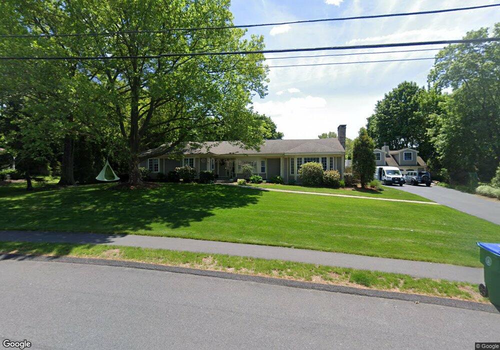
85 Phillips Brooks Rd Westwood, MA 02090
Estimated Value: $1,411,687 - $1,686,000
4
Beds
3
Baths
2,569
Sq Ft
$611/Sq Ft
Est. Value
About This Home
This home is located at 85 Phillips Brooks Rd, Westwood, MA 02090 and is currently estimated at $1,569,672, approximately $611 per square foot. 85 Phillips Brooks Rd is a home located in Norfolk County with nearby schools including Westwood High School, Dedham Country Day School, and St Catherine Of Siena School.
Ownership History
Date
Name
Owned For
Owner Type
Purchase Details
Closed on
Sep 17, 2010
Sold by
Hennessey Deborah S
Bought by
Horan Brooke M and Horan Joseph P
Current Estimated Value
Home Financials for this Owner
Home Financials are based on the most recent Mortgage that was taken out on this home.
Original Mortgage
$523,750
Outstanding Balance
$347,075
Interest Rate
4.51%
Mortgage Type
Purchase Money Mortgage
Estimated Equity
$1,222,597
Purchase Details
Closed on
Aug 27, 1991
Sold by
Needham Coop Bank
Bought by
Hennessey Deborah S
Purchase Details
Closed on
Jul 21, 1988
Sold by
Brown Edward
Bought by
Lynch James M
Create a Home Valuation Report for This Property
The Home Valuation Report is an in-depth analysis detailing your home's value as well as a comparison with similar homes in the area
Home Values in the Area
Average Home Value in this Area
Purchase History
| Date | Buyer | Sale Price | Title Company |
|---|---|---|---|
| Horan Brooke M | $720,000 | -- | |
| Hennessey Deborah S | $278,000 | -- | |
| Lynch James M | $360,000 | -- |
Source: Public Records
Mortgage History
| Date | Status | Borrower | Loan Amount |
|---|---|---|---|
| Open | Horan Brooke M | $523,750 | |
| Closed | Lynch James M | $123,998 | |
| Previous Owner | Lynch James M | $30,000 |
Source: Public Records
Tax History Compared to Growth
Tax History
| Year | Tax Paid | Tax Assessment Tax Assessment Total Assessment is a certain percentage of the fair market value that is determined by local assessors to be the total taxable value of land and additions on the property. | Land | Improvement |
|---|---|---|---|---|
| 2025 | $15,012 | $1,172,800 | $586,200 | $586,600 |
| 2024 | $15,679 | $1,224,000 | $558,400 | $665,600 |
| 2023 | $13,534 | $946,400 | $465,600 | $480,800 |
| 2022 | $13,298 | $896,700 | $393,550 | $503,150 |
| 2021 | $13,309 | $900,500 | $374,950 | $525,550 |
| 2020 | $12,631 | $870,500 | $374,950 | $495,550 |
| 2019 | $12,001 | $819,200 | $356,700 | $462,500 |
| 2018 | $11,699 | $775,300 | $356,700 | $418,600 |
| 2017 | $11,079 | $760,400 | $356,700 | $403,700 |
| 2016 | $10,707 | $730,350 | $356,700 | $373,650 |
| 2015 | $11,039 | $724,350 | $356,700 | $367,650 |
Source: Public Records
Map
Nearby Homes
- 19 Cushing Rd
- 355 Canton St
- 102 Smith Dr
- 290 East St
- 243 Weatherbee Dr
- 24 Overlook Ave
- 215 Blue Hill Dr
- 187 Vincent Rd
- 44 Willard St
- 11 Granite St
- 34 Cranberry Ln
- 29 S Gate St
- 84 Juniper Ridge Rd
- 298 Washington St Unit 302
- 50 Fairview St
- 16 Norwich St
- 360 Blue Hill Dr
- 102 Parker St
- 989 East St Unit 107
- 989 East St Unit 403
- 91 Phillips Brooks Rd
- 79 Phillips Brooks Rd
- 96 Strasser Ave
- 165 Phillips Brooks Rd
- 78 Strasser Ave
- 92 Phillips Brooks Rd
- 151 Phillips Brooks Rd
- 139 Phillips Brooks Rd
- 78 Phillips Brooks Rd
- 69 Phillips Brooks Rd
- 105 Phillips Brooks Rd
- 68 Strasser Ave
- 127 Phillips Brooks Rd
- 68 Phillips Brooks Rd
- 102 Phillips Brooks Rd
- 61 Phillips Brooks Rd
- 158 Phillips Brooks Rd
- 60 Strasser Ave
- 106 Strasser Ave
- 85 Strasser Ave