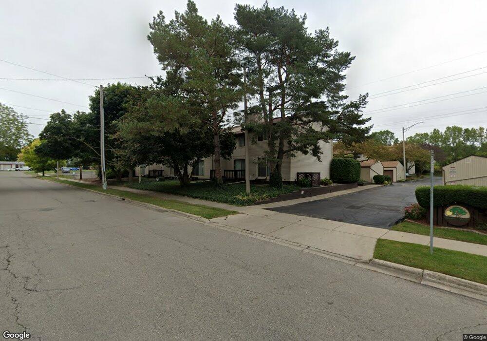
854 Armstrong Rd Unit 2 Lansing, MI 48911
Southern Lansing NeighborhoodEstimated Value: $99,171 - $116,000
2
Beds
2
Baths
504
Sq Ft
$209/Sq Ft
Est. Value
About This Home
This home is located at 854 Armstrong Rd Unit 2, Lansing, MI 48911 and is currently estimated at $105,543, approximately $209 per square foot. 854 Armstrong Rd Unit 2 is a home located in Ingham County with nearby schools including Kendon School, Attwood School, and Everett High School.
Ownership History
Date
Name
Owned For
Owner Type
Purchase Details
Closed on
May 27, 2009
Sold by
Donovan Shaun
Bought by
Ford Donna L
Current Estimated Value
Purchase Details
Closed on
Oct 13, 2008
Sold by
Citimortgage Inc
Bought by
The Secretary Of Housing & Urban Develop
Purchase Details
Closed on
Apr 10, 2008
Sold by
Price Julianne
Bought by
Citimortgage Inc
Purchase Details
Closed on
Apr 11, 2000
Sold by
Scott Paul D and Scott Deborah A
Bought by
Price Julianne
Home Financials for this Owner
Home Financials are based on the most recent Mortgage that was taken out on this home.
Original Mortgage
$62,665
Interest Rate
8.29%
Mortgage Type
FHA
Purchase Details
Closed on
Sep 8, 1999
Sold by
Gallante Joseph M and Gallante Tina M
Bought by
Scott Paul D
Purchase Details
Closed on
Jul 25, 1996
Sold by
Gallante Joseph
Bought by
Scott Paul D
Create a Home Valuation Report for This Property
The Home Valuation Report is an in-depth analysis detailing your home's value as well as a comparison with similar homes in the area
Home Values in the Area
Average Home Value in this Area
Purchase History
| Date | Buyer | Sale Price | Title Company |
|---|---|---|---|
| Ford Donna L | $30,000 | None Available | |
| The Secretary Of Housing & Urban Develop | -- | None Available | |
| Citimortgage Inc | $65,927 | None Available | |
| Price Julianne | $65,900 | -- | |
| Scott Paul D | -- | Midstate Title Company | |
| Scott Paul D | $64,000 | -- |
Source: Public Records
Mortgage History
| Date | Status | Borrower | Loan Amount |
|---|---|---|---|
| Previous Owner | Price Julianne | $62,665 |
Source: Public Records
Tax History
| Year | Tax Paid | Tax Assessment Tax Assessment Total Assessment is a certain percentage of the fair market value that is determined by local assessors to be the total taxable value of land and additions on the property. | Land | Improvement |
|---|---|---|---|---|
| 2025 | $1,775 | $44,000 | $3,500 | $40,500 |
| 2024 | $15 | $37,500 | $3,500 | $34,000 |
| 2023 | $1,661 | $33,900 | $3,500 | $30,400 |
| 2022 | $252 | $30,200 | $1,300 | $28,900 |
| 2021 | $1,461 | $27,700 | $1,300 | $26,400 |
| 2020 | $1,453 | $27,400 | $1,300 | $26,100 |
| 2019 | $1,396 | $26,700 | $1,300 | $25,400 |
| 2018 | $1,304 | $23,800 | $1,300 | $22,500 |
| 2017 | $1,280 | $23,800 | $1,300 | $22,500 |
| 2016 | $1,238 | $23,300 | $1,300 | $22,000 |
| 2015 | $1,238 | $23,100 | $2,500 | $20,600 |
| 2014 | $1,238 | $23,000 | $2,500 | $20,500 |
Source: Public Records
Map
Nearby Homes
- 1115 Shirley St
- 1109 Barr Ave
- 5808 Orchard Ct
- 4815 S Pennsylvania Ave
- 4719 S Pennsylvania Ave
- 1101 Kendon Dr
- 208 E Northrup St
- 205 E Jolly Rd Unit 6
- 201 E Syringa Dr
- 629 Emily Ave
- 115 E Claremore Dr
- 0 Glenwood Ave
- 600 E Cavanaugh Rd
- 522 E Cavanaugh Rd
- 801 Jessop Ave
- 817 Jessop Ave
- 709 Jessop Ave
- 810 Fenton St
- 601 Jessop Ave
- 111 E Potter Ave
- 852 Armstrong Rd
- 856 Armstrong Rd Unit 3
- 858 Armstrong Rd
- 860 Armstrong Rd
- 860 Armstrong Rd Unit 5
- 862 Armstrong Rd Unit 6
- 826 Armstrong Rd
- 826 Armstrong Rd Unit 19
- 828 Armstrong Rd Unit 18
- 824 Armstrong Rd Unit 20
- 844 Armstrong Rd
- 844 Armstrong Rd Unit 10
- 830 Armstrong Rd Unit 17
- 848 Armstrong Rd
- 846 Armstrong Rd
- 832 Armstrong Rd Unit 16
- 834 Armstrong Rd Unit 15
- 850 Armstrong Rd Unit 7
- 836 Armstrong Rd
Your Personal Tour Guide
Ask me questions while you tour the home.