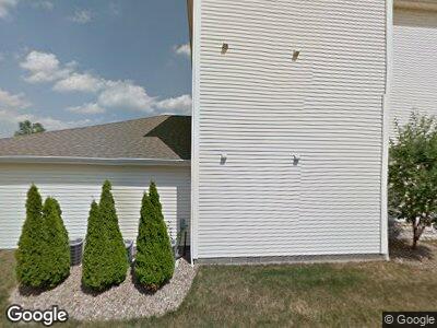
863 Cedar Way Unit 401 Youngstown, OH 44512
Estimated Value: $157,491 - $539,000
2
Beds
2
Baths
1,082
Sq Ft
$243/Sq Ft
Est. Value
About This Home
This home is located at 863 Cedar Way Unit 401, Youngstown, OH 44512 and is currently estimated at $262,623, approximately $242 per square foot. 863 Cedar Way Unit 401 is a home located in Mahoning County with nearby schools including Robinwood Lane Elementary School, Boardman Glenwood Junior High School, and Boardman High School.
Ownership History
Date
Name
Owned For
Owner Type
Purchase Details
Closed on
Apr 30, 2008
Sold by
Master Plan Builders Inc
Bought by
Roach Matthew David
Current Estimated Value
Home Financials for this Owner
Home Financials are based on the most recent Mortgage that was taken out on this home.
Original Mortgage
$17,325
Outstanding Balance
$11,872
Interest Rate
6.99%
Mortgage Type
Adjustable Rate Mortgage/ARM
Estimated Equity
$167,764
Create a Home Valuation Report for This Property
The Home Valuation Report is an in-depth analysis detailing your home's value as well as a comparison with similar homes in the area
Home Values in the Area
Average Home Value in this Area
Purchase History
| Date | Buyer | Sale Price | Title Company |
|---|---|---|---|
| Roach Matthew David | $115,500 | None Available |
Source: Public Records
Mortgage History
| Date | Status | Borrower | Loan Amount |
|---|---|---|---|
| Open | Roach Matthew David | $17,325 | |
| Open | Roach Matthew David | $92,400 |
Source: Public Records
Tax History Compared to Growth
Tax History
| Year | Tax Paid | Tax Assessment Tax Assessment Total Assessment is a certain percentage of the fair market value that is determined by local assessors to be the total taxable value of land and additions on the property. | Land | Improvement |
|---|---|---|---|---|
| 2024 | $2,277 | $45,040 | $5,250 | $39,790 |
| 2023 | $2,246 | $45,040 | $5,250 | $39,790 |
| 2022 | $2,226 | $34,150 | $5,250 | $28,900 |
| 2021 | $2,227 | $34,150 | $5,250 | $28,900 |
| 2020 | $2,238 | $34,150 | $5,250 | $28,900 |
| 2019 | $2,085 | $28,460 | $4,380 | $24,080 |
| 2018 | $1,805 | $28,460 | $4,380 | $24,080 |
| 2017 | $1,802 | $28,460 | $4,380 | $24,080 |
| 2016 | $2,286 | $35,750 | $4,380 | $31,370 |
| 2015 | $2,240 | $35,750 | $4,380 | $31,370 |
| 2014 | $2,246 | $35,750 | $4,380 | $31,370 |
| 2013 | $2,218 | $35,750 | $4,380 | $31,370 |
Source: Public Records
Map
Nearby Homes
- 771 Oakridge Dr
- 8360 South Ave
- 911 Larkridge Ave
- 829 Larkridge Ave
- 790 Larkridge Ave
- 7386 Eisenhower Dr Unit 6
- 876 Pearson Cir Unit 1
- 7404 Eisenhower Dr Unit 7
- 1722 Lynn Mar Ave
- 1826 Johnston Place
- 7592 Sugar Creek Dr
- 681 Cook Ave
- 1822 Canavan Dr
- 688 Cook Ave
- 5483 South Ave
- 1954 Cover Dr
- 34 Delaware Ave
- 0 Mathews Rd Unit 5038026
- 680 Saddlebrook Dr
- 420 Afton Ave
- 863 Cedar Way
- 863 Cedar Way
- 863 Cedar Way Unit 603
- 863 Cedar Way
- 863 Cedar Way
- 863 Cedar Way Unit 806
- 863 Cedar Way Unit 805
- 863 Cedar Way Unit 804
- 863 Cedar Way Unit 803
- 863 Cedar Way Unit 802
- 863 Cedar Way
- 863 Cedar Way Unit 406
- 863 Cedar Way Unit 405
- 863 Cedar Way Unit 404
- 863 Cedar Way Unit 403
- 863 Cedar Way Unit 402
- 863 Cedar Way Unit 401
- 863 Cedar Way Unit 606
- 863 Cedar Way Unit 604
- 863 Cedar Way Unit 605
