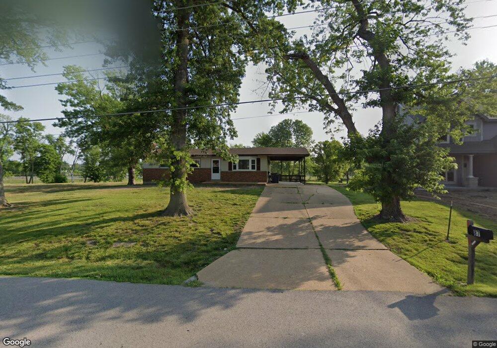
87 Augustine Rd Unit A Eureka, MO 63025
Estimated Value: $261,000 - $559,000
4
Beds
3
Baths
2,399
Sq Ft
$188/Sq Ft
Est. Value
About This Home
This home is located at 87 Augustine Rd Unit A, Eureka, MO 63025 and is currently estimated at $452,000, approximately $188 per square foot. 87 Augustine Rd Unit A is a home located in St. Louis County with nearby schools including Blevins Elementary School, Lasalle Springs Middle School, and Eureka Senior High School.
Ownership History
Date
Name
Owned For
Owner Type
Purchase Details
Closed on
Dec 21, 2023
Sold by
Lubker Ryan
Bought by
Belles Dylan and Cunningham Megan
Current Estimated Value
Home Financials for this Owner
Home Financials are based on the most recent Mortgage that was taken out on this home.
Original Mortgage
$391,200
Outstanding Balance
$383,281
Interest Rate
7.44%
Mortgage Type
New Conventional
Estimated Equity
$68,719
Purchase Details
Closed on
Jun 1, 2023
Sold by
Lubker Ryan
Bought by
Siebels Michael J and Siebels Erica R
Purchase Details
Closed on
Jun 25, 2021
Sold by
Porter April and Porter Brian
Bought by
Lubker Ryan
Create a Home Valuation Report for This Property
The Home Valuation Report is an in-depth analysis detailing your home's value as well as a comparison with similar homes in the area
Home Values in the Area
Average Home Value in this Area
Purchase History
| Date | Buyer | Sale Price | Title Company |
|---|---|---|---|
| Belles Dylan | -- | Investors Title Company | |
| Siebels Michael J | -- | None Listed On Document | |
| Lubker Ryan | $45,000 | Title Partners Agency Llc |
Source: Public Records
Mortgage History
| Date | Status | Borrower | Loan Amount |
|---|---|---|---|
| Open | Belles Dylan | $391,200 |
Source: Public Records
Tax History
| Year | Tax Paid | Tax Assessment Tax Assessment Total Assessment is a certain percentage of the fair market value that is determined by local assessors to be the total taxable value of land and additions on the property. | Land | Improvement |
|---|---|---|---|---|
| 2025 | $389 | $95,820 | $24,020 | $71,800 |
| 2024 | $389 | $5,210 | $5,210 | -- |
| 2023 | $389 | $5,210 | $5,210 | $0 |
| 2022 | $447 | $5,570 | $5,570 | $0 |
| 2021 | $444 | $5,570 | $5,570 | $0 |
| 2020 | $239 | $2,870 | $2,870 | $0 |
| 2019 | $240 | $2,870 | $2,870 | $0 |
| 2018 | $192 | $2,170 | $2,170 | $0 |
| 2017 | $185 | $2,170 | $2,170 | $0 |
| 2016 | $193 | $2,170 | $2,170 | $0 |
| 2015 | $191 | $2,170 | $2,170 | $0 |
| 2014 | $116 | $1,290 | $1,290 | $0 |
Source: Public Records
Map
Nearby Homes
- 318 Kevin Jon Ct
- 329 Kevin Jon Ct
- 369 Cerny Ave
- 118 Towne Square Ct Unit D4
- 125 Towne Square Ct Unit 4E
- 75 Old Farmhouse Way
- 826 Lower Field Ln
- 808 Lower Field Ln
- 830 Lower Field Ln
- 83 Old Farmhouse Way
- 814 Eureka Rd
- 1000 Eureka Rd
- 637 N Virginia Ave
- 345 Palisades Ridge Ct
- 331 Artic Fox Ct
- 1075 Eureka Rd
- 15 Rockwood Place Ct
- 412 Parkview Ln
- 3 Leona Ln
- 944 Emerald Oaks Ct
- 87 Augustine Rd
- 89 Augustine Rd
- 83 Augustine Rd
- 93 Augustine Rd
- 2 Bblt Steeple Hill Prescott
- 2 Bblt Steeple Hill Barrington
- 81 Augustine Rd
- 2 Bblt Steeple Hill Liberty
- 2 Bblt Steeple Hill Westhampton
- 2 Bblt Steeple Hill Arlington
- 0TBB Steeple Hill Est - Richmond
- 0TBB Steeple Hill Est - Brookfield
- 0TBB Steeple Hill Est - Arlington
- 0TBB Steeple Hill Est -Brookfield
- 0TBB Steeple Hill Est -Richmond
- 2 Bblt Steeple Hill Richmond
- 2 Bblt Steeple Hill Brookfield
- 0TBB Steeple Hill Est - Prescott
- 0TBB Steeple Hill Est - Madison
- 0TBB Steeple Hill Est -Prescott
Your Personal Tour Guide
Ask me questions while you tour the home.