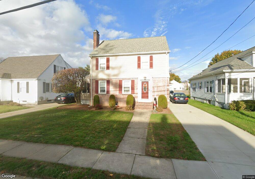
87 Richland Rd Cranston, RI 02910
Forest Hills NeighborhoodEstimated Value: $392,000 - $545,000
3
Beds
2
Baths
1,900
Sq Ft
$234/Sq Ft
Est. Value
About This Home
This home is located at 87 Richland Rd, Cranston, RI 02910 and is currently estimated at $443,651, approximately $233 per square foot. 87 Richland Rd is a home located in Providence County with nearby schools including Woodridge Elementary School, Western Hills Middle School, and Cranston High School West.
Ownership History
Date
Name
Owned For
Owner Type
Purchase Details
Closed on
Oct 2, 1996
Sold by
Vendetti Michael J
Bought by
Singleton Robert R and Singleton Mary
Current Estimated Value
Home Financials for this Owner
Home Financials are based on the most recent Mortgage that was taken out on this home.
Original Mortgage
$109,250
Interest Rate
7.9%
Purchase Details
Closed on
Oct 3, 1991
Sold by
Shepard Dorothy M
Bought by
Vendetti Michael J
Home Financials for this Owner
Home Financials are based on the most recent Mortgage that was taken out on this home.
Original Mortgage
$99,850
Interest Rate
9.08%
Create a Home Valuation Report for This Property
The Home Valuation Report is an in-depth analysis detailing your home's value as well as a comparison with similar homes in the area
Home Values in the Area
Average Home Value in this Area
Purchase History
| Date | Buyer | Sale Price | Title Company |
|---|---|---|---|
| Singleton Robert R | $115,000 | -- | |
| Vendetti Michael J | $99,500 | -- |
Source: Public Records
Mortgage History
| Date | Status | Borrower | Loan Amount |
|---|---|---|---|
| Open | Vendetti Michael J | $94,000 | |
| Closed | Vendetti Michael J | $107,000 | |
| Closed | Vendetti Michael J | $109,250 | |
| Previous Owner | Vendetti Michael J | $99,850 |
Source: Public Records
Tax History
| Year | Tax Paid | Tax Assessment Tax Assessment Total Assessment is a certain percentage of the fair market value that is determined by local assessors to be the total taxable value of land and additions on the property. | Land | Improvement |
|---|---|---|---|---|
| 2025 | $4,593 | $330,900 | $102,000 | $228,900 |
| 2024 | $4,504 | $330,900 | $102,000 | $228,900 |
| 2023 | $4,334 | $229,300 | $70,400 | $158,900 |
| 2022 | $4,244 | $229,300 | $70,400 | $158,900 |
| 2021 | $4,127 | $229,300 | $70,400 | $158,900 |
| 2020 | $4,189 | $201,700 | $73,700 | $128,000 |
| 2019 | $4,189 | $201,700 | $73,700 | $128,000 |
| 2018 | $4,092 | $201,700 | $73,700 | $128,000 |
| 2017 | $4,248 | $185,200 | $67,000 | $118,200 |
| 2016 | $4,158 | $185,200 | $67,000 | $118,200 |
| 2015 | $4,158 | $185,200 | $67,000 | $118,200 |
| 2014 | $3,951 | $173,000 | $67,000 | $106,000 |
Source: Public Records
Map
Nearby Homes
- 91 Richland Rd
- 83 Richland Rd
- 79 Richland Rd
- 68 Knollwood Ave
- 120 Calaman Rd
- 122 Calaman Rd
- 108 Calaman Rd
- 88 Richland Rd
- 80 Knollwood Ave
- 84 Richland Rd
- 75 Richland Rd
- 98 Calaman Rd
- 80 Richland Rd
- 77 Crothers Ave
- 94 Calaman Rd
- 71 Richland Rd
- 76 Richland Rd
- 73 Crothers Ave
- 90 Knollwood Ave
- 73 Knollwood Ave
Your Personal Tour Guide
Ask me questions while you tour the home.