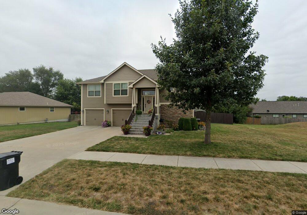
8780 Nellie Dr Manhattan, KS 66502
Estimated Value: $297,000 - $357,000
3
Beds
3
Baths
1,406
Sq Ft
$234/Sq Ft
Est. Value
About This Home
This home is located at 8780 Nellie Dr, Manhattan, KS 66502 and is currently estimated at $329,172, approximately $234 per square foot. 8780 Nellie Dr is a home with nearby schools including Woodrow Wilson Elementary School, Dwight D. Eisenhower Middle School, and Manhattan High School.
Ownership History
Date
Name
Owned For
Owner Type
Purchase Details
Closed on
Oct 25, 2012
Sold by
Nelsons Ridge Llc
Bought by
Drippe Construction Inc
Current Estimated Value
Home Financials for this Owner
Home Financials are based on the most recent Mortgage that was taken out on this home.
Original Mortgage
$192,091
Interest Rate
3.42%
Mortgage Type
FHA
Purchase Details
Closed on
Oct 15, 2012
Sold by
Drippe Construction Inc
Bought by
Olson Justin and Olson Erin
Home Financials for this Owner
Home Financials are based on the most recent Mortgage that was taken out on this home.
Original Mortgage
$192,091
Interest Rate
3.42%
Mortgage Type
FHA
Create a Home Valuation Report for This Property
The Home Valuation Report is an in-depth analysis detailing your home's value as well as a comparison with similar homes in the area
Home Values in the Area
Average Home Value in this Area
Purchase History
| Date | Buyer | Sale Price | Title Company |
|---|---|---|---|
| Drippe Construction Inc | -- | None Available | |
| Olson Justin | -- | None Available |
Source: Public Records
Mortgage History
| Date | Status | Borrower | Loan Amount |
|---|---|---|---|
| Previous Owner | Olson Justin | $192,091 |
Source: Public Records
Tax History Compared to Growth
Tax History
| Year | Tax Paid | Tax Assessment Tax Assessment Total Assessment is a certain percentage of the fair market value that is determined by local assessors to be the total taxable value of land and additions on the property. | Land | Improvement |
|---|---|---|---|---|
| 2025 | $1,295 | $32,426 | $3,374 | $29,052 |
| 2024 | $44 | $32,215 | $3,427 | $28,788 |
| 2023 | $4,363 | $31,386 | $3,386 | $28,000 |
| 2022 | $4,034 | $27,531 | $3,419 | $24,112 |
| 2021 | $4,034 | $27,108 | $3,281 | $23,827 |
| 2020 | $4,034 | $26,946 | $3,281 | $23,665 |
| 2019 | $3,948 | $26,740 | $3,143 | $23,597 |
| 2018 | $3,803 | $25,879 | $2,959 | $22,920 |
| 2017 | $3,687 | $25,068 | $2,652 | $22,416 |
| 2016 | $3,603 | $24,360 | $2,494 | $21,866 |
| 2015 | -- | $23,334 | $2,706 | $20,628 |
| 2014 | -- | $23,046 | $2,782 | $20,264 |
Source: Public Records
Map
Nearby Homes
- 4314 Aspen Dr
- 4319 Aspen Dr
- 8635 Williams
- 8717 Kinzie Jo's Way
- Sutton Plan at Nelson Ridge
- Scorpio Plan at Nelson Ridge
- Olivia Plan at Nelson Ridge
- Noah Plan at Nelson Ridge
- Nicholas Plan at Nelson Ridge
- Nadia Plan at Nelson Ridge
- Madeline Plan at Nelson Ridge
- Lucas Plan at Nelson Ridge
- Liam Plan at Nelson Ridge
- Kyler Plan at Nelson Ridge
- Lennon Plan at Nelson Ridge
- Kate Plan at Nelson Ridge
- Heidi Plan at Nelson Ridge
- Elsa Plan at Nelson Ridge
- Blake Plan at Nelson Ridge
- Colton Plan at Nelson Ridge