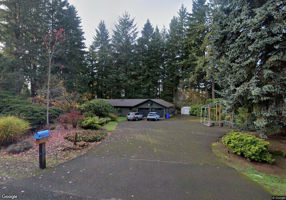
88032 Grandview Dr Springfield, OR 97478
Estimated Value: $508,741 - $602,000
3
Beds
1
Bath
1,320
Sq Ft
$413/Sq Ft
Est. Value
About This Home
This home is located at 88032 Grandview Dr, Springfield, OR 97478 and is currently estimated at $544,685, approximately $412 per square foot. 88032 Grandview Dr is a home located in Lane County with nearby schools including Walterville Elementary School, Briggs Middle School, and Thurston High School.
Ownership History
Date
Name
Owned For
Owner Type
Purchase Details
Closed on
Apr 26, 2002
Sold by
Rhoads Roger T and Rhoads Shirley M
Bought by
Porter Tom E and Porter Jane Ann
Current Estimated Value
Home Financials for this Owner
Home Financials are based on the most recent Mortgage that was taken out on this home.
Original Mortgage
$143,920
Outstanding Balance
$60,203
Interest Rate
7.08%
Estimated Equity
$484,482
Create a Home Valuation Report for This Property
The Home Valuation Report is an in-depth analysis detailing your home's value as well as a comparison with similar homes in the area
Home Values in the Area
Average Home Value in this Area
Purchase History
| Date | Buyer | Sale Price | Title Company |
|---|---|---|---|
| Porter Tom E | $179,900 | Fidelity National Title Co |
Source: Public Records
Mortgage History
| Date | Status | Borrower | Loan Amount |
|---|---|---|---|
| Open | Porter Tom E | $143,920 | |
| Closed | Porter Tom E | $35,980 |
Source: Public Records
Tax History Compared to Growth
Tax History
| Year | Tax Paid | Tax Assessment Tax Assessment Total Assessment is a certain percentage of the fair market value that is determined by local assessors to be the total taxable value of land and additions on the property. | Land | Improvement |
|---|---|---|---|---|
| 2025 | $3,772 | $276,353 | -- | -- |
| 2024 | $3,535 | $268,304 | -- | -- |
| 2023 | $3,535 | $260,490 | $0 | $0 |
| 2022 | $3,366 | $252,903 | $0 | $0 |
| 2021 | $3,286 | $245,537 | $0 | $0 |
| 2020 | $3,187 | $238,386 | $0 | $0 |
| 2019 | $3,034 | $231,443 | $0 | $0 |
| 2018 | $2,937 | $218,157 | $0 | $0 |
| 2017 | $2,835 | $218,157 | $0 | $0 |
| 2016 | $2,760 | $211,803 | $0 | $0 |
| 2015 | $2,688 | $205,634 | $0 | $0 |
| 2014 | $2,607 | $199,645 | $0 | $0 |
Source: Public Records
Map
Nearby Homes
- 0 Tonga Ln
- 40365 Tonga Ln
- 40153 Booth Kelly Rd
- 40971 Deerhorn Rd
- 39136 Easton Ln
- 39125 Easton Ln
- 41886 Deerhorn Rd
- 89011 Bridge St
- 0000 Whitewater Rd Unit 2332
- 87886 Cedar Flat Rd
- 41929 Deerhorn Rd
- 0 Bridge St
- 38350 Mckenzie Hwy
- 87250 Cedar Flat Rd
- 0 Upper Camp Creek Rd Unit 734099093
- 0 Upper Camp Creek Rd Unit 473471921
- 88692 Ermi Bee Rd
- 42799 Leaburg Dr
- 0 S B St Unit 488241963
- 37276 Camp Creek Rd
- 88044 Grandview Dr
- 88016 Grandview Dr
- 40433 Booth Kelly Rd
- 40331 Tonga Ln
- 40429 Booth Kelly Rd
- 88077 Keola Ln
- 88059 Keola Ln
- 40310 Tonga Ln
- 40426 Booth Kelly Rd
- 40334 Tonga Ln
- 40287 Tonga Ln
- 40356 Tonga Ln
- 88020 Keola Ct
- 88038 Keola Ct
- 40356 Tonga Way
- 88107 Keola Ln
- 88070 Keola Ln
- 40374 Tonga Ln
- 88104 Keola Ln
- 87998 Keola Ct