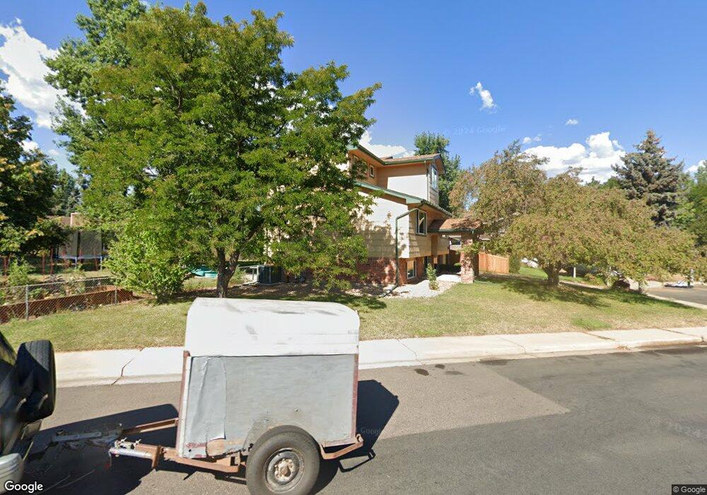
885 Mcintire St Boulder, CO 80303
Southeast Boulder NeighborhoodEstimated Value: $1,030,358 - $1,183,000
4
Beds
2
Baths
1,570
Sq Ft
$712/Sq Ft
Est. Value
About This Home
This home is located at 885 Mcintire St, Boulder, CO 80303 and is currently estimated at $1,117,090, approximately $711 per square foot. 885 Mcintire St is a home located in Boulder County with nearby schools including Eisenhower Elementary School, Manhattan Middle School of the Arts & Academics, and Fairview High School.
Ownership History
Date
Name
Owned For
Owner Type
Purchase Details
Closed on
Apr 3, 2009
Sold by
Houchens Martha L
Bought by
Kendall Martha L
Current Estimated Value
Home Financials for this Owner
Home Financials are based on the most recent Mortgage that was taken out on this home.
Original Mortgage
$238,500
Interest Rate
5.24%
Mortgage Type
Purchase Money Mortgage
Purchase Details
Closed on
Feb 24, 2009
Sold by
Houchens Martha L
Bought by
Kendall Martha H
Home Financials for this Owner
Home Financials are based on the most recent Mortgage that was taken out on this home.
Original Mortgage
$238,500
Interest Rate
5.24%
Mortgage Type
Purchase Money Mortgage
Purchase Details
Closed on
Mar 28, 2001
Sold by
Gill Jack E and Gill Jane C
Bought by
Houchens Martha L
Home Financials for this Owner
Home Financials are based on the most recent Mortgage that was taken out on this home.
Original Mortgage
$261,600
Interest Rate
6.98%
Purchase Details
Closed on
Sep 8, 1971
Bought by
Kendall Martha L and Kendall Lewis S
Create a Home Valuation Report for This Property
The Home Valuation Report is an in-depth analysis detailing your home's value as well as a comparison with similar homes in the area
Home Values in the Area
Average Home Value in this Area
Purchase History
| Date | Buyer | Sale Price | Title Company |
|---|---|---|---|
| Kendall Martha L | -- | None Available | |
| Kendall Martha H | -- | None Available | |
| Houchens Martha L | $327,000 | Land Title | |
| Kendall Martha L | $26,500 | -- |
Source: Public Records
Mortgage History
| Date | Status | Borrower | Loan Amount |
|---|---|---|---|
| Closed | Kendall Martha L | $238,500 | |
| Previous Owner | Houchens Martha L | $261,600 |
Source: Public Records
Tax History Compared to Growth
Tax History
| Year | Tax Paid | Tax Assessment Tax Assessment Total Assessment is a certain percentage of the fair market value that is determined by local assessors to be the total taxable value of land and additions on the property. | Land | Improvement |
|---|---|---|---|---|
| 2025 | $6,633 | $68,676 | $44,038 | $24,638 |
| 2024 | $6,633 | $68,676 | $44,038 | $24,638 |
| 2023 | $6,518 | $75,476 | $51,650 | $27,510 |
| 2022 | $5,430 | $58,470 | $37,078 | $21,392 |
| 2021 | $5,178 | $60,153 | $38,145 | $22,008 |
| 2020 | $4,711 | $54,126 | $33,462 | $20,664 |
| 2019 | $4,639 | $54,126 | $33,462 | $20,664 |
| 2018 | $4,426 | $51,055 | $31,392 | $19,663 |
| 2017 | $4,288 | $56,445 | $34,706 | $21,739 |
| 2016 | $4,044 | $46,718 | $23,164 | $23,554 |
| 2015 | $3,830 | $38,240 | $21,492 | $16,748 |
| 2014 | $3,215 | $38,240 | $21,492 | $16,748 |
Source: Public Records
Map
Nearby Homes
- 4630 Talbot Dr
- 695 Manhattan Dr Unit 109
- 695 Manhattan Dr Unit 219
- 4500 Baseline Rd Unit 3302
- 4500 Baseline Rd Unit 4104
- 4500 Baseline Rd Unit 2107
- 4415 Laguna Place Unit 201
- 1209 Harrison Ct
- 645 Manhattan Place Unit 302
- 645 Manhattan Place Unit 304
- 625 Manhattan Place Unit 308
- 880 Gilpin Dr
- 853 Racquet Ln
- 500 Mohawk Dr Unit 510
- 655 Cree Cir
- 500 Manhattan Dr Unit B1
- 905 36th St
- 325 Fox Ct
- 3009 Madison Ave Unit M-315
- 3000 Colorado Ave Unit F122