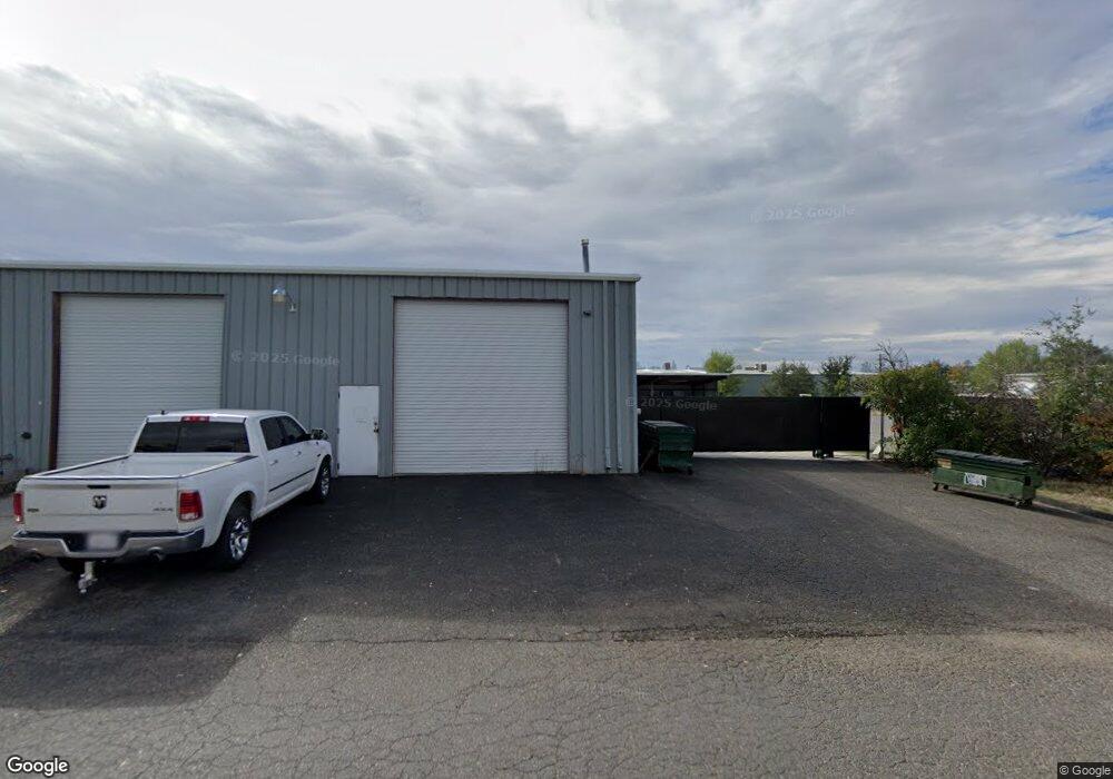
8924 Airport Rd Redding, CA 96002
Clover Creek NeighborhoodEstimated Value: $933,114
--
Bed
3
Baths
8,900
Sq Ft
$105/Sq Ft
Est. Value
About This Home
This home is located at 8924 Airport Rd, Redding, CA 96002 and is currently estimated at $933,114, approximately $104 per square foot. 8924 Airport Rd is a home located in Shasta County with nearby schools including Columbia Elementary School, Junction Elementary School, and Mountain View Middle School.
Ownership History
Date
Name
Owned For
Owner Type
Purchase Details
Closed on
Jun 6, 2018
Sold by
Crandall Sylvia
Bought by
Werner Christopher R and Wright Jeremy A
Current Estimated Value
Home Financials for this Owner
Home Financials are based on the most recent Mortgage that was taken out on this home.
Original Mortgage
$325,000
Outstanding Balance
$281,071
Interest Rate
4.5%
Mortgage Type
Commercial
Estimated Equity
$652,043
Purchase Details
Closed on
Jun 4, 2005
Sold by
Cole William A and Cole Cynthia E
Bought by
Crandall Sylvia
Home Financials for this Owner
Home Financials are based on the most recent Mortgage that was taken out on this home.
Original Mortgage
$675,000
Interest Rate
5.72%
Mortgage Type
Seller Take Back
Create a Home Valuation Report for This Property
The Home Valuation Report is an in-depth analysis detailing your home's value as well as a comparison with similar homes in the area
Home Values in the Area
Average Home Value in this Area
Purchase History
| Date | Buyer | Sale Price | Title Company |
|---|---|---|---|
| Werner Christopher R | $650,000 | First American Title | |
| Crandall Sylvia | $875,000 | Chicago Title Co |
Source: Public Records
Mortgage History
| Date | Status | Borrower | Loan Amount |
|---|---|---|---|
| Open | Werner Christopher R | $325,000 | |
| Previous Owner | Crandall Sylvia | $675,000 |
Source: Public Records
Tax History Compared to Growth
Tax History
| Year | Tax Paid | Tax Assessment Tax Assessment Total Assessment is a certain percentage of the fair market value that is determined by local assessors to be the total taxable value of land and additions on the property. | Land | Improvement |
|---|---|---|---|---|
| 2025 | $7,842 | $739,583 | $227,563 | $512,020 |
| 2024 | $7,715 | $725,082 | $223,101 | $501,981 |
| 2023 | $7,715 | $710,866 | $218,727 | $492,139 |
| 2022 | $7,524 | $696,929 | $214,439 | $482,490 |
| 2021 | $7,390 | $683,265 | $210,235 | $473,030 |
| 2020 | $7,403 | $676,260 | $208,080 | $468,180 |
| 2019 | $7,119 | $663,000 | $204,000 | $459,000 |
| 2018 | $8,085 | $725,000 | $210,000 | $515,000 |
| 2017 | $7,727 | $700,000 | $200,000 | $500,000 |
| 2016 | $7,283 | $681,290 | $150,000 | $531,290 |
| 2015 | $7,175 | $690,450 | $150,000 | $540,450 |
| 2014 | $7,129 | $680,990 | $150,000 | $530,990 |
Source: Public Records
Map
Nearby Homes
- 3863 Indian Wells Ln
- 4655 Goodwater Ave
- 3792 Thomason Trail
- 3685 Wimbledon Dr
- 3195 Forest Hills Dr
- 2877 Green Riffle Rd
- 2903 Newbury Ln
- 2796 Madison River Dr
- 4810 Rising River Ct
- 5090 Bogie Ln
- 3849 Capricorn Way
- 4151 Saratoga Dr
- 2408 Castlewood Dr
- 3035 Argyle Rd
- 2608 La Rinconada Place
- 3512 Capricorn Way
- 4813 St Charles Dr
- 3160 Sinaloa Trail
- 3688 Polaris Way
- 20822 Clough Creek Rd
- 8938 Airport Rd
- 20290 Charlanne Dr
- 99999 Pickford Way
- 20240 Skypark Dr
- 20299 Charlanne Dr
- 20289 Charlanne Dr
- 20250 Skypark Dr
- 20347 Pickford Way
- 20276 Skypark Dr
- 20272 Skypark Dr
- 8933 Stayer Ct
- 20266 Charlanne Dr
- 20307 Charlanne Dr
- 8970 Stayer Ct
- 8941 Stayer Ct
- 20355 Pickford Way
- 8903 Airport Rd
- 20264 Skypark Dr
- 20356 Pickford Way
- 8971 Stayer Ct