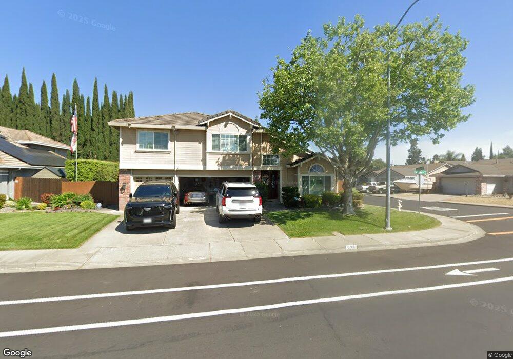
899 Christine Dr Vacaville, CA 95687
Estimated Value: $709,000 - $759,000
4
Beds
3
Baths
2,501
Sq Ft
$292/Sq Ft
Est. Value
About This Home
This home is located at 899 Christine Dr, Vacaville, CA 95687 and is currently estimated at $730,000, approximately $291 per square foot. 899 Christine Dr is a home located in Solano County with nearby schools including Cooper Elementary School, Orchard Elementary School, and Vaca Pena Middle School.
Ownership History
Date
Name
Owned For
Owner Type
Purchase Details
Closed on
May 14, 2012
Sold by
Quaintance Kevin C and Quaintance Maria A
Bought by
Quaintance Kevin Charles and Quaintance Maria Ann
Current Estimated Value
Purchase Details
Closed on
Jan 12, 1994
Sold by
Malcomb Steve C and Malcomb Carla E
Bought by
Quaintance Kevin C and Quaintance Maria A
Home Financials for this Owner
Home Financials are based on the most recent Mortgage that was taken out on this home.
Original Mortgage
$133,500
Interest Rate
7.16%
Create a Home Valuation Report for This Property
The Home Valuation Report is an in-depth analysis detailing your home's value as well as a comparison with similar homes in the area
Home Values in the Area
Average Home Value in this Area
Purchase History
| Date | Buyer | Sale Price | Title Company |
|---|---|---|---|
| Quaintance Kevin Charles | -- | None Available | |
| Quaintance Kevin C | $223,500 | Fidelity National Title |
Source: Public Records
Mortgage History
| Date | Status | Borrower | Loan Amount |
|---|---|---|---|
| Closed | Quaintance Kevin C | $133,500 |
Source: Public Records
Tax History Compared to Growth
Tax History
| Year | Tax Paid | Tax Assessment Tax Assessment Total Assessment is a certain percentage of the fair market value that is determined by local assessors to be the total taxable value of land and additions on the property. | Land | Improvement |
|---|---|---|---|---|
| 2025 | $4,877 | $413,385 | $93,483 | $319,902 |
| 2024 | $4,877 | $405,280 | $91,650 | $313,630 |
| 2023 | $4,752 | $397,334 | $89,853 | $307,481 |
| 2022 | $4,644 | $389,544 | $88,093 | $301,451 |
| 2021 | $4,649 | $381,907 | $86,366 | $295,541 |
| 2020 | $4,587 | $377,992 | $85,481 | $292,511 |
| 2019 | $4,507 | $370,581 | $83,805 | $286,776 |
| 2018 | $4,445 | $363,315 | $82,162 | $281,153 |
| 2017 | $4,291 | $356,192 | $80,551 | $275,641 |
| 2016 | $4,267 | $349,209 | $78,972 | $270,237 |
| 2015 | $4,210 | $343,964 | $77,786 | $266,178 |
| 2014 | $3,952 | $337,227 | $76,263 | $260,964 |
Source: Public Records
Map
Nearby Homes
- 725 Wellsey Rd
- 654 Rutgers St
- 1055 Notre Dame Cir
- 725 Arabian Cir
- 420 Temple Dr
- 309 Regency Cir
- 431 Stanford St
- 137 Edwin Dr
- 154 Edwin Dr
- 755 Oak Hollow Ave
- 313 Toyon Ln
- 142 Nantucket Cir
- 512 Oakmeadow Ct
- 148 Randall Ave
- 642 White Oak Ln
- 113 Asbury Dr
- 1018 Alouette Place
- 190 Huntington Dr
- 418 Gatehouse Dr
- 124 Dover Way
- 893 Christine Dr
- 784 Lafayette Rd
- 764 Syracuse Dr
- 760 Syracuse Dr
- 887 Christine Dr
- 756 Syracuse Dr
- 898 Christine Dr
- 772 Lafayette Rd
- 892 Christine Dr
- 881 Christine Dr
- 752 Syracuse Dr
- 1138 Notre Dame Cir
- 886 Christine Dr
- 1144 Notre Dame Cir
- 808 Syracuse Dr
- 1150 Notre Dame Cir
- 773 Lafayette Rd
- 880 Christine Dr
- 766 Lafayette Rd