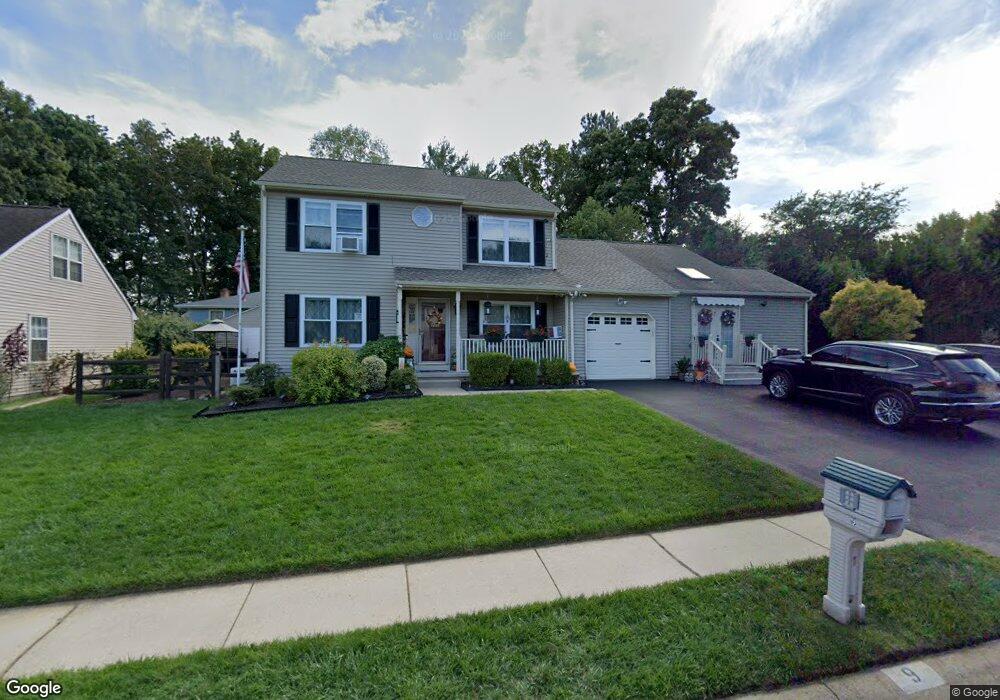
9 Deasy Dr Newark, DE 19702
Estimated Value: $424,000 - $506,000
4
Beds
4
Baths
2,465
Sq Ft
$186/Sq Ft
Est. Value
About This Home
This home is located at 9 Deasy Dr, Newark, DE 19702 and is currently estimated at $459,447, approximately $186 per square foot. 9 Deasy Dr is a home located in New Castle County with nearby schools including Oberle (William) Elementary School, Gauger-Cobbs Middle School, and Glasgow High School.
Ownership History
Date
Name
Owned For
Owner Type
Purchase Details
Closed on
Jul 21, 2012
Sold by
Robaskiewicz Darlene and Robaskiewicz Joseh
Bought by
Robaszkiewicz Darlene and Robaszkiewicz Joseph
Current Estimated Value
Purchase Details
Closed on
Jul 26, 2006
Sold by
Adams Norman P and Adams Judith A
Bought by
Hyett Darlene E
Home Financials for this Owner
Home Financials are based on the most recent Mortgage that was taken out on this home.
Original Mortgage
$236,000
Outstanding Balance
$140,997
Interest Rate
6.67%
Mortgage Type
Unknown
Estimated Equity
$318,450
Purchase Details
Closed on
Apr 26, 2001
Sold by
Baldini West Inc
Bought by
Adams Norman P and Adams Judith A
Home Financials for this Owner
Home Financials are based on the most recent Mortgage that was taken out on this home.
Original Mortgage
$166,000
Interest Rate
6.85%
Create a Home Valuation Report for This Property
The Home Valuation Report is an in-depth analysis detailing your home's value as well as a comparison with similar homes in the area
Home Values in the Area
Average Home Value in this Area
Purchase History
| Date | Buyer | Sale Price | Title Company |
|---|---|---|---|
| Robaszkiewicz Darlene | -- | None Available | |
| Hyett Darlene E | $295,000 | None Available | |
| Adams Norman P | $176,405 | -- |
Source: Public Records
Mortgage History
| Date | Status | Borrower | Loan Amount |
|---|---|---|---|
| Open | Hyett Darlene E | $236,000 | |
| Previous Owner | Adams Norman P | $166,000 |
Source: Public Records
Tax History Compared to Growth
Tax History
| Year | Tax Paid | Tax Assessment Tax Assessment Total Assessment is a certain percentage of the fair market value that is determined by local assessors to be the total taxable value of land and additions on the property. | Land | Improvement |
|---|---|---|---|---|
| 2024 | $2,847 | $95,800 | $11,700 | $84,100 |
| 2023 | $2,775 | $95,800 | $11,700 | $84,100 |
| 2022 | $2,749 | $95,800 | $11,700 | $84,100 |
| 2021 | $2,690 | $95,800 | $11,700 | $84,100 |
| 2020 | $2,614 | $95,800 | $11,700 | $84,100 |
| 2019 | $2,540 | $95,800 | $11,700 | $84,100 |
| 2018 | $2,274 | $95,800 | $11,700 | $84,100 |
| 2017 | $2,198 | $95,800 | $11,700 | $84,100 |
| 2016 | $2,175 | $95,800 | $11,700 | $84,100 |
| 2015 | $1,992 | $95,800 | $11,700 | $84,100 |
| 2014 | $1,994 | $95,800 | $11,700 | $84,100 |
Source: Public Records
Map
Nearby Homes
- Aria Plan at French Park Townhomes
- Ballad Plan at French Park Townhomes
- Cadence Plan at French Park Townhomes
- 308 Gray Blvd
- 1809 Bergerac Ct
- 1869 Bergerac Ct
- 1821 Bergerac Ct
- 1850 Bergerac Ct
- 13 Christina Woods Ct
- 5 Wellington Dr
- 145 Boyer Dr
- 107 Rushmore Ct
- 208 Yosemite Dr
- 1944 Spearfish Ct
- 149 W Flagstone Dr
- 200 Birch Ln
- 78 Lake Tahoe Cir
- 4 Bristol Ct
- 115 Whitburn Place
- 16 Barberry Ct Unit A016