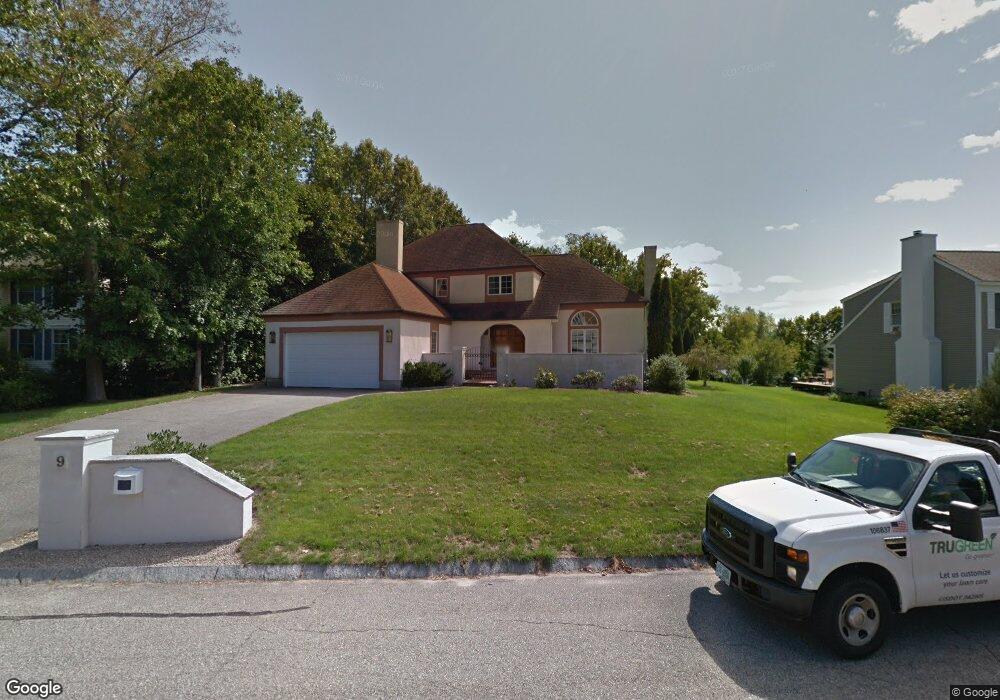
9 Hubbard Rd Dover, NH 03820
Dover Point NeighborhoodEstimated Value: $804,000 - $991,000
4
Beds
4
Baths
2,876
Sq Ft
$312/Sq Ft
Est. Value
About This Home
This home is located at 9 Hubbard Rd, Dover, NH 03820 and is currently estimated at $896,020, approximately $311 per square foot. 9 Hubbard Rd is a home located in Strafford County with nearby schools including Garrison School, Dover Middle School, and Dover Senior High School.
Create a Home Valuation Report for This Property
The Home Valuation Report is an in-depth analysis detailing your home's value as well as a comparison with similar homes in the area
Home Values in the Area
Average Home Value in this Area
Tax History
| Year | Tax Paid | Tax Assessment Tax Assessment Total Assessment is a certain percentage of the fair market value that is determined by local assessors to be the total taxable value of land and additions on the property. | Land | Improvement |
|---|---|---|---|---|
| 2024 | $17,202 | $946,700 | $206,900 | $739,800 |
| 2023 | $15,203 | $813,000 | $163,800 | $649,200 |
| 2022 | $14,688 | $740,300 | $155,200 | $585,100 |
| 2021 | $14,153 | $652,200 | $137,900 | $514,300 |
| 2020 | $13,707 | $551,600 | $125,000 | $426,600 |
| 2019 | $13,351 | $530,000 | $112,100 | $417,900 |
| 2018 | $12,278 | $492,700 | $99,100 | $393,600 |
| 2017 | $12,146 | $469,500 | $94,800 | $374,700 |
| 2016 | $11,457 | $435,800 | $84,500 | $351,300 |
| 2015 | $11,253 | $422,900 | $80,100 | $342,800 |
| 2014 | $11,000 | $422,900 | $80,100 | $342,800 |
| 2011 | $10,435 | $415,400 | $84,900 | $330,500 |
Source: Public Records
Map
Nearby Homes
- 6 Hayden Dr
- 15 Teresa Dr
- 55 Pointe Place Unit 108
- 55 Pointe Place Unit 101
- 55 Pointe Place Unit 201
- 55 Pointe Place Unit 304
- 13 Stark Ave
- 51 Constitution Way
- 1 Independence Dr
- 14 Independence Dr
- 20 Lenox Dr Unit c
- 22 Lenox Dr Unit D
- 181 Central Ave
- 29 Lenox Dr Unit B
- 16 Lenox Dr Unit C
- 15 Lenox Dr Unit A
- 93 Henry Law Ave Unit 74
- 88 Cricketbrook
- 26 Lenox Dr Unit D
- 136 Locust St Unit 101
Your Personal Tour Guide
Ask me questions while you tour the home.