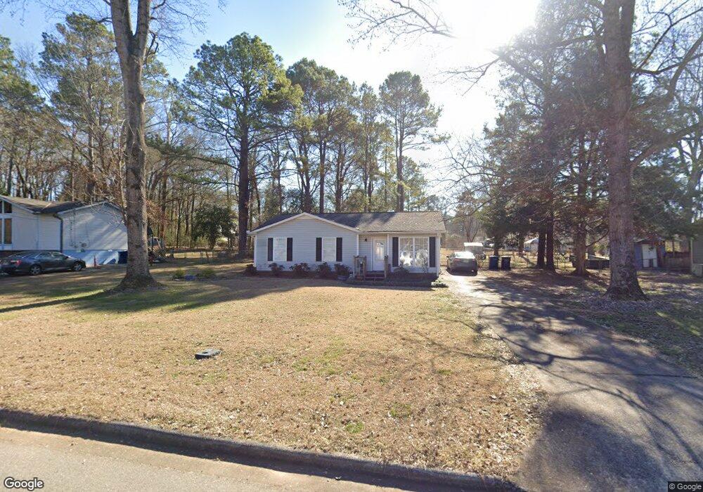
904 Burnt Pine Dr Maylene, AL 35114
Estimated Value: $200,000 - $265,000
--
Bed
1
Bath
1,116
Sq Ft
$203/Sq Ft
Est. Value
About This Home
This home is located at 904 Burnt Pine Dr, Maylene, AL 35114 and is currently estimated at $226,549, approximately $203 per square foot. 904 Burnt Pine Dr is a home located in Shelby County with nearby schools including Thompson Intermediate School, Thompson Middle School, and Thompson High School.
Ownership History
Date
Name
Owned For
Owner Type
Purchase Details
Closed on
Aug 27, 2007
Sold by
Howard Cullen
Bought by
Howard Nancy A
Current Estimated Value
Home Financials for this Owner
Home Financials are based on the most recent Mortgage that was taken out on this home.
Original Mortgage
$95,600
Outstanding Balance
$61,451
Interest Rate
6.87%
Mortgage Type
Unknown
Estimated Equity
$165,098
Purchase Details
Closed on
Aug 17, 2007
Sold by
Howard Amber Nicole
Bought by
Howard Cullen William
Home Financials for this Owner
Home Financials are based on the most recent Mortgage that was taken out on this home.
Original Mortgage
$95,600
Outstanding Balance
$61,451
Interest Rate
6.87%
Mortgage Type
Unknown
Estimated Equity
$165,098
Purchase Details
Closed on
Mar 29, 2001
Sold by
Day Lawrence A
Bought by
Fiveash Amanda L and Fiveash Jerry J
Home Financials for this Owner
Home Financials are based on the most recent Mortgage that was taken out on this home.
Original Mortgage
$86,148
Interest Rate
7.11%
Mortgage Type
FHA
Purchase Details
Closed on
Nov 3, 2000
Sold by
Day Casey P and Day Phillip Casey
Bought by
Day Lawrence A
Create a Home Valuation Report for This Property
The Home Valuation Report is an in-depth analysis detailing your home's value as well as a comparison with similar homes in the area
Home Values in the Area
Average Home Value in this Area
Purchase History
| Date | Buyer | Sale Price | Title Company |
|---|---|---|---|
| Howard Nancy A | $119,500 | Title South | |
| Howard Cullen William | $10,000 | Title South | |
| Fiveash Amanda L | $87,500 | -- | |
| Day Lawrence A | $90,000 | -- |
Source: Public Records
Mortgage History
| Date | Status | Borrower | Loan Amount |
|---|---|---|---|
| Open | Howard Nancy A | $95,600 | |
| Previous Owner | Fiveash Amanda L | $86,148 |
Source: Public Records
Tax History Compared to Growth
Tax History
| Year | Tax Paid | Tax Assessment Tax Assessment Total Assessment is a certain percentage of the fair market value that is determined by local assessors to be the total taxable value of land and additions on the property. | Land | Improvement |
|---|---|---|---|---|
| 2024 | $1,675 | $31,020 | $0 | $0 |
| 2023 | $1,583 | $29,320 | $0 | $0 |
| 2022 | $1,497 | $27,720 | $0 | $0 |
| 2021 | $1,326 | $24,560 | $0 | $0 |
| 2020 | $1,186 | $0 | $0 | $0 |
| 2019 | $1,095 | $20,280 | $0 | $0 |
| 2017 | $963 | $17,840 | $0 | $0 |
| 2015 | $945 | $17,500 | $0 | $0 |
| 2014 | $928 | $17,180 | $0 | $0 |
Source: Public Records
Map
Nearby Homes
- 212 Lacey Ave
- 257 Lacey Ave
- 1315 Yellowleaf Cir
- 128 Oak St
- 189 Sweetbay Dr
- 217 Kensington Ln
- 1633 Caribbean Cir
- 549 Ramsgate Dr
- 117 Big Oak Dr
- 104 Kentwood Trail Cir
- 545 Ramsgate Dr
- 1520 Tropical Cir
- 236 Queens Gate
- 309 Cedar Grove Ct
- 501 Ramsgate Dr
- 233 Queens Gate
- 208 Queens Gate
- 104 Camden Cir
- 117 Kensington Ln
- 537 Ramsgate Dr
- 906 Burnt Pine Dr
- 902 Burnt Pine Dr
- 1105 Eagle Dr
- 1103 Eagle Dr
- 908 Burnt Pine Dr
- 905 Burnt Pine Dr
- 900 Burnt Pine Dr
- 1107 Eagle Dr
- 903 Burnt Pine Dr
- 1109 Eagle Dr
- 910 Burnt Pine Dr
- 1101 Eagle Dr
- 901 Burnt Pine Dr
- 549 N Grandview Trail
- 1111 Eagle Dr
- 1102 Eagle Dr
- 909 Burnt Pine Dr
- 1106 Eagle Dr
- 1104 Eagle Dr
- 912 Burnt Pine Dr