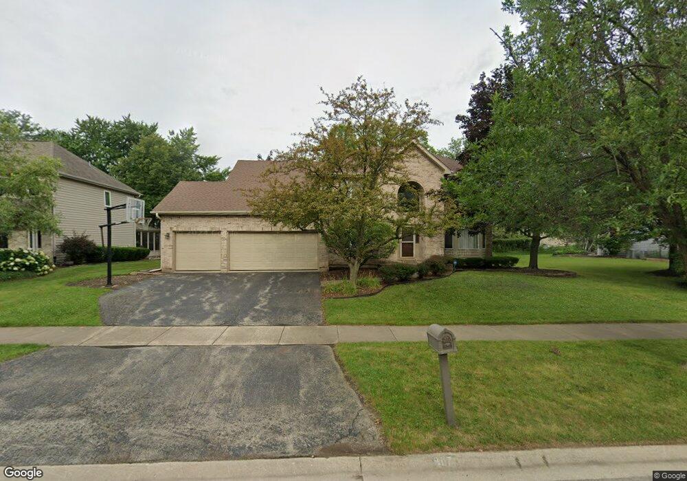
907 Mortonsberry Dr Naperville, IL 60540
West Wind NeighborhoodEstimated Value: $822,000 - $892,000
4
Beds
3
Baths
3,270
Sq Ft
$260/Sq Ft
Est. Value
About This Home
This home is located at 907 Mortonsberry Dr, Naperville, IL 60540 and is currently estimated at $850,479, approximately $260 per square foot. 907 Mortonsberry Dr is a home located in DuPage County with nearby schools including May Watts Elementary School, Thayer J. Hill Middle School, and Metea Valley High School.
Ownership History
Date
Name
Owned For
Owner Type
Purchase Details
Closed on
Oct 28, 2003
Sold by
Ellis Theodore J and Ellis Dianne L
Bought by
Pruyne James C and Pruyne Melissa R
Current Estimated Value
Home Financials for this Owner
Home Financials are based on the most recent Mortgage that was taken out on this home.
Original Mortgage
$322,700
Outstanding Balance
$147,627
Interest Rate
5.81%
Mortgage Type
Purchase Money Mortgage
Estimated Equity
$702,852
Purchase Details
Closed on
Dec 15, 1994
Sold by
Cox Howard and Cox Wendy
Bought by
Ellis Theodore J and Ellis Dianne L
Home Financials for this Owner
Home Financials are based on the most recent Mortgage that was taken out on this home.
Original Mortgage
$248,000
Interest Rate
7.25%
Create a Home Valuation Report for This Property
The Home Valuation Report is an in-depth analysis detailing your home's value as well as a comparison with similar homes in the area
Home Values in the Area
Average Home Value in this Area
Purchase History
| Date | Buyer | Sale Price | Title Company |
|---|---|---|---|
| Pruyne James C | $450,000 | Ctic | |
| Ellis Theodore J | $310,000 | Attorneys National Title |
Source: Public Records
Mortgage History
| Date | Status | Borrower | Loan Amount |
|---|---|---|---|
| Open | Pruyne James C | $322,700 | |
| Previous Owner | Ellis Theodore J | $248,000 |
Source: Public Records
Tax History
| Year | Tax Paid | Tax Assessment Tax Assessment Total Assessment is a certain percentage of the fair market value that is determined by local assessors to be the total taxable value of land and additions on the property. | Land | Improvement |
|---|---|---|---|---|
| 2024 | $14,692 | $243,369 | $52,941 | $190,428 |
| 2023 | $14,086 | $218,680 | $47,570 | $171,110 |
| 2022 | $13,523 | $203,870 | $43,970 | $159,900 |
| 2021 | $13,101 | $196,590 | $42,400 | $154,190 |
| 2020 | $13,083 | $196,590 | $42,400 | $154,190 |
| 2019 | $12,574 | $186,980 | $40,330 | $146,650 |
| 2018 | $12,558 | $183,400 | $38,920 | $144,480 |
| 2017 | $12,216 | $177,180 | $37,600 | $139,580 |
| 2016 | $11,999 | $170,030 | $36,080 | $133,950 |
| 2015 | $11,894 | $161,440 | $34,260 | $127,180 |
| 2014 | $11,673 | $153,260 | $32,260 | $121,000 |
| 2013 | $11,646 | $154,320 | $32,480 | $121,840 |
Source: Public Records
Map
Nearby Homes
- 1262 Rhodes Ln Unit 2701
- 1161 Banyon Ct
- 1208 Tennyson Ln
- 901 Heathrow Ln
- 1259 Natchez Trace Cir
- 625 Buttonwood Cir
- 7S410 Arbor Dr
- 1033 Emerald Dr
- 421 Berry Dr
- 1308 Stonegate Rd
- 2407 Orchid Ct
- 316 Hemlock Ln
- 319 Claremont Ct
- 2524 Carrolwood Rd Unit 25
- 845 Tulip Ln
- 417 River Bluff Cir
- 2809 Blakely Ln Unit 24
- 1099 W Jefferson Ave
- 511 Aurora Ave Unit 108
- 511 Aurora Ave Unit 620
- 911 Mortonsberry Dr
- 903 Mortonsberry Dr
- 1336 Oakton Ln
- 1351 Ada Ln
- 1347 Ada Ln
- 915 Mortonsberry Dr
- 1340 Oakton Ln
- 908 Mortonsberry Dr
- 912 Mortonsberry Dr
- 1343 Ada Ln
- 916 Mortonsberry Dr
- 919 Mortonsberry Dr Unit 4
- 1337 Oakton Ln
- 920 Mortonsberry Dr
- 1325 Oakton Ln
- 1339 Ada Ln
- 1329 Oakton Ln
- 1348 Ada Ln
- 1333 Oakton Ln