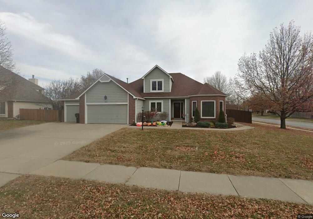
912 Biltmore Ct Lawrence, KS 66049
West Lawrence NeighborhoodEstimated Value: $455,266 - $521,000
4
Beds
3
Baths
2,195
Sq Ft
$223/Sq Ft
Est. Value
About This Home
This home is located at 912 Biltmore Ct, Lawrence, KS 66049 and is currently estimated at $489,567, approximately $223 per square foot. 912 Biltmore Ct is a home located in Douglas County with nearby schools including Langston Hughes Elementary School, Southwest Middle School, and Lawrence Free State High School.
Ownership History
Date
Name
Owned For
Owner Type
Purchase Details
Closed on
Dec 4, 2025
Sold by
Tsiboe Francis and Tsiboe Mary Ama
Bought by
Tsiboe Francis and Tsiboe Mary Ama
Current Estimated Value
Purchase Details
Closed on
Aug 16, 2010
Sold by
Burke David K and Burke Nancy A
Bought by
Coffman Nathan N and Coffman Andrea D
Home Financials for this Owner
Home Financials are based on the most recent Mortgage that was taken out on this home.
Original Mortgage
$204,000
Interest Rate
4.54%
Mortgage Type
New Conventional
Create a Home Valuation Report for This Property
The Home Valuation Report is an in-depth analysis detailing your home's value as well as a comparison with similar homes in the area
Home Values in the Area
Average Home Value in this Area
Purchase History
| Date | Buyer | Sale Price | Title Company |
|---|---|---|---|
| Tsiboe Francis | -- | Security 1St Title | |
| Coffman Nathan N | -- | Continental Title Company |
Source: Public Records
Mortgage History
| Date | Status | Borrower | Loan Amount |
|---|---|---|---|
| Previous Owner | Coffman Nathan N | $204,000 |
Source: Public Records
Tax History Compared to Growth
Tax History
| Year | Tax Paid | Tax Assessment Tax Assessment Total Assessment is a certain percentage of the fair market value that is determined by local assessors to be the total taxable value of land and additions on the property. | Land | Improvement |
|---|---|---|---|---|
| 2025 | $6,565 | $52,544 | $9,200 | $43,344 |
| 2024 | $6,281 | $50,301 | $7,475 | $42,826 |
| 2023 | $5,943 | $46,058 | $7,475 | $38,583 |
| 2022 | $5,700 | $43,883 | $7,475 | $36,408 |
| 2021 | $4,991 | $37,294 | $6,334 | $30,960 |
| 2020 | $4,763 | $35,788 | $6,334 | $29,454 |
| 2019 | $4,381 | $32,982 | $6,334 | $26,648 |
| 2018 | $4,216 | $31,517 | $6,334 | $25,183 |
| 2017 | $3,996 | $29,555 | $6,334 | $23,221 |
| 2016 | $3,769 | $29,129 | $5,753 | $23,376 |
| 2015 | $3,904 | $30,153 | $5,753 | $24,400 |
| 2014 | $3,744 | $29,210 | $5,753 | $23,457 |
Source: Public Records
Map
Nearby Homes
- 5024 Cedar Grove Way
- 5117 Harvard Rd
- 5204 Foxchase Dr
- 5204 Fox Chase Dr
- 1202 Little Knife
- 904 Moundridge Dr
- 1017 Stoneridge Dr
- 1040 Stonecreek Dr
- 1033 Stonecreek Dr
- 1300 Research Park Dr
- 5245 Overland Dr Unit A15
- 5245 Overland Dr Unit C12
- 5245 Overland Dr Unit D4
- 1315 Research Park Dr
- 5614 Chimney Rocks Cir
- 1347 Kanza Dr
- 237 Landon Ct
- 1204 Chadwick Ct
- 1012 Wagon Wheel Rd
- 611 Eldridge St
- 908 Biltmore Ct
- 917 Congressional Dr
- 913 Congressional Dr
- 1000 Biltmore Dr
- 913 Biltmore Ct
- 904 Biltmore Ct
- 909 Biltmore Ct
- 909 Biltmore Ct
- 909 Congressional Dr
- 1001 Congressional Ct
- 1004 Biltmore Dr
- 1001 Biltmore Dr
- 905 Congressional Dr
- 905 Biltmore Ct
- 1005 Congressional Ct
- 900 Biltmore Ct
- 916 Summerfield Ct
- 912 Summerfield Ct
- 924 Congressional Dr
- 920 Congressional Dr