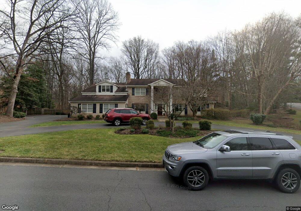
913 Frome Ln McLean, VA 22102
Estimated Value: $2,469,839 - $2,666,000
6
Beds
5
Baths
5,101
Sq Ft
$497/Sq Ft
Est. Value
About This Home
This home is located at 913 Frome Ln, McLean, VA 22102 and is currently estimated at $2,536,613, approximately $497 per square foot. 913 Frome Ln is a home located in Fairfax County with nearby schools including Spring Hill Elementary School, Cooper Middle School, and Langley High School.
Ownership History
Date
Name
Owned For
Owner Type
Purchase Details
Closed on
Jun 23, 2020
Sold by
Malawer Martin M and Holmes Alison Malawer
Bought by
Malawer Martin M
Current Estimated Value
Home Financials for this Owner
Home Financials are based on the most recent Mortgage that was taken out on this home.
Original Mortgage
$234,500
Outstanding Balance
$163,609
Interest Rate
2.87%
Mortgage Type
New Conventional
Estimated Equity
$2,373,004
Purchase Details
Closed on
Sep 25, 2018
Sold by
Homes Alison Malawer
Bought by
Malawer Martin M and Holmes Alison Malawer
Purchase Details
Closed on
Aug 5, 1987
Bought by
Malawer Martin M and And Jane D
Create a Home Valuation Report for This Property
The Home Valuation Report is an in-depth analysis detailing your home's value as well as a comparison with similar homes in the area
Home Values in the Area
Average Home Value in this Area
Purchase History
| Date | Buyer | Sale Price | Title Company |
|---|---|---|---|
| Malawer Martin M | -- | Accommodation | |
| Malawer Martin M | -- | None Available | |
| Malawer Martin M | $603,000 | -- |
Source: Public Records
Mortgage History
| Date | Status | Borrower | Loan Amount |
|---|---|---|---|
| Open | Malawer Martin M | $234,500 |
Source: Public Records
Tax History Compared to Growth
Tax History
| Year | Tax Paid | Tax Assessment Tax Assessment Total Assessment is a certain percentage of the fair market value that is determined by local assessors to be the total taxable value of land and additions on the property. | Land | Improvement |
|---|---|---|---|---|
| 2021 | $15,638 | $1,306,940 | $728,000 | $578,940 |
| 2020 | $15,768 | $1,306,940 | $728,000 | $578,940 |
| 2019 | $14,156 | $1,173,340 | $728,000 | $445,340 |
| 2018 | $14,156 | $1,173,340 | $728,000 | $445,340 |
| 2017 | $13,892 | $1,173,340 | $728,000 | $445,340 |
| 2016 | $15,178 | $1,284,670 | $728,000 | $556,670 |
| 2015 | $13,714 | $1,204,030 | $707,000 | $497,030 |
| 2014 | $13,265 | $1,167,210 | $707,000 | $460,210 |
Source: Public Records
Map
Nearby Homes
- 919 Dominion Reserve Dr
- 1003 Gelston Cir
- 7816 Georgetown Pike
- 7315 Georgetown Pike
- 7400 Churchill Rd
- 8013 Greenwich Woods Dr
- 8014 Greenwich Woods Dr
- 1052 Balls Hill Rd
- 8023 Georgetown Pike
- 1212 Old Stable Rd
- 1112 Balls Hill Rd
- 8111 Georgetown Pike
- 1197 Winter Hunt Rd
- 7806 Birnam Wood Dr
- 1221 Mottrom Dr
- 1200 Chadsworth Ct
- 7009 Benjamin St
- 7008 Arbor Ln
- 7701 Lewinsville Rd
- 8023 Lewinsville Rd
- 7524 Royal Oak Dr
- 909 Frome Ln
- 7648 Burford Dr
- 7520 Royal Oak Dr
- 7645 Burford Dr
- 7641 Burford Dr
- 905 Frome Ln
- 906 Frome Ln
- 7516 Royal Oak Dr
- 7521 Royal Oak Dr
- 7652 Burford Dr
- 7525 Royal Oak Dr
- 7633 Burford Dr
- 901 Lynton Place
- 905 Lynton Place
- 7517 Royal Oak Dr
- 7512 Royal Oak Dr
- 867 Alvermar Ridge Dr
- 7630 Burford Dr
- 863 Alvermar Ridge Dr