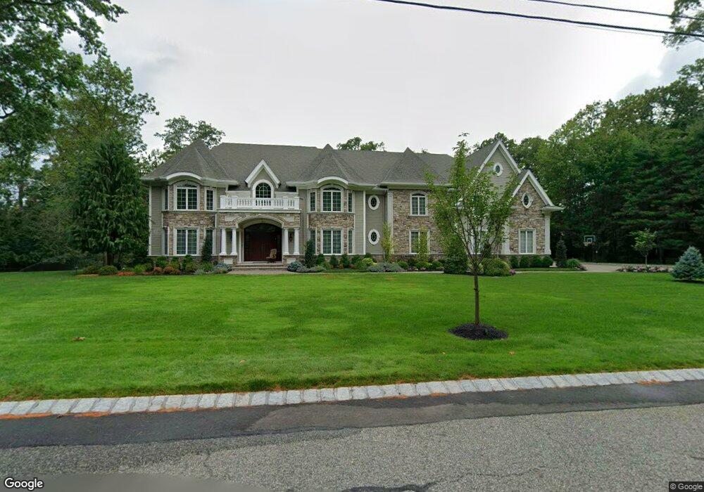
919 Mohawk Rd Franklin Lakes, NJ 07417
Estimated Value: $3,461,000 - $3,797,000
7
Beds
9
Baths
7,423
Sq Ft
$499/Sq Ft
Est. Value
About This Home
This home is located at 919 Mohawk Rd, Franklin Lakes, NJ 07417 and is currently estimated at $3,705,781, approximately $499 per square foot. 919 Mohawk Rd is a home located in Bergen County with nearby schools including High Mountain Road Elementary School, Franklin Avenue Middle School, and Ramapo High School.
Ownership History
Date
Name
Owned For
Owner Type
Purchase Details
Closed on
Sep 27, 2019
Sold by
Laino Anthony M
Bought by
Laino Anthony M
Current Estimated Value
Purchase Details
Closed on
Feb 12, 2010
Sold by
Mccarthy F Robert
Bought by
Laino Anthony M
Home Financials for this Owner
Home Financials are based on the most recent Mortgage that was taken out on this home.
Original Mortgage
$350,000
Interest Rate
4.4%
Mortgage Type
Purchase Money Mortgage
Create a Home Valuation Report for This Property
The Home Valuation Report is an in-depth analysis detailing your home's value as well as a comparison with similar homes in the area
Home Values in the Area
Average Home Value in this Area
Purchase History
| Date | Buyer | Sale Price | Title Company |
|---|---|---|---|
| Laino Anthony M | -- | None Available | |
| Laino Anthony M | $1,100,000 | -- |
Source: Public Records
Mortgage History
| Date | Status | Borrower | Loan Amount |
|---|---|---|---|
| Previous Owner | Laino Anthony M | $350,000 |
Source: Public Records
Tax History Compared to Growth
Tax History
| Year | Tax Paid | Tax Assessment Tax Assessment Total Assessment is a certain percentage of the fair market value that is determined by local assessors to be the total taxable value of land and additions on the property. | Land | Improvement |
|---|---|---|---|---|
| 2025 | $45,406 | $2,528,200 | $544,000 | $1,984,200 |
| 2024 | $43,738 | $2,528,200 | $544,000 | $1,984,200 |
| 2023 | $42,625 | $2,528,200 | $544,000 | $1,984,200 |
| 2022 | $42,625 | $2,528,200 | $544,000 | $1,984,200 |
| 2021 | $42,019 | $2,528,200 | $544,000 | $1,984,200 |
| 2020 | $41,549 | $2,521,200 | $544,000 | $1,977,200 |
| 2019 | $41,398 | $2,521,200 | $544,000 | $1,977,200 |
| 2018 | $40,970 | $2,521,200 | $544,000 | $1,977,200 |
| 2017 | $41,247 | $2,521,200 | $544,000 | $1,977,200 |
| 2016 | $41,373 | $2,521,200 | $544,000 | $1,977,200 |
| 2015 | $40,314 | $2,521,200 | $544,000 | $1,977,200 |
| 2014 | $39,633 | $2,421,500 | $544,000 | $1,877,500 |
Source: Public Records
Map
Nearby Homes
- 907 Scioto Dr
- 951 Scioto Dr
- 865 Olentangy Rd
- 847 Apache Rd
- 912 Cherokee Ln
- 259 Indian Trail Dr
- 311 Algonquin Rd
- 212 Seminole Ln
- 340 Indian Trail Dr
- 356 Indian Trail Dr
- 569 Navaho Trail Dr
- 587 High Mountain Rd
- 240 Ottowa Ln
- 76 Point View Pkwy
- 727 Dakota Trail
- 63 Spring Hill Cir
- 223 Terrace Rd
- 711 Cheyenne Dr
- 16 Shinnecock Trail
- 265 Terrace Rd