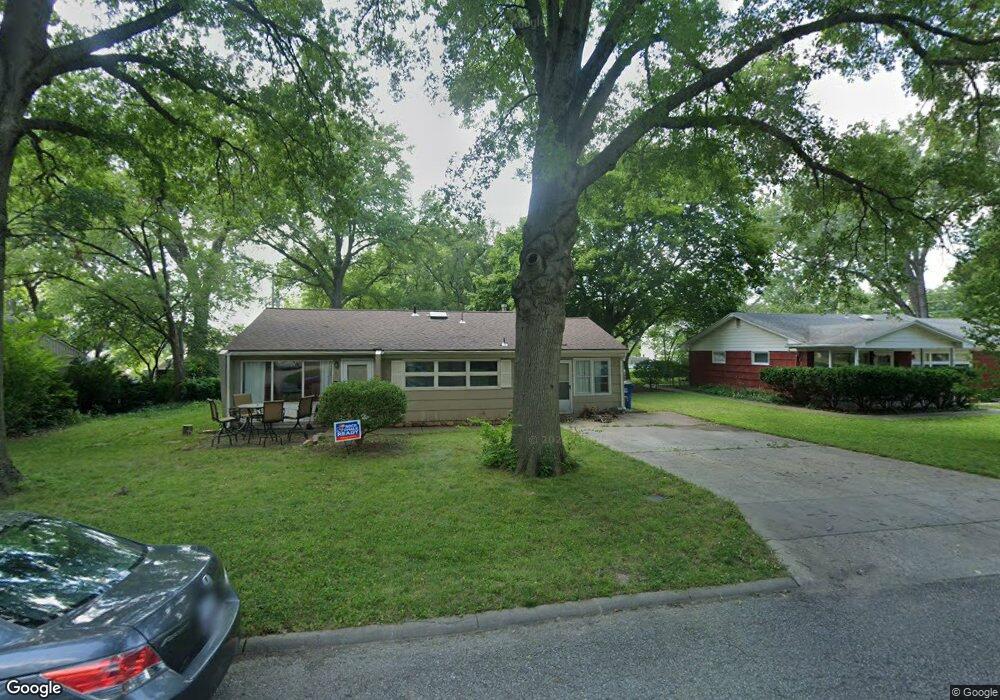
919 Murrow Ct Lawrence, KS 66049
Sunset Hills NeighborhoodEstimated Value: $241,000 - $283,000
3
Beds
3
Baths
1,400
Sq Ft
$183/Sq Ft
Est. Value
About This Home
This home is located at 919 Murrow Ct, Lawrence, KS 66049 and is currently estimated at $256,441, approximately $183 per square foot. 919 Murrow Ct is a home located in Douglas County with nearby schools including Sunset Hill Elementary School, West Middle School, and Lawrence Free State High School.
Ownership History
Date
Name
Owned For
Owner Type
Purchase Details
Closed on
Mar 28, 2006
Sold by
Sli Properties Llc
Bought by
Godinez Michael and Phillips Sara
Current Estimated Value
Home Financials for this Owner
Home Financials are based on the most recent Mortgage that was taken out on this home.
Original Mortgage
$128,554
Outstanding Balance
$73,363
Interest Rate
6.24%
Mortgage Type
Fannie Mae Freddie Mac
Estimated Equity
$183,078
Create a Home Valuation Report for This Property
The Home Valuation Report is an in-depth analysis detailing your home's value as well as a comparison with similar homes in the area
Home Values in the Area
Average Home Value in this Area
Purchase History
| Date | Buyer | Sale Price | Title Company |
|---|---|---|---|
| Godinez Michael | -- | Capital Title Ins Co Lc |
Source: Public Records
Mortgage History
| Date | Status | Borrower | Loan Amount |
|---|---|---|---|
| Open | Godinez Michael | $128,554 |
Source: Public Records
Tax History
| Year | Tax Paid | Tax Assessment Tax Assessment Total Assessment is a certain percentage of the fair market value that is determined by local assessors to be the total taxable value of land and additions on the property. | Land | Improvement |
|---|---|---|---|---|
| 2025 | $3,110 | $25,599 | $7,475 | $18,124 |
| 2024 | $2,964 | $24,449 | $5,750 | $18,699 |
| 2023 | $2,845 | $22,437 | $5,520 | $16,917 |
| 2022 | $2,531 | $19,872 | $4,830 | $15,042 |
| 2021 | $2,081 | $15,748 | $3,795 | $11,953 |
| 2020 | $1,913 | $14,582 | $3,795 | $10,787 |
| 2019 | $1,851 | $14,134 | $3,795 | $10,339 |
| 2018 | $1,800 | $13,651 | $3,680 | $9,971 |
| 2017 | $1,805 | $13,536 | $3,680 | $9,856 |
| 2016 | $1,899 | $14,847 | $3,680 | $11,167 |
| 2015 | $2,021 | $15,778 | $3,680 | $12,098 |
| 2014 | $2,034 | $16,031 | $3,680 | $12,351 |
Source: Public Records
Map
Nearby Homes
- 800 Madeline Ln
- 1020 Crestline Dr
- 2915 W 7th St
- 2609 Westdale Rd
- 1008 Lawrence Ave
- 819 Crawford Dr
- 2127 Orchard Ln
- 1029 Highland Dr
- 3007 Trail Rd
- 2124 Terrace Rd
- 1321 Raintree Place
- 3415 Trail Rd
- 1168 Parkside Cir
- 302 Providence Rd
- 1809 W 4th St
- 3712 Trail Rd
- 3808 Pinnacle Cir
- 3129 Ranger Dr
- 515 McDonald Dr
- 317 Tallgrass Ct
Your Personal Tour Guide
Ask me questions while you tour the home.