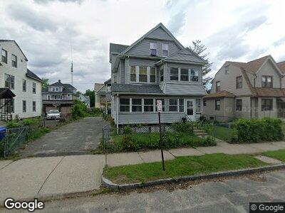
92 Dunmoreland St Unit 94 Springfield, MA 01109
Upper Hill NeighborhoodEstimated Value: $308,311 - $380,000
4
Beds
3
Baths
3,073
Sq Ft
$117/Sq Ft
Est. Value
About This Home
This home is located at 92 Dunmoreland St Unit 94, Springfield, MA 01109 and is currently estimated at $360,328, approximately $117 per square foot. 92 Dunmoreland St Unit 94 is a home located in Hampden County with nearby schools including Mary M. Walsh Elementary School, M Marcus Kiley Middle, and Springfield High School of Science and Technology.
Ownership History
Date
Name
Owned For
Owner Type
Purchase Details
Closed on
Feb 28, 2021
Sold by
Williams Keisha
Bought by
Herbert Joseph B
Current Estimated Value
Create a Home Valuation Report for This Property
The Home Valuation Report is an in-depth analysis detailing your home's value as well as a comparison with similar homes in the area
Home Values in the Area
Average Home Value in this Area
Purchase History
| Date | Buyer | Sale Price | Title Company |
|---|---|---|---|
| Herbert Joseph B | -- | None Available |
Source: Public Records
Mortgage History
| Date | Status | Borrower | Loan Amount |
|---|---|---|---|
| Previous Owner | Herbert Joseph B | $62,400 |
Source: Public Records
Tax History Compared to Growth
Tax History
| Year | Tax Paid | Tax Assessment Tax Assessment Total Assessment is a certain percentage of the fair market value that is determined by local assessors to be the total taxable value of land and additions on the property. | Land | Improvement |
|---|---|---|---|---|
| 2025 | $4,560 | $290,800 | $31,100 | $259,700 |
| 2024 | $4,343 | $270,400 | $31,100 | $239,300 |
| 2023 | $4,162 | $244,100 | $28,300 | $215,800 |
| 2022 | $4,253 | $226,000 | $26,400 | $199,600 |
| 2021 | $3,729 | $197,300 | $18,700 | $178,600 |
| 2020 | $3,504 | $179,400 | $18,700 | $160,700 |
| 2019 | $3,196 | $162,400 | $16,000 | $146,400 |
| 2018 | $3,037 | $154,300 | $16,000 | $138,300 |
| 2017 | $2,912 | $148,100 | $15,000 | $133,100 |
| 2016 | $2,522 | $128,300 | $15,000 | $113,300 |
| 2015 | $2,474 | $125,800 | $15,000 | $110,800 |
Source: Public Records
Map
Nearby Homes
- 88 Massachusetts Ave
- 68-70 Massachusetts Ave
- 90 Rochelle St
- 80 Rochelle St
- 116-118 Westford Ave
- 157-159 Massachusetts Ave
- 118-120 Westford Cir
- 124-126 Westford Cir
- 8 Marlborough St
- 174 Wellington St
- 122 Middlesex St
- 35-37 Suffolk St
- 144 Bristol St
- 290 Quincy St
- 288 Quincy St
- 93 Bristol St
- 153 Bristol St
- 56 Colonial Ave
- 129 Eastern Ave
- 19 Hayden Ave
- 92 Dunmoreland St Unit 94
- 92-94 Dunmoreland St
- 88 Dunmoreland St
- 98 Dunmoreland St Unit 100
- 91 Massachusetts Ave
- 87 Massachusetts Ave
- 82 Dunmoreland St
- 104 Dunmoreland St Unit 106
- 104-106 Dunmoreland St
- 97 Massachusetts Ave
- 87 Massachusetts Ave
- 91 Dunmoreland St
- 93 Massachusetts Ave
- 79 Massachusetts Ave Unit 81
- 101 Massachusetts Ave Unit 103
- 89 Dunmoreland St
- 99 Dunmoreland St
- 99 Massachusetts Ave
- 76 Dunmoreland St
- 110 Dunmoreland St Unit 112