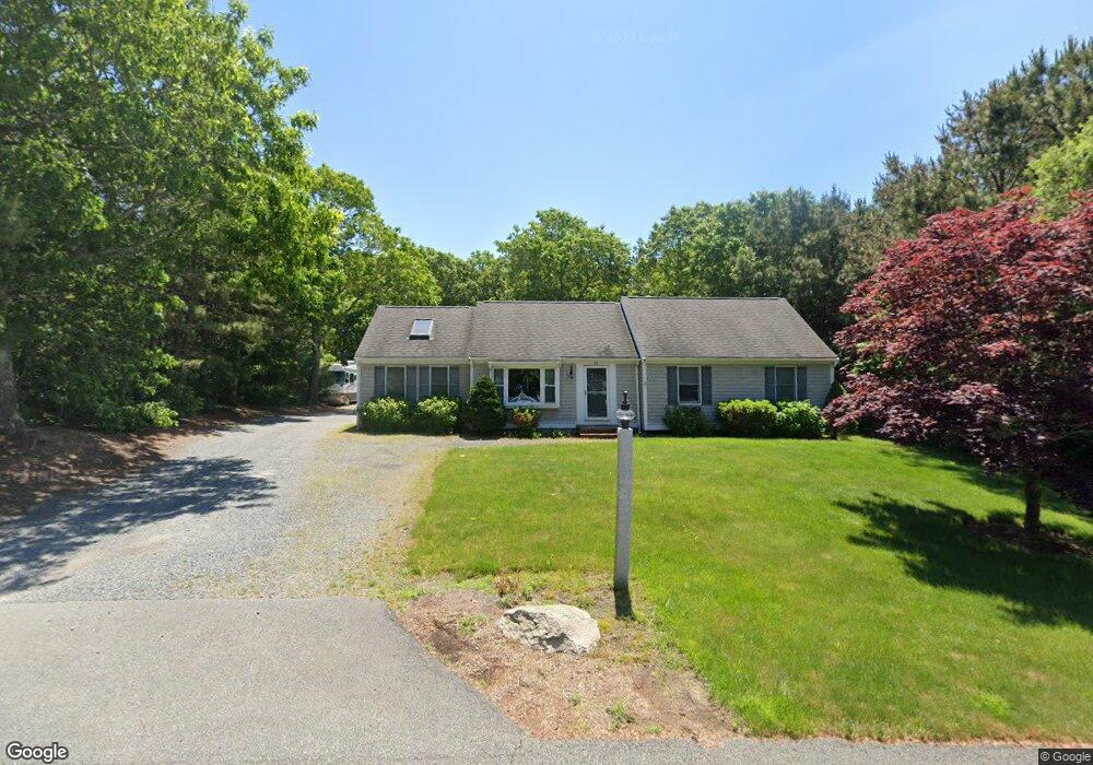
92 Park Place Way Mashpee, MA 02649
Estimated Value: $557,000 - $663,000
3
Beds
2
Baths
1,001
Sq Ft
$596/Sq Ft
Est. Value
About This Home
This home is located at 92 Park Place Way, Mashpee, MA 02649 and is currently estimated at $596,989, approximately $596 per square foot. 92 Park Place Way is a home located in Barnstable County with nearby schools including Kenneth C. Coombs School, Quashnet School, and Mashpee Middle School.
Ownership History
Date
Name
Owned For
Owner Type
Purchase Details
Closed on
Apr 18, 2003
Sold by
Odams Valerie L and Odams David G
Bought by
Gardner Richard H
Current Estimated Value
Home Financials for this Owner
Home Financials are based on the most recent Mortgage that was taken out on this home.
Original Mortgage
$194,000
Outstanding Balance
$83,341
Interest Rate
5.75%
Mortgage Type
Purchase Money Mortgage
Estimated Equity
$513,648
Purchase Details
Closed on
Oct 13, 1995
Sold by
Campbell Florence E
Bought by
Hatch Valerie L
Home Financials for this Owner
Home Financials are based on the most recent Mortgage that was taken out on this home.
Original Mortgage
$84,300
Interest Rate
7.71%
Mortgage Type
Purchase Money Mortgage
Purchase Details
Closed on
Jan 3, 1994
Sold by
Henken Milton L and Henken Sara G
Bought by
Campbell Richard A and Campbell Florence E
Create a Home Valuation Report for This Property
The Home Valuation Report is an in-depth analysis detailing your home's value as well as a comparison with similar homes in the area
Home Values in the Area
Average Home Value in this Area
Purchase History
| Date | Buyer | Sale Price | Title Company |
|---|---|---|---|
| Gardner Richard H | $242,500 | -- | |
| Hatch Valerie L | $92,500 | -- | |
| Campbell Richard A | $85,000 | -- |
Source: Public Records
Mortgage History
| Date | Status | Borrower | Loan Amount |
|---|---|---|---|
| Open | Gardner Richard H | $194,000 | |
| Previous Owner | Hatch Valerie L | $84,300 |
Source: Public Records
Tax History Compared to Growth
Tax History
| Year | Tax Paid | Tax Assessment Tax Assessment Total Assessment is a certain percentage of the fair market value that is determined by local assessors to be the total taxable value of land and additions on the property. | Land | Improvement |
|---|---|---|---|---|
| 2025 | $3,483 | $526,100 | $198,800 | $327,300 |
| 2024 | $3,191 | $496,200 | $180,800 | $315,400 |
| 2023 | $3,042 | $434,000 | $172,100 | $261,900 |
| 2022 | $2,944 | $360,400 | $139,900 | $220,500 |
| 2021 | $2,853 | $314,500 | $126,100 | $188,400 |
| 2020 | $2,761 | $303,700 | $121,200 | $182,500 |
| 2019 | $2,666 | $294,600 | $121,200 | $173,400 |
| 2018 | $2,486 | $278,700 | $121,200 | $157,500 |
| 2017 | $2,461 | $267,800 | $121,200 | $146,600 |
| 2016 | $2,403 | $260,100 | $121,200 | $138,900 |
| 2015 | $2,320 | $254,700 | $121,200 | $133,500 |
| 2014 | $2,365 | $251,900 | $119,700 | $132,200 |
Source: Public Records
Map
Nearby Homes
- 35 Claulise Ln
- 235 Main St
- 22 Stratford Ridge Unit 22
- 100 Great Neck Rd N Unit 3
- 100 Great Neck Rd N Unit 1003
- 30 Windsor Point
- 5 Darby Point Unit 5
- 4 Bishops Park
- 20 Windsor Way
- 6 Mayfair Ct
- 6 Mayfair Ct Unit 6
- 45 Pequot Rd
- 295 Pheasant Hill Cir
- 26 Collins Ln
- 16 Spring Brook Ln
- 195 Falmouth Rd Unit 10E
- 195 Falmouth Rd Unit 12F
- 195 Falmouth Rd Unit 9D
- 195 Falmouth Rd Unit 7B
- 90 Lakewood Dr
- 86 Park Place Way
- 98 Park Place Way
- 87 Park Place Way
- 95 Park Place Way
- 74 Park Place Way
- 97 Sunset Strip
- 104 Park Place Way
- 87 Sunset Strip
- 77 Park Place Way
- 188 Noisy Hole Rd
- 170 Noisy Hole Rd
- 109 Sunset Strip
- 54 Scenic Dr
- 72 Park Place Way
- 198 Noisy Hole Rd
- 81 Sunset Strip
- 113 Sunset Strip
- 48 Scenic Dr
- 71 Park Place Way
- 96 Sunset Strip