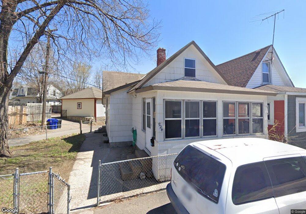
924 Denslow St Saint Paul, MN 55103
North End NeighborhoodEstimated Value: $149,932 - $214,000
2
Beds
1
Bath
900
Sq Ft
$191/Sq Ft
Est. Value
About This Home
This home is located at 924 Denslow St, Saint Paul, MN 55103 and is currently estimated at $172,233, approximately $191 per square foot. 924 Denslow St is a home located in Ramsey County with nearby schools including Como Park Elementary School, Murray Middle School, and Como Park Senior High School.
Ownership History
Date
Name
Owned For
Owner Type
Purchase Details
Closed on
Dec 12, 2007
Sold by
Jpmorgan Chase Bank
Bought by
Hogan Patrick
Current Estimated Value
Purchase Details
Closed on
Aug 6, 2004
Sold by
Hall Roy J and Hall Pamela J
Bought by
Doffing Jason L
Purchase Details
Closed on
Aug 13, 2003
Sold by
Hall Pamela
Bought by
Doffing L Jason
Create a Home Valuation Report for This Property
The Home Valuation Report is an in-depth analysis detailing your home's value as well as a comparison with similar homes in the area
Home Values in the Area
Average Home Value in this Area
Purchase History
| Date | Buyer | Sale Price | Title Company |
|---|---|---|---|
| Hogan Patrick | $34,500 | -- | |
| Doffing Jason L | $79,900 | -- | |
| Doffing L Jason | $79,000 | -- |
Source: Public Records
Mortgage History
| Date | Status | Borrower | Loan Amount |
|---|---|---|---|
| Closed | Doffing L Jason | -- |
Source: Public Records
Tax History Compared to Growth
Tax History
| Year | Tax Paid | Tax Assessment Tax Assessment Total Assessment is a certain percentage of the fair market value that is determined by local assessors to be the total taxable value of land and additions on the property. | Land | Improvement |
|---|---|---|---|---|
| 2025 | $1,642 | $119,100 | $10,000 | $109,100 |
| 2023 | $1,642 | $97,900 | $8,000 | $89,900 |
| 2022 | $1,500 | $91,600 | $8,000 | $83,600 |
| 2021 | $1,372 | $88,400 | $8,000 | $80,400 |
| 2020 | $1,322 | $83,500 | $6,700 | $76,800 |
| 2019 | $1,060 | $74,700 | $6,700 | $68,000 |
| 2018 | $812 | $58,100 | $6,700 | $51,400 |
| 2017 | $734 | $44,700 | $6,700 | $38,000 |
| 2016 | $636 | $0 | $0 | $0 |
| 2015 | $616 | $35,300 | $6,700 | $28,600 |
| 2014 | $620 | $0 | $0 | $0 |
Source: Public Records
Map
Nearby Homes
- 352 Como Ave
- 552 Burgess St
- 569 Hatch Ave
- 1049 Kent St
- 705 Como Ave
- 1063 Dale St N
- 740 Como Ave
- 1104 MacKubin St
- 631 Van Buren Ave
- 956 Western Ave N
- 1040 Cumberland St
- 511 Van Buren Ave
- 646 Van Buren Ave
- 989 Barrett St
- 359 Stinson St W
- 553 Blair Ave
- 547 Blair Ave
- 1083 Western Ave N
- 751 Van Buren Ave
- 1165 Norton St