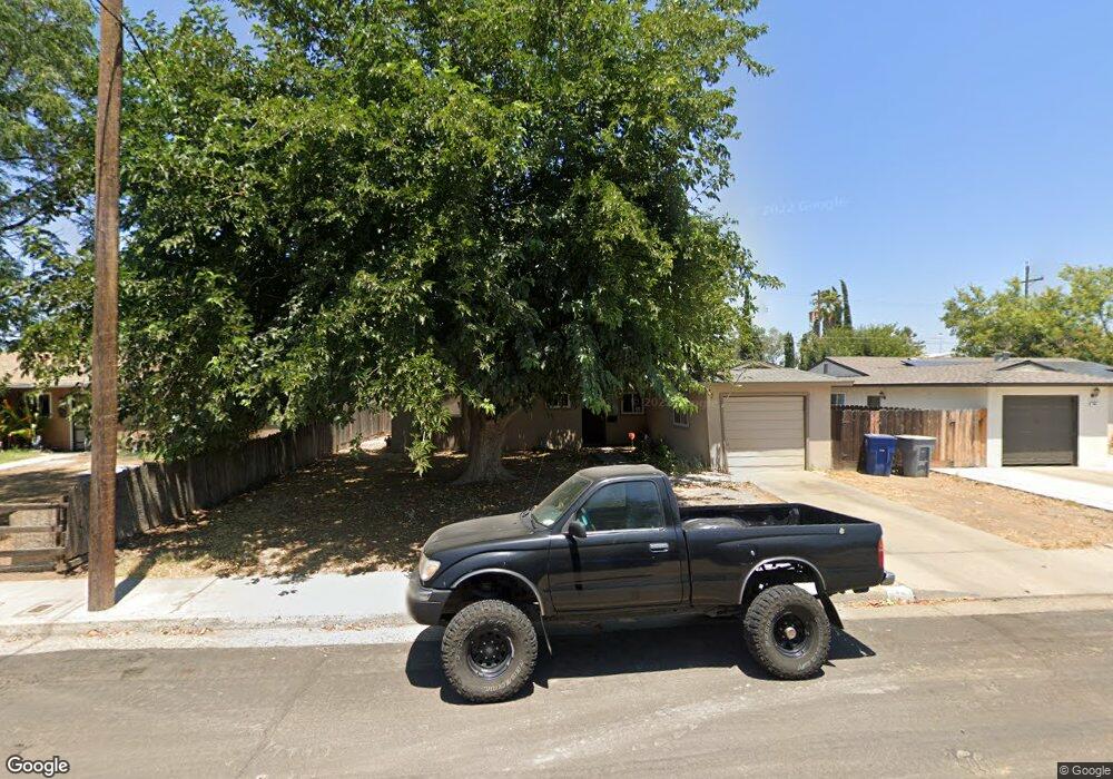
925 Brookside Dr Clovis, CA 93612
Estimated Value: $280,000 - $340,000
3
Beds
2
Baths
1,104
Sq Ft
$286/Sq Ft
Est. Value
About This Home
This home is located at 925 Brookside Dr, Clovis, CA 93612 and is currently estimated at $315,647, approximately $285 per square foot. 925 Brookside Dr is a home located in Fresno County with nearby schools including Clovis Elementary School, Clark Intermediate School, and Clovis High School.
Ownership History
Date
Name
Owned For
Owner Type
Purchase Details
Closed on
Nov 6, 2017
Sold by
Central Valley Caiital Ivlp
Bought by
Central Valley Capital I Llc
Current Estimated Value
Home Financials for this Owner
Home Financials are based on the most recent Mortgage that was taken out on this home.
Original Mortgage
$28,500,000
Interest Rate
4.5%
Mortgage Type
Commercial
Purchase Details
Closed on
Mar 21, 2017
Sold by
Miller Teresa M and Jackson Kristi A
Bought by
Central Valley Capital Iv Lp
Purchase Details
Closed on
Jul 10, 2012
Sold by
Jackson Kristi A and Jackson Jerard
Bought by
Jackson Kristi A
Home Financials for this Owner
Home Financials are based on the most recent Mortgage that was taken out on this home.
Original Mortgage
$20,000
Interest Rate
3.7%
Mortgage Type
Credit Line Revolving
Purchase Details
Closed on
Mar 21, 1994
Sold by
Miller Larry and Miller Teresa
Bought by
Miller Larry D and Miller Teresa M
Create a Home Valuation Report for This Property
The Home Valuation Report is an in-depth analysis detailing your home's value as well as a comparison with similar homes in the area
Home Values in the Area
Average Home Value in this Area
Purchase History
| Date | Buyer | Sale Price | Title Company |
|---|---|---|---|
| Central Valley Capital I Llc | $6,447,500 | Os National | |
| Central Valley Capital Iv Lp | $100,000 | Placer Title Fresno Er | |
| Jackson Kristi A | -- | Chicago Title Company | |
| Miller Larry D | -- | Chicago Title Company |
Source: Public Records
Mortgage History
| Date | Status | Borrower | Loan Amount |
|---|---|---|---|
| Previous Owner | Central Valley Capital I Llc | $28,500,000 | |
| Previous Owner | Jackson Kristi A | $20,000 |
Source: Public Records
Tax History
| Year | Tax Paid | Tax Assessment Tax Assessment Total Assessment is a certain percentage of the fair market value that is determined by local assessors to be the total taxable value of land and additions on the property. | Land | Improvement |
|---|---|---|---|---|
| 2025 | $2,302 | $193,426 | $62,578 | $130,848 |
| 2023 | $2,215 | $185,917 | $60,149 | $125,768 |
| 2022 | $2,186 | $182,272 | $58,970 | $123,302 |
| 2021 | $2,125 | $178,699 | $57,814 | $120,885 |
| 2020 | $2,117 | $176,868 | $57,222 | $119,646 |
| 2019 | $2,076 | $173,400 | $56,100 | $117,300 |
| 2018 | $1,530 | $127,500 | $45,900 | $81,600 |
| 2017 | $1,038 | $85,480 | $32,794 | $52,686 |
| 2016 | $1,003 | $83,804 | $32,151 | $51,653 |
| 2015 | $988 | $82,547 | $31,669 | $50,878 |
| 2014 | $971 | $80,931 | $31,049 | $49,882 |
Source: Public Records
Map
Nearby Homes
- 1228 Jefferson Ave
- 1272 Bullard Ave
- 760 Sunnyside Ave
- 142 9th St
- 134 10th St
- 103 Poppy Ln
- 1428 Miami Ave
- 127 5th St
- 1498 Escalon Ave
- 1606 Barstow Ave
- 1622 Dennis Ave
- 1515 Keats Ave
- 51 San Jose Ave
- 1234 No Address Available
- 1273 Bundy Ave
- 860 Mcarthur Ave
- 69 W Beverly Ave Unit 101
- 216 Keats Ave
- 1334 Shirley Ave
- 1721 Beverly Ave
- 935 Brookside Dr
- 915 Brookside Dr
- 945 Brookside Dr
- 907 Brookside Dr
- 930 Brookside Dr
- 914 Brookside Dr
- 940 Brookside Dr
- 955 Brookside Dr
- 861 Brookside Dr
- 906 Brookside Dr
- 950 Brookside Dr
- 963 Brookside Dr
- 855 Brookside Dr
- 939 Estabrook Dr
- 858 Brookside Dr
- 960 Brookside Dr
- 905 Estabrook Dr
- 931 Estabrook Dr
- 951 Estabrook Dr
- 915 Estabrook Dr
Your Personal Tour Guide
Ask me questions while you tour the home.