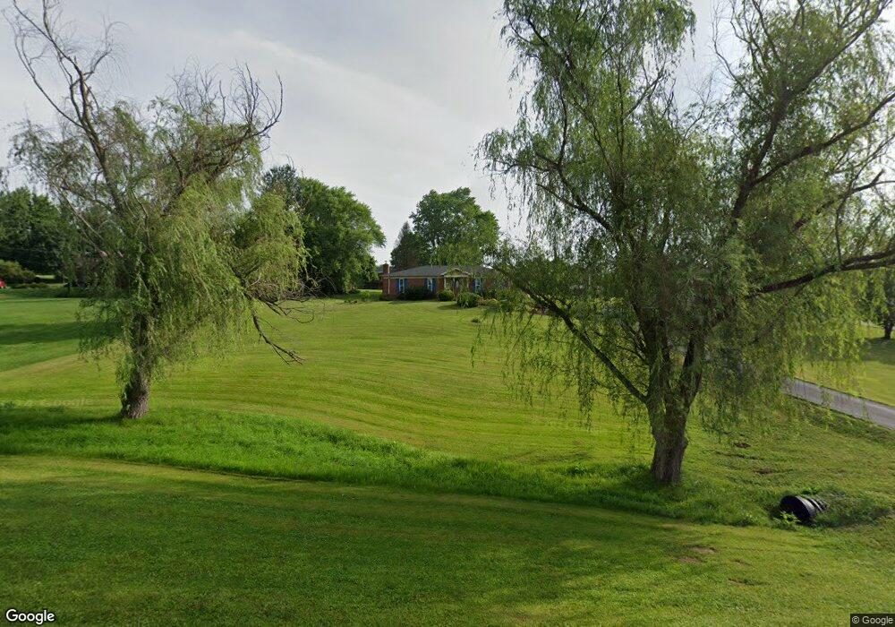
930 Hogreffe Rd Independence, KY 41051
Estimated Value: $392,000 - $426,000
3
Beds
3
Baths
1,450
Sq Ft
$285/Sq Ft
Est. Value
About This Home
This home is located at 930 Hogreffe Rd, Independence, KY 41051 and is currently estimated at $413,315, approximately $285 per square foot. 930 Hogreffe Rd is a home located in Kenton County with nearby schools including Beechgrove Elementary School, Twenhofel Middle School, and Simon Kenton High School.
Ownership History
Date
Name
Owned For
Owner Type
Purchase Details
Closed on
May 22, 2025
Sold by
Lisa Jeffrey A and Lisa Gayle
Bought by
Vonderahe Austin J and Vonderahe Joseph E
Current Estimated Value
Purchase Details
Closed on
Nov 7, 2022
Sold by
Martin Jeffrey A and Martin Lisa G
Bought by
Jeffrey A Martin And Lisa Gayle Martin Trust
Purchase Details
Closed on
Apr 16, 2014
Sold by
Federal Home Loan Mortgage Corporation
Bought by
Martin Jeffrey A and Martin Lisa G
Purchase Details
Closed on
Sep 9, 2013
Sold by
Carter Lisa A and Carter Richard J
Bought by
Federal Home Loan Mortgage Corporation and Fhlmc
Create a Home Valuation Report for This Property
The Home Valuation Report is an in-depth analysis detailing your home's value as well as a comparison with similar homes in the area
Home Values in the Area
Average Home Value in this Area
Purchase History
| Date | Buyer | Sale Price | Title Company |
|---|---|---|---|
| Vonderahe Austin J | $420,000 | Kentucky Land Title | |
| Vonderahe Austin J | $420,000 | Kentucky Land Title | |
| Jeffrey A Martin And Lisa Gayle Martin Trust | $129,200 | -- | |
| Jeffrey A Martin And Lisa Gayle Martin Trust | $129,200 | None Listed On Document | |
| Martin Jeffrey A | $99,900 | Kentucky Land Title Agency | |
| Federal Home Loan Mortgage Corporation | $100,100 | None Available |
Source: Public Records
Tax History
| Year | Tax Paid | Tax Assessment Tax Assessment Total Assessment is a certain percentage of the fair market value that is determined by local assessors to be the total taxable value of land and additions on the property. | Land | Improvement |
|---|---|---|---|---|
| 2025 | $2,279 | $196,000 | $35,000 | $161,000 |
| 2024 | $1,583 | $129,200 | $25,000 | $104,200 |
| 2023 | $1,631 | $129,200 | $25,000 | $104,200 |
| 2022 | $1,696 | $129,200 | $25,000 | $104,200 |
| 2021 | $1,720 | $129,200 | $25,000 | $104,200 |
| 2020 | $1,506 | $110,000 | $20,000 | $90,000 |
| 2019 | $1,510 | $110,000 | $20,000 | $90,000 |
| 2018 | $1,518 | $110,000 | $20,000 | $90,000 |
| 2017 | $1,477 | $110,000 | $20,000 | $90,000 |
| 2015 | $1,304 | $99,900 | $28,000 | $71,900 |
| 2014 | $1,956 | $154,500 | $28,000 | $126,500 |
Source: Public Records
Map
Nearby Homes
- 10690 Melbury Ct Unit 305GL
- 10700 Melbury Ct
- 800 Berlander Dr
- 10654 Sinclair Dr
- 10422 Flintrock Bluff
- 1202 Wellford Dr
- 1197 Catletts Ct
- 1211 Wellford Dr
- 1217 Cannonball Way
- 10775 Brian Dr
- 10790 Parker
- 1748 Cherry Blossom Dr
- 1739 Cherry Blossom Dr
- 1736 Cherry Blossom Dr
- 9877 Flagstone Dr
- 1707 Cherry Blossom Dr
- 1727 Cherry Blossom Dr
- 1727 Cherry Blossom Dr
- 1707 Cherry Blossom Dr
- 1247 Monocacy Ct
- 906 Hogreffe Rd
- 940 Hogrefe Rd
- 960 Hogreffe Rd
- 950 Hogreffe Rd
- 915 Hogreffe Rd
- 978 Hogrefe Rd
- 931 Hogrefe Rd
- 961 Hogrefe Rd
- 899 Hogrefe Rd
- 899 Hogrefe Rd
- 963 Hogrefe Rd
- 888 Hogreffe Rd
- 898 Hogrefe Rd
- 647 Bristow Rd
- 988 Hogrefe Rd
- 988 Hogrefe Rd
- 643 Bristow Rd
- 902 Hogrefe Rd
- 649 Bristow Rd
- 902 Hogreffe Rd
Your Personal Tour Guide
Ask me questions while you tour the home.