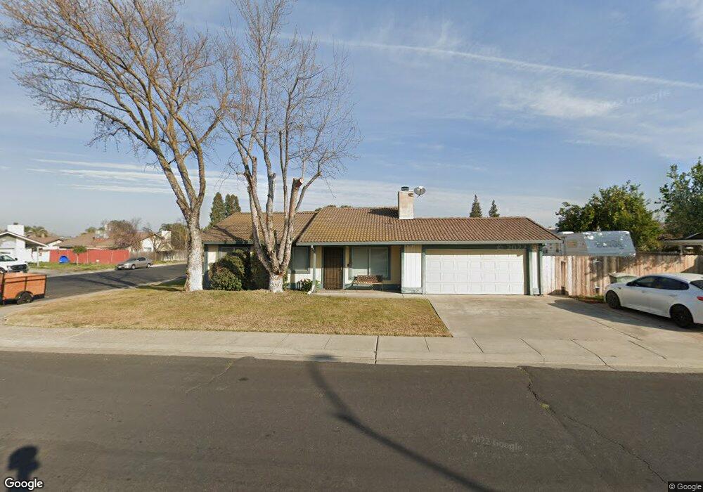
933 King Richard Way Manteca, CA 95336
Downtown Manteca NeighborhoodEstimated Value: $340,000 - $483,000
3
Beds
2
Baths
1,156
Sq Ft
$376/Sq Ft
Est. Value
About This Home
This home is located at 933 King Richard Way, Manteca, CA 95336 and is currently estimated at $434,974, approximately $376 per square foot. 933 King Richard Way is a home located in San Joaquin County with nearby schools including Neil Hafley Elementary School, East Union High School, and BE.TECH Charter High School.
Ownership History
Date
Name
Owned For
Owner Type
Purchase Details
Closed on
May 22, 2001
Sold by
Thornton James D
Bought by
Thornton James D
Current Estimated Value
Home Financials for this Owner
Home Financials are based on the most recent Mortgage that was taken out on this home.
Original Mortgage
$145,000
Outstanding Balance
$54,624
Interest Rate
7.15%
Estimated Equity
$380,350
Purchase Details
Closed on
Aug 3, 1999
Sold by
Thornton Lisa L
Bought by
Thornton James D
Home Financials for this Owner
Home Financials are based on the most recent Mortgage that was taken out on this home.
Original Mortgage
$123,500
Interest Rate
7.64%
Purchase Details
Closed on
Apr 6, 1998
Sold by
Donald Putz
Bought by
Putz Donald W and Putz Jeanne L
Create a Home Valuation Report for This Property
The Home Valuation Report is an in-depth analysis detailing your home's value as well as a comparison with similar homes in the area
Home Values in the Area
Average Home Value in this Area
Purchase History
| Date | Buyer | Sale Price | Title Company |
|---|---|---|---|
| Thornton James D | -- | Old Republic Title Company | |
| Thornton James D | -- | Old Republic Title Company | |
| Thornton James D | $130,000 | Old Republic Title Company | |
| Putz Donald W | -- | -- |
Source: Public Records
Mortgage History
| Date | Status | Borrower | Loan Amount |
|---|---|---|---|
| Open | Thornton James D | $145,000 | |
| Closed | Thornton James D | $123,500 | |
| Closed | Thornton James D | $40,000 |
Source: Public Records
Tax History Compared to Growth
Tax History
| Year | Tax Paid | Tax Assessment Tax Assessment Total Assessment is a certain percentage of the fair market value that is determined by local assessors to be the total taxable value of land and additions on the property. | Land | Improvement |
|---|---|---|---|---|
| 2025 | $2,158 | $199,793 | $69,157 | $130,636 |
| 2024 | $2,096 | $195,876 | $67,801 | $128,075 |
| 2023 | $2,069 | $192,036 | $66,472 | $125,564 |
| 2022 | $2,036 | $188,271 | $65,169 | $123,102 |
| 2021 | $2,013 | $184,581 | $63,892 | $120,689 |
| 2020 | $1,931 | $182,689 | $63,237 | $119,452 |
| 2019 | $1,904 | $179,108 | $61,998 | $117,110 |
| 2018 | $1,878 | $175,597 | $60,783 | $114,814 |
| 2017 | $1,849 | $172,155 | $59,592 | $112,563 |
| 2016 | $1,803 | $168,780 | $58,424 | $110,356 |
| 2014 | $1,675 | $162,989 | $56,419 | $106,570 |
Source: Public Records
Map
Nearby Homes
- 873 Nottingham Dr
- 11097 S Union Rd
- 1624 S Highway 99 Unit 19
- 889 Harvest Mill Dr
- 2254 Maple Hollow Ln
- 2253 Maple Hollow Ln
- 1309 Ruffino Ct
- 1870 Pecanwood Ave
- 1660 Kingwood Ave
- 2021 Holbrook Place
- 447 Ericwood Ct
- 1414 Pajaro Ave Unit 14
- 2418 Finchwood Landing Ln
- 1379 Maple Valley St
- 2066 Hyde Park Place
- 1394 Pajaro Ave Unit 17
- 2367 Bellchase Dr
- 2345 Pepper Tree Ln
- 6288 E Lathrop Rd
- 1340 Crimson Place
- 1972 Oldham Place
- 1969 Sherwood Place
- 1981 Sherwood Place
- 1934 Oldham Place
- 1984 Oldham Place
- 1955 Oldham Place
- 1993 Sherwood Place
- 1951 Sherwood Place
- 1967 Oldham Place
- 1943 Oldham Place
- 960 Croyden Way
- 1998 Oldham Place
- 1920 Oldham Place
- 1931 Oldham Place
- 2005 Sherwood Place
- 1939 Sherwood Place
- 1972 Sherwood Place
- 972 Croyden Way
- 1009 Derby Ct
- 2014 Oldham Place