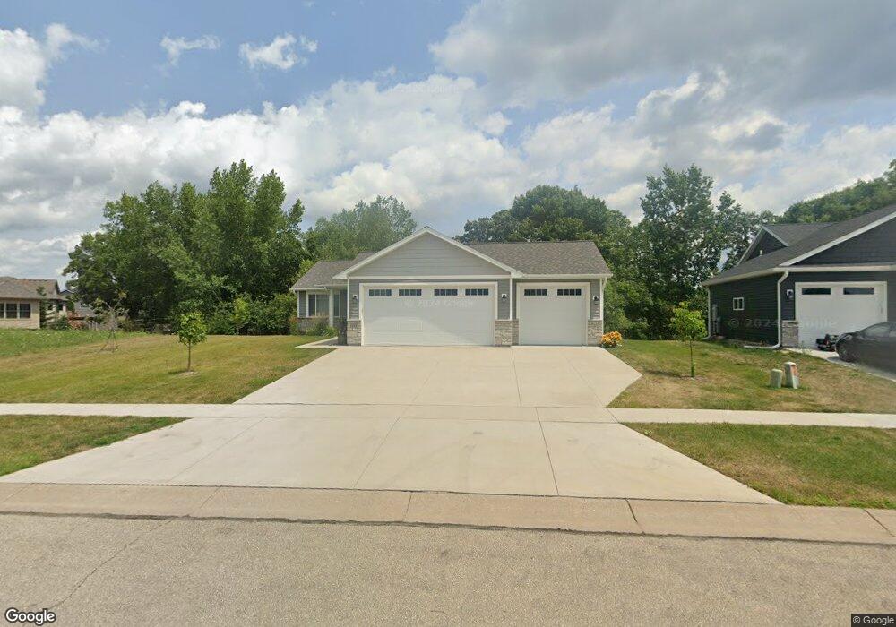
933 Snowbird Dr Red Wing, MN 55066
Estimated Value: $437,000 - $512,000
3
Beds
2
Baths
1,439
Sq Ft
$336/Sq Ft
Est. Value
About This Home
This home is located at 933 Snowbird Dr, Red Wing, MN 55066 and is currently estimated at $483,336, approximately $335 per square foot. 933 Snowbird Dr is a home located in Goodhue County with nearby schools including Burnside Elementary School, Sunnyside Elementary School, and Twin Bluff Middle School.
Ownership History
Date
Name
Owned For
Owner Type
Purchase Details
Closed on
Jun 15, 2021
Sold by
Flanders Kelly and Flanders Steven
Bought by
Flanders Kelly
Current Estimated Value
Purchase Details
Closed on
Jun 12, 2020
Sold by
Goodman Holdings I Llc
Bought by
Flanders Kelly and Flanders Steven
Purchase Details
Closed on
May 1, 2019
Sold by
Schmidt Craig Craig
Home Financials for this Owner
Home Financials are based on the most recent Mortgage that was taken out on this home.
Original Mortgage
$45,000
Interest Rate
4.2%
Purchase Details
Closed on
Aug 7, 2008
Sold by
Not Provided
Bought by
Schmidt Craig M and Not Provided
Purchase Details
Closed on
Dec 31, 2007
Sold by
Smith Kenneth D and Smith Michelle A
Bought by
Dylan Enterprises Llc
Create a Home Valuation Report for This Property
The Home Valuation Report is an in-depth analysis detailing your home's value as well as a comparison with similar homes in the area
Home Values in the Area
Average Home Value in this Area
Purchase History
| Date | Buyer | Sale Price | Title Company |
|---|---|---|---|
| Flanders Kelly | -- | None Available | |
| Flanders Kelly | $404,357 | None Available | |
| -- | $45,000 | -- | |
| Schmidt Craig M | $125,302 | -- | |
| Dylan Enterprises Llc | $325,000 | -- |
Source: Public Records
Mortgage History
| Date | Status | Borrower | Loan Amount |
|---|---|---|---|
| Previous Owner | -- | $45,000 | |
| Previous Owner | -- | -- |
Source: Public Records
Tax History Compared to Growth
Tax History
| Year | Tax Paid | Tax Assessment Tax Assessment Total Assessment is a certain percentage of the fair market value that is determined by local assessors to be the total taxable value of land and additions on the property. | Land | Improvement |
|---|---|---|---|---|
| 2025 | $6,386 | $483,200 | $50,100 | $433,100 |
| 2024 | $6,386 | $474,700 | $49,800 | $424,900 |
| 2023 | $5,982 | $444,000 | $49,800 | $394,200 |
| 2022 | $5,684 | $441,100 | $49,800 | $391,300 |
| 2021 | $4,300 | $382,400 | $63,800 | $318,600 |
| 2020 | $640 | $299,800 | $63,800 | $236,000 |
| 2019 | $632 | $33,500 | $33,500 | $0 |
| 2018 | $606 | $33,500 | $33,500 | $0 |
| 2017 | $598 | $33,500 | $33,500 | $0 |
| 2016 | $570 | $33,500 | $33,500 | $0 |
| 2015 | $574 | $33,500 | $33,500 | $0 |
| 2014 | -- | $45,900 | $45,900 | $0 |
Source: Public Records
Map
Nearby Homes
- 921 Snowbird Dr
- 914 Snowbird Dr
- 910 Snowbird Dr
- 906 Snowbird Dr
- 4786 Mount Hood Ln
- 505 Aspen Ave
- 469 Aspen Ave
- 4739 Big Sky Ct
- 4958 Chalet Ct
- 4976 Chalet Ct
- 4986 Chalet Ct
- 4990 Chalet Ct
- 4994 Chalet Ct
- 808 Aurora Cir
- 853 Aurora Cir
- 912 Aurora Cir
- 936 Aurora Cir
- 980 Aurora Cir
- 135 Kingswood Dr
- TBD Mill Rd
- 909 Snowbird Dr
- 930 Snowbird Dr
- 936 Snowbird Dr
- 924 Snowbird Dr
- 905 Snowbird Dr
- Lot 12 Snowbird
- 899 Snowbird Dr
- 887 Snowbird Dr
- 0 Snowbird Dr Unit 4194542
- 00 Snowbird-Drive-
- 0 Snowbird Dr Unit 4403267
- 542 Aspen Ave
- 4736 Big Sky Ct
- 550 Aspen Ave
- 534 Aspen Ave
- 898 Snowbird Dr
- 4794 Mount Hood Ln
- 522 Aspen Ave
- 875 Snowbird Dr
- 00 Snowbird Dr