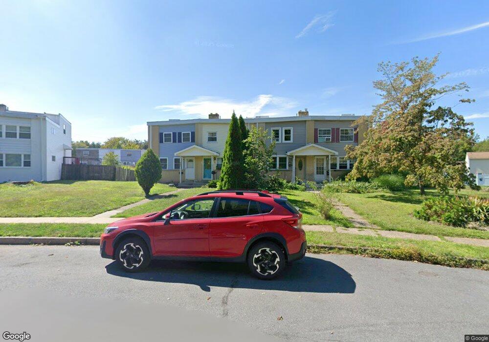
944 Andover Rd Lansdale, PA 19446
Estimated Value: $261,000 - $329,000
3
Beds
3
Baths
1,250
Sq Ft
$247/Sq Ft
Est. Value
About This Home
This home is located at 944 Andover Rd, Lansdale, PA 19446 and is currently estimated at $308,797, approximately $247 per square foot. 944 Andover Rd is a home located in Montgomery County with nearby schools including Oak Park El School, Penndale Middle School, and North Penn Senior High School.
Ownership History
Date
Name
Owned For
Owner Type
Purchase Details
Closed on
Jan 19, 2017
Sold by
Reid Michael
Bought by
Reid Michael and Vernon Phillipa
Current Estimated Value
Purchase Details
Closed on
May 13, 2011
Sold by
Jacob Viraf
Bought by
Reid Michael
Home Financials for this Owner
Home Financials are based on the most recent Mortgage that was taken out on this home.
Original Mortgage
$3,000
Outstanding Balance
$2,091
Interest Rate
4.94%
Estimated Equity
$306,706
Purchase Details
Closed on
Oct 29, 2010
Sold by
Ashbaugh Steven L
Bought by
Household Finance Consumer Discount Comp
Purchase Details
Closed on
Oct 27, 2010
Sold by
Household Finance Consumer Discount Comp
Bought by
Jacob Viraf
Create a Home Valuation Report for This Property
The Home Valuation Report is an in-depth analysis detailing your home's value as well as a comparison with similar homes in the area
Home Values in the Area
Average Home Value in this Area
Purchase History
| Date | Buyer | Sale Price | Title Company |
|---|---|---|---|
| Reid Michael | -- | Fidelity Abstract | |
| Reid Michael | $162,500 | None Available | |
| Household Finance Consumer Discount Comp | $2,500 | None Available | |
| Jacob Viraf | $85,000 | None Available |
Source: Public Records
Mortgage History
| Date | Status | Borrower | Loan Amount |
|---|---|---|---|
| Open | Reid Michael | $3,000 | |
| Open | Reid Michael | $158,239 |
Source: Public Records
Tax History Compared to Growth
Tax History
| Year | Tax Paid | Tax Assessment Tax Assessment Total Assessment is a certain percentage of the fair market value that is determined by local assessors to be the total taxable value of land and additions on the property. | Land | Improvement |
|---|---|---|---|---|
| 2025 | $3,451 | $82,020 | $17,460 | $64,560 |
| 2024 | $3,451 | $82,020 | $17,460 | $64,560 |
| 2023 | $3,228 | $82,020 | $17,460 | $64,560 |
| 2022 | $3,125 | $82,020 | $17,460 | $64,560 |
| 2021 | $2,998 | $82,020 | $17,460 | $64,560 |
| 2020 | $2,907 | $82,020 | $17,460 | $64,560 |
| 2019 | $2,859 | $82,020 | $17,460 | $64,560 |
| 2018 | $767 | $82,020 | $17,460 | $64,560 |
| 2017 | $2,669 | $82,020 | $17,460 | $64,560 |
| 2016 | $2,637 | $82,020 | $17,460 | $64,560 |
| 2015 | $2,591 | $82,020 | $17,460 | $64,560 |
| 2014 | $2,447 | $82,020 | $17,460 | $64,560 |
Source: Public Records
Map
Nearby Homes
- 1315 Deer Run Rd
- 1226 Cabin Rd
- 732 Cowpath Rd
- 816 Kenilworth Ave
- 1028 Poplar St Unit 75
- 302 W 8th St Unit 21
- 1306 W Orvilla Rd
- 1524 Tarrington Way
- 833 W 4th St
- 9 Fortuna Dr
- 8 Fortuna Dr
- 5 Fortuna Dr
- 6 Fortuna Dr
- 1035 Forest Ave
- 204 N Valley Forge Rd Unit 7B
- 401 Sadie Ave
- 381 Sydney Ave
- 373 Sydney Ln
- 375 Sydney Ln
- 13 W End Dr
- 946 Andover Rd
- 942 Andover Rd
- 948 Andover Rd
- 938 Andover Rd
- 936 Andover Rd
- 1292 Andover Rd
- 934 Andover Rd
- 969 Wedgewood Dr
- 932 Andover Rd
- 961 Wedgewood Dr
- 959 Wedgewood Dr
- 967 Wedgewood Dr
- 963 Wedgewood Dr
- 973 Wedgewood Dr
- 957 Wedgewood Dr
- 951 Wedgewood Dr
- 1293 Wedgewood Dr
- 1296 Andover Rd
- 949 Wedgewood Dr
- 928 Andover Rd