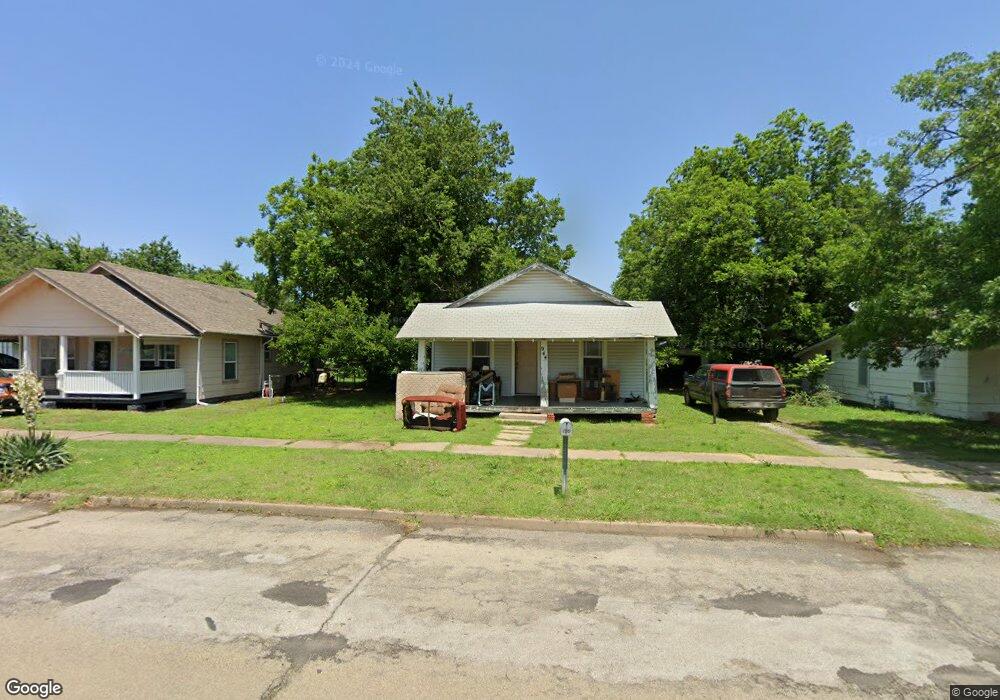
944 E Maple St Cushing, OK 74023
Estimated Value: $60,074 - $97,000
2
Beds
1
Bath
720
Sq Ft
$103/Sq Ft
Est. Value
About This Home
This home is located at 944 E Maple St, Cushing, OK 74023 and is currently estimated at $74,019, approximately $102 per square foot. 944 E Maple St is a home located in Payne County with nearby schools including Cushing Upper Elementary School, Cushing Lower Elementary School, and Cushing High School.
Ownership History
Date
Name
Owned For
Owner Type
Purchase Details
Closed on
May 31, 2024
Sold by
Mojo Investments Inc
Bought by
Mcfarlin Wesley
Current Estimated Value
Home Financials for this Owner
Home Financials are based on the most recent Mortgage that was taken out on this home.
Original Mortgage
$1,191,000
Outstanding Balance
$1,172,877
Interest Rate
7.1%
Mortgage Type
New Conventional
Estimated Equity
-$1,098,858
Purchase Details
Closed on
May 1, 2007
Sold by
Cargill Gordon Darrell and Cargill Tommie Lee
Bought by
Cargill Gordon Darrell and Cargill Tommie Lee
Create a Home Valuation Report for This Property
The Home Valuation Report is an in-depth analysis detailing your home's value as well as a comparison with similar homes in the area
Purchase History
| Date | Buyer | Sale Price | Title Company |
|---|---|---|---|
| Mcfarlin Wesley | $1,073,500 | None Listed On Document | |
| Mojo Investments Inc | -- | None Listed On Document | |
| Cargill Gordon Darrell | -- | None Available |
Source: Public Records
Mortgage History
| Date | Status | Borrower | Loan Amount |
|---|---|---|---|
| Open | Mcfarlin Wesley | $1,191,000 |
Source: Public Records
Tax History
| Year | Tax Paid | Tax Assessment Tax Assessment Total Assessment is a certain percentage of the fair market value that is determined by local assessors to be the total taxable value of land and additions on the property. | Land | Improvement |
|---|---|---|---|---|
| 2025 | $500 | $3,460 | $341 | $3,119 |
| 2024 | $293 | $3,460 | $341 | $3,119 |
| 2023 | $293 | $3,296 | $541 | $2,755 |
| 2022 | $268 | $3,139 | $579 | $2,560 |
| 2021 | $248 | $2,989 | $590 | $2,399 |
| 2020 | $233 | $2,847 | $489 | $2,358 |
| 2019 | $232 | $2,712 | $741 | $1,971 |
| 2018 | $225 | $2,712 | $741 | $1,971 |
| 2017 | $223 | $2,712 | $741 | $1,971 |
| 2016 | $229 | $2,712 | $741 | $1,971 |
| 2015 | $233 | $2,694 | $539 | $2,155 |
| 2014 | $232 | $2,694 | $539 | $2,155 |
Source: Public Records
Map
Nearby Homes
- 933 E Maple St
- 915 E Oak St
- 1002 E Cherry St
- 724 E Moses St
- 732 E Broadway St
- 112 S Highland Ave
- 1001 E Pecan St
- 708 E Broadway St
- 919 E 2nd St
- 1301 E Ash St
- 1236 E Main St
- 1224 E Cherry St
- 1133 E Pecan St
- 616 E Cherry St
- 1217 E Cherry St
- 1318 E Oak St
- 1129 E Vine St
- 612 E 2nd St
- 1003 E 4th St
- 843 E 4th St
- 936 E Maple St
- 946 E Maple St
- 948 E Maple St
- 932 E Maple St
- 928 E Maple St
- 937 E Walnut St
- 941 E Walnut St
- 935 E Walnut St
- 947 E Walnut St
- 945 E Maple St
- 941 E Maple St
- 924 E Maple St
- 947 E Maple St
- 1004 E Maple St
- 949 E Maple St
- 927 E Walnut St
- 931 E Maple St
- 920 E Maple St
- 1003 E Walnut St
- 1008 E Maple St
Your Personal Tour Guide
Ask me questions while you tour the home.