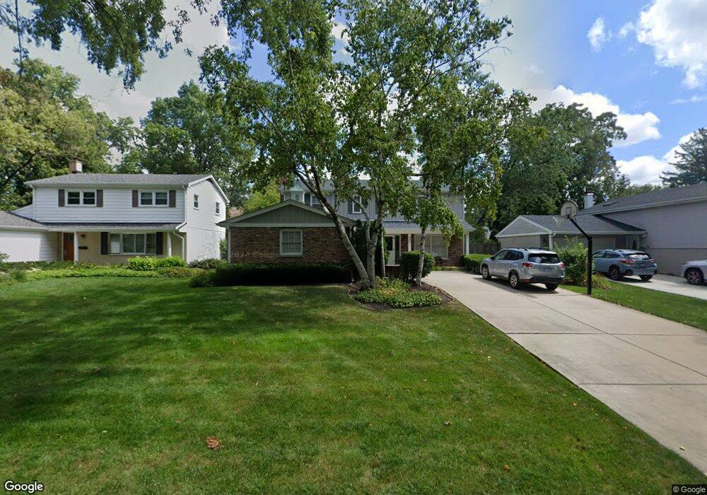
945 Wayne Ave Deerfield, IL 60015
Estimated Value: $627,979 - $714,000
4
Beds
3
Baths
2,080
Sq Ft
$322/Sq Ft
Est. Value
About This Home
This home is located at 945 Wayne Ave, Deerfield, IL 60015 and is currently estimated at $669,745, approximately $321 per square foot. 945 Wayne Ave is a home located in Lake County with nearby schools including Walden Elementary School, Alan B Shepard Middle School, and Deerfield High School.
Ownership History
Date
Name
Owned For
Owner Type
Purchase Details
Closed on
Feb 6, 2014
Sold by
Schwartz Yehuda and Schwartz Lori Ann
Bought by
The Lori A Schwartz & Yehuda Schwartz Jo
Current Estimated Value
Purchase Details
Closed on
Jul 28, 1995
Sold by
Hogan Timothy P and Hogan Jill G
Bought by
Schwartz Yehuda and Schwartz Lori Ann
Home Financials for this Owner
Home Financials are based on the most recent Mortgage that was taken out on this home.
Original Mortgage
$260,000
Interest Rate
6.87%
Create a Home Valuation Report for This Property
The Home Valuation Report is an in-depth analysis detailing your home's value as well as a comparison with similar homes in the area
Home Values in the Area
Average Home Value in this Area
Purchase History
| Date | Buyer | Sale Price | Title Company |
|---|---|---|---|
| The Lori A Schwartz & Yehuda Schwartz Jo | -- | None Available | |
| Schwartz Yehuda | $325,000 | Republic Title Company |
Source: Public Records
Mortgage History
| Date | Status | Borrower | Loan Amount |
|---|---|---|---|
| Closed | Schwartz Yehuda | $260,000 |
Source: Public Records
Tax History
| Year | Tax Paid | Tax Assessment Tax Assessment Total Assessment is a certain percentage of the fair market value that is determined by local assessors to be the total taxable value of land and additions on the property. | Land | Improvement |
|---|---|---|---|---|
| 2024 | $13,092 | $161,594 | $43,008 | $118,586 |
| 2023 | $12,915 | $155,080 | $41,274 | $113,806 |
| 2022 | $12,915 | $147,282 | $44,333 | $102,949 |
| 2021 | $12,163 | $142,000 | $42,743 | $99,257 |
| 2020 | $12,144 | $142,299 | $42,833 | $99,466 |
| 2019 | $12,349 | $152,518 | $42,760 | $109,758 |
| 2018 | $11,162 | $139,336 | $45,322 | $94,014 |
| 2017 | $11,072 | $138,891 | $45,177 | $93,714 |
| 2016 | $10,763 | $133,639 | $43,469 | $90,170 |
| 2015 | $10,532 | $125,565 | $40,843 | $84,722 |
| 2014 | $9,412 | $111,340 | $41,135 | $70,205 |
| 2012 | $9,189 | $110,358 | $40,772 | $69,586 |
Source: Public Records
Map
Nearby Homes
- 1302 Hazel Ave
- 926 Cedar St
- 1030 Chestnut St
- 1004 Broadmoor Place
- 1054 Broadmoor Place
- 826 Chestnut St
- 954 Osterman Ave
- 1106 Waukegan Rd
- 1165 Linden Ave
- 525 Mallard Ln
- 950 Brookside Ln
- 1285 Warwick Ct
- 1632 Village Green Ct
- 1420 Crowe Ave
- 1625 Marcie Ct Unit 5
- 1335 Wilmot Rd
- 1151 Walden Ln
- 930 King Richards Ct
- 1423 Northwoods Rd
- 1525 Hawthorne Place
- 939 Wayne Ave
- 951 Wayne Ave
- 933 Wayne Ave
- 944 Woodward Ave
- 938 Woodward Ave
- 1157 Hazel Ave
- 950 Woodward Ave
- 931 Wayne Ave
- 1151 Hazel Ave
- 934 Woodward Ave
- 930 Wayne Ave
- 924 Wayne Ave
- 940 Wayne Ave
- 928 Woodward Ave
- 1145 Hazel Ave
- 923 Wayne Ave
- 950 Wayne Ave
- 920 Wayne Ave
- 924 Woodward Ave
- 1135 Hazel Ave
Your Personal Tour Guide
Ask me questions while you tour the home.