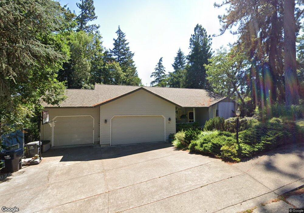
95 Marlboro Ln Eugene, OR 97405
Southeast Eugene NeighborhoodEstimated Value: $658,000 - $802,000
3
Beds
2
Baths
1,933
Sq Ft
$376/Sq Ft
Est. Value
About This Home
This home is located at 95 Marlboro Ln, Eugene, OR 97405 and is currently estimated at $726,428, approximately $375 per square foot. 95 Marlboro Ln is a home located in Lane County with nearby schools including Edgewood Community Elementary School, Spencer Butte Middle School, and South Eugene High School.
Ownership History
Date
Name
Owned For
Owner Type
Purchase Details
Closed on
Sep 8, 2010
Sold by
Wadnizak Leo M and Wadnizak Rosemary E
Bought by
Wadnizak Leo M and Wadnizak Rosemary E
Current Estimated Value
Purchase Details
Closed on
Feb 17, 2006
Sold by
Savage James William and Savage Jeanne Forrest
Bought by
Macarthur Thomas R and Macarthur Kathleen H
Home Financials for this Owner
Home Financials are based on the most recent Mortgage that was taken out on this home.
Original Mortgage
$202,000
Interest Rate
5.69%
Mortgage Type
Stand Alone Second
Create a Home Valuation Report for This Property
The Home Valuation Report is an in-depth analysis detailing your home's value as well as a comparison with similar homes in the area
Home Values in the Area
Average Home Value in this Area
Purchase History
| Date | Buyer | Sale Price | Title Company |
|---|---|---|---|
| Wadnizak Leo M | -- | Cascade Title Co | |
| Macarthur Thomas R | $395,000 | Cascade Title Co |
Source: Public Records
Mortgage History
| Date | Status | Borrower | Loan Amount |
|---|---|---|---|
| Closed | Macarthur Thomas R | $202,000 | |
| Closed | Macarthur Thomas R | $114,000 |
Source: Public Records
Tax History Compared to Growth
Tax History
| Year | Tax Paid | Tax Assessment Tax Assessment Total Assessment is a certain percentage of the fair market value that is determined by local assessors to be the total taxable value of land and additions on the property. | Land | Improvement |
|---|---|---|---|---|
| 2025 | $8,979 | $460,850 | -- | -- |
| 2024 | $8,867 | $447,428 | -- | -- |
| 2023 | $8,867 | $434,397 | $0 | $0 |
| 2022 | $8,307 | $421,745 | $0 | $0 |
| 2021 | $7,672 | $409,462 | $0 | $0 |
| 2020 | $7,472 | $397,536 | $0 | $0 |
| 2019 | $7,267 | $385,958 | $0 | $0 |
| 2018 | $6,775 | $363,803 | $0 | $0 |
| 2017 | $6,343 | $363,803 | $0 | $0 |
| 2016 | $6,105 | $353,207 | $0 | $0 |
| 2015 | $5,926 | $342,919 | $0 | $0 |
| 2014 | $5,846 | $332,931 | $0 | $0 |
Source: Public Records
Map
Nearby Homes
- 5075 Saratoga St
- 5120 Talisman St
- 5369 Donald St
- 143 Treehill Loop Unit 143
- 152 Treehill Loop Unit 152
- 151 Treehill Loop Unit 151
- 296 Woodridge Dr
- 202 Foxtail Dr
- 223 Trailside Loop Unit 223
- 278 Rockridge Ct
- 4815 Brookwood St
- 36 Westbrook Way
- 418 Stonewood Dr Unit 418
- 5159 Solar Heights Dr
- 4845 Brookwood St
- 645 Kingswood Ave
- 121 Westbrook Way
- 124 Brae Burn Dr
- 4695 Fox Hollow Rd
- 396 Brae Burn Dr
- 93 Marlboro Ln
- 17 Marlboro Ln
- 99 Marlboro Ln
- 71 Marlboro Ln
- 346 Ventura Ave
- 106 Marlboro Ln
- 73 Marlboro Ln
- 90 Marlboro Ln
- 344 Ventura Ave
- 110 Marlboro Ln
- 109 Marlboro Ln
- 0 Marlboro Ln
- 348 Ventura Ave
- 55 Marlboro Ln
- 89 Marlboro Ln
- 342 Ventura Ave
- 75 Marlboro Ln
- 111 Marlboro Ln
- 56 Marlboro Ln
- 87 Marlboro Ln