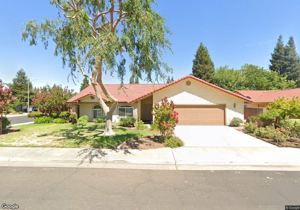
95 N Joshua Ave Clovis, CA 93611
Estimated Value: $384,000 - $486,000
3
Beds
2
Baths
1,603
Sq Ft
$268/Sq Ft
Est. Value
About This Home
This home is located at 95 N Joshua Ave, Clovis, CA 93611 and is currently estimated at $429,519, approximately $267 per square foot. 95 N Joshua Ave is a home located in Fresno County with nearby schools including Cox Elementary School, Clark Intermediate School, and Clovis High School.
Ownership History
Date
Name
Owned For
Owner Type
Purchase Details
Closed on
Mar 5, 1999
Sold by
Minasian Robert B and Minasian Eleanor C
Bought by
Minasian Michael R
Current Estimated Value
Purchase Details
Closed on
Nov 8, 1993
Sold by
Minasian Robert B and Minasian Eleanor C
Bought by
Minasian Robert B and Minasian Eleanor C
Home Financials for this Owner
Home Financials are based on the most recent Mortgage that was taken out on this home.
Original Mortgage
$111,000
Interest Rate
6.88%
Create a Home Valuation Report for This Property
The Home Valuation Report is an in-depth analysis detailing your home's value as well as a comparison with similar homes in the area
Home Values in the Area
Average Home Value in this Area
Purchase History
| Date | Buyer | Sale Price | Title Company |
|---|---|---|---|
| Minasian Michael R | -- | -- | |
| Minasian Robert B | -- | Chicago Title Company |
Source: Public Records
Mortgage History
| Date | Status | Borrower | Loan Amount |
|---|---|---|---|
| Closed | Minasian Robert B | $111,000 |
Source: Public Records
Tax History
| Year | Tax Paid | Tax Assessment Tax Assessment Total Assessment is a certain percentage of the fair market value that is determined by local assessors to be the total taxable value of land and additions on the property. | Land | Improvement |
|---|---|---|---|---|
| 2025 | $2,022 | $177,281 | $56,279 | $121,002 |
| 2023 | $1,943 | $170,399 | $54,095 | $116,304 |
| 2022 | $1,915 | $167,059 | $53,035 | $114,024 |
| 2021 | $1,860 | $163,785 | $51,996 | $111,789 |
| 2020 | $1,852 | $162,106 | $51,463 | $110,643 |
| 2019 | $1,815 | $158,928 | $50,454 | $108,474 |
| 2018 | $1,774 | $155,813 | $49,465 | $106,348 |
| 2017 | $1,742 | $152,759 | $48,496 | $104,263 |
| 2016 | $1,682 | $149,765 | $47,546 | $102,219 |
| 2015 | $1,655 | $147,516 | $46,832 | $100,684 |
| 2014 | -- | $144,627 | $45,915 | $98,712 |
Source: Public Records
Map
Nearby Homes
- 2325 Sierra Ave
- 2535 Sierra Ave
- 2216 Ellery Ave
- 2231 Escalon Ave
- 2578 Warner Ave
- 338 N Filbert Ave
- 344 McKelvy Ave
- 2051 Los Altos Ave
- 2051 Sierra Ave
- 2047 Menlo Ave
- 2043 Escalon Ave
- 367 N Raphael Ln Unit 367
- 96 Burgan Ave
- 1855 Vartikian Ave
- 2691 Morris Ave
- 1946 Calimyrna Ave
- 865 McKelvy Ave
- 2337 Wrenwood Ave
- 637 Coventry Ave
- 793 Applegate Ave
- 79 N Joshua Ave
- 2382 Paul Ave
- 2377 Paul Ave
- 2392 Paul Ave
- 96 N Joshua Ave
- 2387 Paul Ave
- 2367 Paul Ave
- 63 N Joshua Ave
- 82 N McKelvy Ave
- 80 N Joshua Ave
- 2397 Paul Ave
- 2357 Paul Ave
- 68 N McKelvy Ave
- 64 N Joshua Ave
- 2376 Los Altos Ave
- 2336 Paul Ave
- 2386 Los Altos Ave
- 2366 Los Altos Ave
- 2371 Menlo Ave
- 2383 Menlo Ave
Your Personal Tour Guide
Ask me questions while you tour the home.