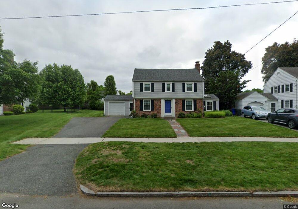
95 S Branch Pkwy Springfield, MA 01118
East Forest Park NeighborhoodEstimated Value: $339,458 - $362,000
3
Beds
2
Baths
1,458
Sq Ft
$239/Sq Ft
Est. Value
About This Home
This home is located at 95 S Branch Pkwy, Springfield, MA 01118 and is currently estimated at $348,615, approximately $239 per square foot. 95 S Branch Pkwy is a home located in Hampden County with nearby schools including Mary A. Dryden Veterans Memorial School, M Marcus Kiley Middle, and Springfield High School of Science and Technology.
Ownership History
Date
Name
Owned For
Owner Type
Purchase Details
Closed on
May 17, 2022
Sold by
Baush H Philip H and Baush Darlene
Bought by
Darlene Baush
Current Estimated Value
Purchase Details
Closed on
Sep 28, 1979
Bought by
Baush H Philip and Baush Darlene
Create a Home Valuation Report for This Property
The Home Valuation Report is an in-depth analysis detailing your home's value as well as a comparison with similar homes in the area
Home Values in the Area
Average Home Value in this Area
Purchase History
| Date | Buyer | Sale Price | Title Company |
|---|---|---|---|
| Darlene Baush | -- | None Available | |
| Baush H Philip | $35,500 | -- |
Source: Public Records
Mortgage History
| Date | Status | Borrower | Loan Amount |
|---|---|---|---|
| Previous Owner | Baush H Philip | $99,700 | |
| Previous Owner | Baush H Philip | $90,575 | |
| Previous Owner | Baush H Philip | $51,094 |
Source: Public Records
Tax History Compared to Growth
Tax History
| Year | Tax Paid | Tax Assessment Tax Assessment Total Assessment is a certain percentage of the fair market value that is determined by local assessors to be the total taxable value of land and additions on the property. | Land | Improvement |
|---|---|---|---|---|
| 2025 | $4,911 | $313,200 | $47,800 | $265,400 |
| 2024 | $4,349 | $270,800 | $47,800 | $223,000 |
| 2023 | $4,430 | $259,800 | $45,500 | $214,300 |
| 2022 | $4,120 | $218,900 | $45,500 | $173,400 |
| 2021 | $4,103 | $217,100 | $41,300 | $175,800 |
| 2020 | $3,875 | $198,400 | $41,300 | $157,100 |
| 2019 | $3,863 | $196,300 | $41,300 | $155,000 |
| 2018 | $3,869 | $196,600 | $41,300 | $155,300 |
| 2017 | $3,564 | $181,300 | $41,300 | $140,000 |
| 2016 | $3,378 | $171,800 | $41,300 | $130,500 |
| 2015 | $3,285 | $167,000 | $41,300 | $125,700 |
Source: Public Records
Map
Nearby Homes
- 54 S Shore Dr
- 384 Abbott St
- 100 Derryfield Ave
- 74 Oregon St
- 236 Pondview Dr
- 97 Lancaster St
- 91 Lancaster St
- 7 Ashbrook St
- 283 Plumtree Rd
- 190 Whittum Ave
- 141 Hartford Terrace
- 75 Carnavon Cir
- 138 Abbott St
- 74 Leatherleaf Dr
- 74 Judith St
- 867 Roosevelt Ave
- 100 Abbott St
- 27 Regal St
- 34 Ina St
- 89 Cherokee Dr
- 87 S Branch Pkwy
- 103 S Branch Pkwy
- 40 Arvesta St
- 50 Arvesta St
- 32 Arvesta St
- 81 S Branch Pkwy
- 412 Gillette Ave
- 100 S Branch Pkwy
- 24 Arvesta St
- 75 S Branch Pkwy
- 80 S Branch Pkwy
- 119 S Branch Pkwy
- 41 Arvesta St
- 33 Arvesta St
- 16 Arvesta St
- 400 Gillette Ave
- 120 S Branch Pkwy
- 18 S Shore Dr
- 51 Arvesta St
- 409 Gillette Ave