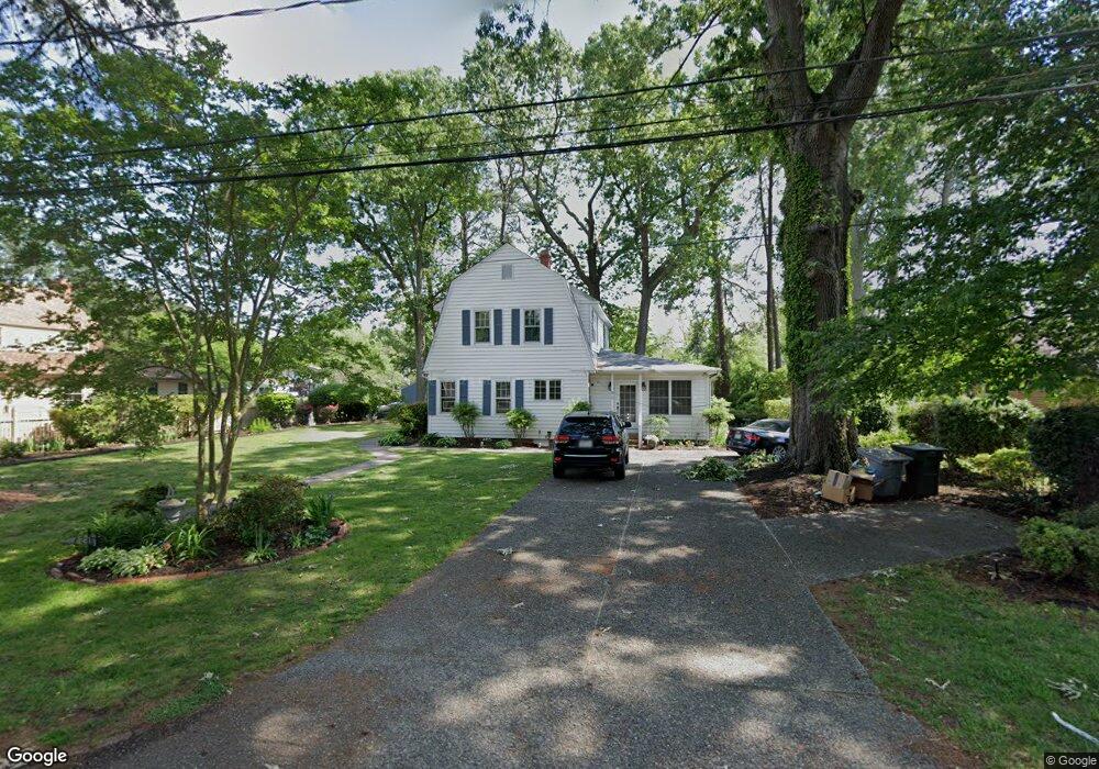
95 Snug Harbor Dr Hampton, VA 23661
Wythe NeighborhoodEstimated Value: $387,883 - $411,000
4
Beds
2
Baths
2,389
Sq Ft
$166/Sq Ft
Est. Value
About This Home
This home is located at 95 Snug Harbor Dr, Hampton, VA 23661 and is currently estimated at $395,721, approximately $165 per square foot. 95 Snug Harbor Dr is a home located in Hampton City with nearby schools including Hunter B. Andrews PK-8 School, C. Alton Lindsay Middle School, and Hampton High School.
Ownership History
Date
Name
Owned For
Owner Type
Purchase Details
Closed on
Jan 11, 2024
Sold by
Baker Michael Ray
Bought by
Baker Michael Ray and Boyd Catherine
Current Estimated Value
Purchase Details
Closed on
Feb 10, 2021
Sold by
Wilson Taylor C and Wilson Colbert S
Bought by
Baker Michael Ray
Home Financials for this Owner
Home Financials are based on the most recent Mortgage that was taken out on this home.
Original Mortgage
$216,450
Interest Rate
2.6%
Mortgage Type
New Conventional
Create a Home Valuation Report for This Property
The Home Valuation Report is an in-depth analysis detailing your home's value as well as a comparison with similar homes in the area
Home Values in the Area
Average Home Value in this Area
Purchase History
| Date | Buyer | Sale Price | Title Company |
|---|---|---|---|
| Baker Michael Ray | -- | Barristers Settlement & Title | |
| Baker Michael Ray | $288,600 | Attorney |
Source: Public Records
Mortgage History
| Date | Status | Borrower | Loan Amount |
|---|---|---|---|
| Previous Owner | Baker Michael Ray | $216,450 |
Source: Public Records
Tax History
| Year | Tax Paid | Tax Assessment Tax Assessment Total Assessment is a certain percentage of the fair market value that is determined by local assessors to be the total taxable value of land and additions on the property. | Land | Improvement |
|---|---|---|---|---|
| 2025 | $4,277 | $375,000 | $122,400 | $252,600 |
| 2024 | $3,984 | $346,400 | $122,400 | $224,000 |
| 2023 | $3,686 | $317,800 | $119,100 | $198,700 |
| 2022 | $3,593 | $304,500 | $112,700 | $191,800 |
| 2021 | $3,828 | $298,200 | $96,600 | $201,600 |
| 2020 | $3,271 | $263,800 | $96,600 | $167,200 |
| 2019 | $3,058 | $246,600 | $85,000 | $161,600 |
| 2018 | $3,152 | $246,600 | $85,000 | $161,600 |
| 2017 | $3,152 | $0 | $0 | $0 |
| 2016 | $3,152 | $246,600 | $0 | $0 |
| 2015 | $3,152 | $0 | $0 | $0 |
| 2014 | $3,142 | $246,600 | $85,000 | $161,600 |
Source: Public Records
Map
Nearby Homes
- 138 Hampton Roads Ave
- 2915 Chesapeake Ave
- 135 Pochin Place
- 216 Manteo Ave
- 218 Alleghany Rd
- 144 Algonquin Rd
- 238 Pochin Place
- 2708 Victoria Blvd
- 3308 Matoaka Rd
- 254 Pocahontas Place
- 402 Melville Rd
- 2416 Victoria Blvd
- 222 Wythe Pkwy
- 421 Glendale Rd
- 620 Celey St
- 512 Pocahontas Place
- 3503 Fairfax Dr
- 628 Celey St
- 255 Lasalle Ave
- 607 Pocahontas Place
- 87 Hampton Roads Ave
- 69 Hampton Roads Ave
- 87 Snug Harbor Dr
- 93 Hampton Roads Ave
- 89 Snug Harbor Dr
- 61 Hampton Roads Ave
- 3004 Kenmore Dr
- 3006 Kenmore Dr
- 93 Snug Harbor Dr
- 91 Snug Harbor Dr
- 54 Manteo Ave
- 59 Hampton Roads Ave
- 92 Hampton Roads Ave
- 94 Hampton Roads Ave Unit 1
- 94 Hampton Roads Ave Unit 2
- 94 Hampton Roads Ave Unit 4
- 94 Hampton Roads Ave Unit 3
- 94 Hampton Roads Ave
- 90 Hampton Roads Ave
- 3000 Kenmore Dr
Your Personal Tour Guide
Ask me questions while you tour the home.