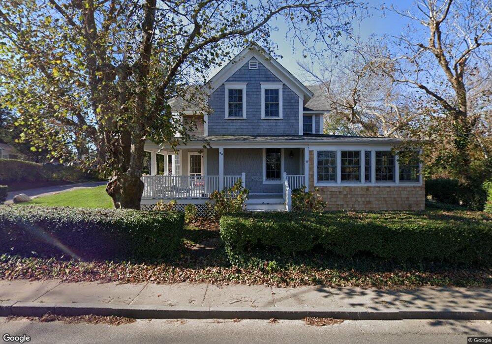
96 Peases Point Way S Edgartown, MA 02539
Edgartown NeighborhoodEstimated Value: $2,740,000 - $3,156,000
4
Beds
2
Baths
2,224
Sq Ft
$1,302/Sq Ft
Est. Value
About This Home
This home is located at 96 Peases Point Way S, Edgartown, MA 02539 and is currently estimated at $2,896,614, approximately $1,302 per square foot. 96 Peases Point Way S is a home located in Dukes County with nearby schools including Edgartown Elementary School and Martha's Vineyard Regional High School.
Ownership History
Date
Name
Owned For
Owner Type
Purchase Details
Closed on
Dec 9, 2013
Sold by
Derby Ft
Bought by
Greis Jan and Sorensen Lana M
Current Estimated Value
Home Financials for this Owner
Home Financials are based on the most recent Mortgage that was taken out on this home.
Original Mortgage
$840,000
Outstanding Balance
$657,854
Interest Rate
5%
Mortgage Type
Purchase Money Mortgage
Estimated Equity
$2,238,761
Create a Home Valuation Report for This Property
The Home Valuation Report is an in-depth analysis detailing your home's value as well as a comparison with similar homes in the area
Home Values in the Area
Average Home Value in this Area
Purchase History
| Date | Buyer | Sale Price | Title Company |
|---|---|---|---|
| Greis Jan | $900,000 | -- |
Source: Public Records
Mortgage History
| Date | Status | Borrower | Loan Amount |
|---|---|---|---|
| Open | Greis Jan | $840,000 |
Source: Public Records
Tax History Compared to Growth
Tax History
| Year | Tax Paid | Tax Assessment Tax Assessment Total Assessment is a certain percentage of the fair market value that is determined by local assessors to be the total taxable value of land and additions on the property. | Land | Improvement |
|---|---|---|---|---|
| 2025 | $5,519 | $2,082,700 | $1,135,500 | $947,200 |
| 2024 | $5,182 | $2,032,000 | $1,135,500 | $896,500 |
| 2023 | $4,943 | $1,961,600 | $1,095,500 | $866,100 |
| 2022 | $4,949 | $1,633,400 | $1,081,500 | $551,900 |
| 2021 | $5,569 | $1,698,000 | $1,085,300 | $612,700 |
| 2020 | $5,688 | $1,698,000 | $1,085,300 | $612,700 |
| 2019 | $5,842 | $1,509,500 | $957,600 | $551,900 |
| 2018 | $5,564 | $1,437,800 | $924,500 | $513,300 |
| 2017 | $3,879 | $1,092,800 | $616,300 | $476,500 |
| 2016 | $3,956 | $1,092,800 | $616,300 | $476,500 |
| 2015 | $3,499 | $1,008,400 | $552,400 | $456,000 |
Source: Public Records
Map
Nearby Homes
- 8 High St
- 69 School St
- 11 Norton St
- 43 Peases Point Way S
- 52 S Summer St
- 10 Tilton Way
- 48 W Tisbury Rd
- 48 Edgartown - West Tisbury Rd
- 10 Peases Point Way N
- 10 Peases Point Rd
- 23 Pinehurst Rd
- 25 Dock St
- 10 Pease Point Rd
- 62 N Summer St
- 19 Kitts Field Cir
- 5 Louis Field Rd
- 5 Louis Field Rd Unit 121.3
- 26 Curtis Ln
- 68 N Water St
- 1 Louis Field Rd
- 101 Peasepoint Way Ed324 Unit 1
- 101 Peasepoint Way Ed324
- 95 Peases Point Way S
- 3 Mullen Way
- 102 Peases Point Way S
- 114 School St
- 8 Mullen Way
- 19 & 23 Mullen Way (Portion Of)
- 110 School St
- 90 Peases Point Way S
- 90 Pease Point Way S
- 9 Mullen Way
- 94 Peases Point Way S
- 12 Mullen Way
- 1 North St
- 111 School St
- 106 School St
- 11 Mullen Way
- 83 Peases Point Way S
- 109 School St