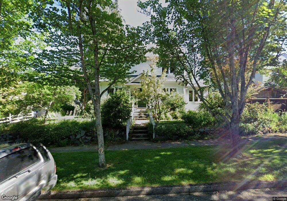
961 E 21st Ave Eugene, OR 97405
South University NeighborhoodEstimated Value: $718,381 - $921,000
4
Beds
2
Baths
1,921
Sq Ft
$420/Sq Ft
Est. Value
About This Home
This home is located at 961 E 21st Ave, Eugene, OR 97405 and is currently estimated at $806,095, approximately $419 per square foot. 961 E 21st Ave is a home located in Lane County with nearby schools including Edison Elementary School, Roosevelt Middle School, and South Eugene High School.
Ownership History
Date
Name
Owned For
Owner Type
Purchase Details
Closed on
Mar 29, 2019
Sold by
Wilson Malcolm C and Jaeger Mary K
Bought by
Jaeger Mary K and Wilson Malcolm C
Current Estimated Value
Purchase Details
Closed on
Oct 3, 2008
Sold by
Jaeger Mary K and Wilson Malcolm
Bought by
Wilson Malcolm C and Jaeger Mary K
Home Financials for this Owner
Home Financials are based on the most recent Mortgage that was taken out on this home.
Original Mortgage
$275,000
Interest Rate
6.39%
Mortgage Type
New Conventional
Create a Home Valuation Report for This Property
The Home Valuation Report is an in-depth analysis detailing your home's value as well as a comparison with similar homes in the area
Home Values in the Area
Average Home Value in this Area
Purchase History
| Date | Buyer | Sale Price | Title Company |
|---|---|---|---|
| Jaeger Mary K | -- | None Available | |
| Wilson Malcolm C | -- | Cascade Title Co |
Source: Public Records
Mortgage History
| Date | Status | Borrower | Loan Amount |
|---|---|---|---|
| Closed | Wilson Malcolm C | $275,000 |
Source: Public Records
Tax History
| Year | Tax Paid | Tax Assessment Tax Assessment Total Assessment is a certain percentage of the fair market value that is determined by local assessors to be the total taxable value of land and additions on the property. | Land | Improvement |
|---|---|---|---|---|
| 2025 | $8,284 | $425,148 | -- | -- |
| 2024 | $8,180 | $412,766 | -- | -- |
| 2023 | $8,180 | $400,744 | $0 | $0 |
| 2022 | $7,664 | $389,072 | $0 | $0 |
| 2021 | $7,198 | $377,740 | $0 | $0 |
| 2020 | $7,223 | $366,738 | $0 | $0 |
| 2019 | $6,976 | $356,057 | $0 | $0 |
| 2018 | $6,567 | $335,618 | $0 | $0 |
| 2017 | $6,273 | $335,618 | $0 | $0 |
| 2016 | $5,953 | $325,843 | $0 | $0 |
| 2015 | $5,833 | $316,352 | $0 | $0 |
| 2014 | $5,822 | $307,138 | $0 | $0 |
Source: Public Records
Map
Nearby Homes
- 780 E 22nd Ave
- 2042 Onyx St
- 2610 Elinor St
- 1733 Mill Aly
- 2707 Hilyard St
- 193 E 20th Ave
- 1970 Amazon Pkwy
- 181 Civic Dr
- 508 E 14th Ave
- 177 E 20th Ave
- 171 E 20th Ave
- 2749 Hilyard St
- 0 Agate St
- 1600 Pearl St Unit 608
- 509 E 13th Ave
- 2815 Hilyard St
- 2642 Central Blvd
- 1492 Pearl St
- 2031 Olive St
- 135 W 18th Ave
- 2073 Harris Aly
- 2088 Harris St
- 939 E 21st Ave
- 2058 Harris St
- 990 E 21st Ave
- 958 E 21st Ave
- 2091 Kincaid St
- 948 E 21st Ave
- 2075 Kincaid St
- 2042 Harris St
- 2063 Kincaid St
- 2124 Harris St
- 930 E 21st Ave
- 2045 Kincaid St
- 1025 E 21st Ave
- 2140 Harris St
- 2133 Kincaid St
- 960 E 20th Ave
- 2075 Harris St
- 976 E 20th Ave
Your Personal Tour Guide
Ask me questions while you tour the home.