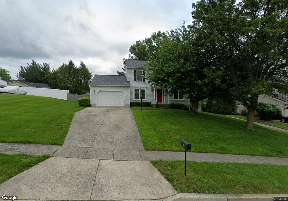
963 E Ring Factory Rd Bel Air, MD 21014
Estimated Value: $423,068 - $529,000
Studio
3
Baths
1,932
Sq Ft
$242/Sq Ft
Est. Value
About This Home
This home is located at 963 E Ring Factory Rd, Bel Air, MD 21014 and is currently estimated at $466,767, approximately $241 per square foot. 963 E Ring Factory Rd is a home located in Harford County with nearby schools including Homestead-Wakefield Elementary School, Bel Air Middle School, and Bel Air High School.
Ownership History
Date
Name
Owned For
Owner Type
Purchase Details
Closed on
Oct 10, 1990
Sold by
Harford Homes Inc
Bought by
Armiger John C and Armiger Cynthia S
Current Estimated Value
Home Financials for this Owner
Home Financials are based on the most recent Mortgage that was taken out on this home.
Original Mortgage
$129,150
Interest Rate
10.08%
Purchase Details
Closed on
Jun 11, 1990
Sold by
Bel Air Land Development Iii
Bought by
Harford Homes Inc
Purchase Details
Closed on
Jun 4, 1986
Sold by
Gerrett Company Inc The
Bought by
Bel Air Land Development Iii
Create a Home Valuation Report for This Property
The Home Valuation Report is an in-depth analysis detailing your home's value as well as a comparison with similar homes in the area
Home Values in the Area
Average Home Value in this Area
Purchase History
| Date | Buyer | Sale Price | Title Company |
|---|---|---|---|
| Armiger John C | $126,000 | -- | |
| Harford Homes Inc | $42,500 | -- | |
| Bel Air Land Development Iii | $716,400 | -- |
Source: Public Records
Mortgage History
| Date | Status | Borrower | Loan Amount |
|---|---|---|---|
| Closed | Armiger John C | $129,150 |
Source: Public Records
Tax History
| Year | Tax Paid | Tax Assessment Tax Assessment Total Assessment is a certain percentage of the fair market value that is determined by local assessors to be the total taxable value of land and additions on the property. | Land | Improvement |
|---|---|---|---|---|
| 2025 | $3,969 | $378,000 | $110,900 | $267,100 |
| 2024 | $3,969 | $364,167 | $0 | $0 |
| 2023 | $3,818 | $350,333 | $0 | $0 |
| 2022 | $3,668 | $336,500 | $110,900 | $225,600 |
| 2021 | $3,625 | $325,333 | $0 | $0 |
| 2020 | $3,625 | $314,167 | $0 | $0 |
| 2019 | $3,497 | $303,000 | $120,100 | $182,900 |
| 2018 | $3,438 | $300,667 | $0 | $0 |
| 2017 | $3,412 | $303,000 | $0 | $0 |
| 2016 | -- | $296,000 | $0 | $0 |
| 2015 | $3,361 | $293,267 | $0 | $0 |
| 2014 | $3,361 | $290,533 | $0 | $0 |
Source: Public Records
Map
Nearby Homes
- 901 Macphail Woods Crossing Unit 3A
- 902 Macphail Woods Crossing Unit 3E
- 703 Claridge Ct
- 102 Brandywine Place
- 1312 Scottsdale Dr Unit Q
- 926 Cheswold Ct
- 1314 Scottsdale Dr Unit G
- 1307 Scottsdale Dr Unit G
- 1603 Martha Ct Unit 101
- 1308 Scottsdale Dr Unit H
- 707 Linwood Ave
- 520 Woodbury Way
- 1309 Sheridan Place Unit 99
- 1302 Scottsdale Dr Unit G
- 1307 Sheridan Place Unit 80
- 243 Mary Jane Ln
- 1406 Bonnett Place Unit 201
- 1402 Bonnett Place Unit 131
- 906 Whispering Ridge Ln
- 925 Richwood Rd
- 967 E Ring Factory Rd
- 959 E Ring Factory Rd
- 955 E Macphail Rd
- 959 E Macphail Rd
- 969 E Ring Factory Rd
- 915 Meadow Ridge Ct
- 965 E Ring Factory Rd
- 914 Meadow Ridge Ct
- 957 E Macphail Rd
- 957 E Ring Factory Rd
- 971 E Ring Factory Rd
- 912 Hedgerow Ct
- 912 Meadow Ridge Ct
- 913 Meadow Ridge Ct
- 919 Fallen Stone Ct
- 955 E Ring Factory Rd
- 973 E Ring Factory Rd
- 910 Hedgerow Ct
- 1026 E Macphail Rd
- 951 E Macphail Rd
Your Personal Tour Guide
Ask me questions while you tour the home.