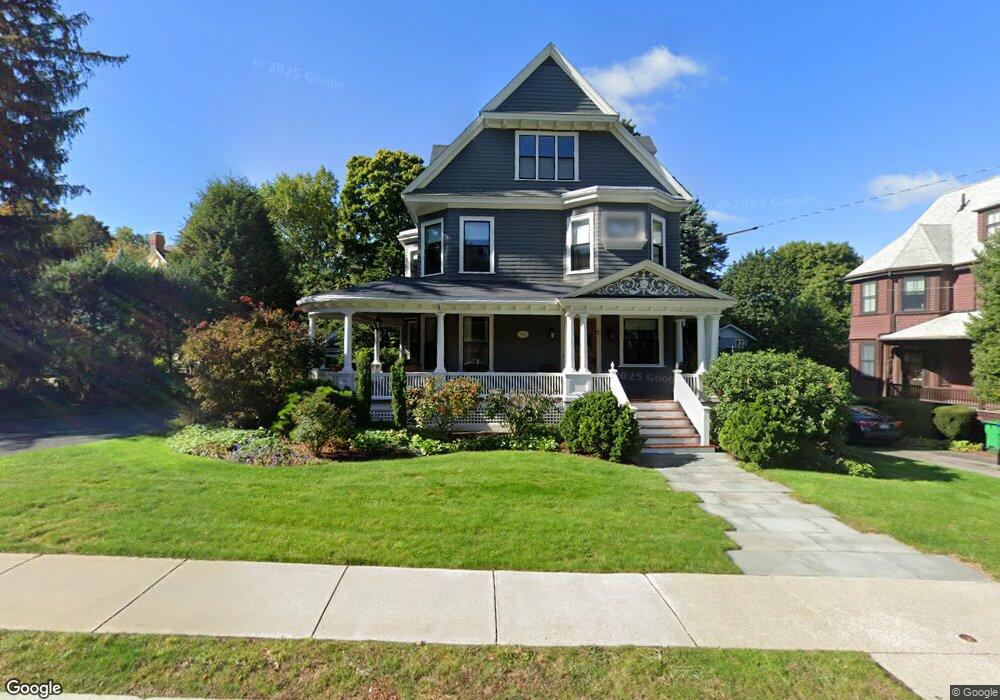
97 Hillside Ave West Newton, MA 02465
West Newton NeighborhoodEstimated Value: $2,946,000 - $3,703,000
5
Beds
4
Baths
4,329
Sq Ft
$764/Sq Ft
Est. Value
About This Home
This home is located at 97 Hillside Ave, West Newton, MA 02465 and is currently estimated at $3,305,495, approximately $763 per square foot. 97 Hillside Ave is a home located in Middlesex County with nearby schools including Peirce Elementary School, F.A. Day Middle School, and Newton North High School.
Ownership History
Date
Name
Owned For
Owner Type
Purchase Details
Closed on
Apr 30, 1998
Sold by
Mangion Robert B and Chase Johanna B
Bought by
Bernstein Stephen W and Bernstein Leslie A
Current Estimated Value
Create a Home Valuation Report for This Property
The Home Valuation Report is an in-depth analysis detailing your home's value as well as a comparison with similar homes in the area
Home Values in the Area
Average Home Value in this Area
Purchase History
| Date | Buyer | Sale Price | Title Company |
|---|---|---|---|
| Bernstein Stephen W | $755,750 | -- |
Source: Public Records
Mortgage History
| Date | Status | Borrower | Loan Amount |
|---|---|---|---|
| Open | Bernstein Stephen W | $325,000 |
Source: Public Records
Tax History Compared to Growth
Tax History
| Year | Tax Paid | Tax Assessment Tax Assessment Total Assessment is a certain percentage of the fair market value that is determined by local assessors to be the total taxable value of land and additions on the property. | Land | Improvement |
|---|---|---|---|---|
| 2025 | $28,349 | $2,892,800 | $1,255,100 | $1,637,700 |
| 2024 | $27,411 | $2,808,500 | $1,218,500 | $1,590,000 |
| 2023 | $26,543 | $2,607,400 | $945,000 | $1,662,400 |
| 2022 | $25,398 | $2,414,300 | $875,000 | $1,539,300 |
| 2021 | $24,507 | $2,277,600 | $825,500 | $1,452,100 |
| 2020 | $23,283 | $2,230,200 | $825,500 | $1,404,700 |
| 2019 | $22,626 | $2,165,200 | $801,500 | $1,363,700 |
| 2018 | $22,117 | $2,044,100 | $726,400 | $1,317,700 |
| 2017 | $21,444 | $1,928,400 | $685,300 | $1,243,100 |
| 2016 | $20,509 | $1,802,200 | $640,500 | $1,161,700 |
| 2015 | $19,555 | $1,684,300 | $598,600 | $1,085,700 |
Source: Public Records
Map
Nearby Homes
- 318 Austin St Unit A
- 27 Cross St Unit 27
- 18 Sewall St
- 12 Wiswall St
- 4 Wiswall St
- 39 Valentine Park
- 123 Mount Vernon St Unit 2
- 123-125 Mount Vernon St
- 97 Valentine St
- 40 Sewall St
- 11 Randlett Park
- 371 Cherry St
- 308 Prince St
- 957 Washington St Unit 1
- 10 Ruane Rd
- 2 Elm St Unit 6
- 2 Elm St Unit 8
- 106 River St Unit 18
- 106 River St Unit 2
- 106 River St Unit 14
- 91 Hillside Ave
- 333 Otis St
- 333 Otis St Unit 333R
- 343 Otis St
- 343 Otis St Unit 343
- 44 Westfield Rd
- 85 Hillside Ave
- 100 Hillside Ave
- 106 Hillside Ave
- 351 Otis St
- 343 Highland Ave
- 79 Hillside Ave
- 114 Hillside Ave
- 36 Westfield Rd
- 80 Hillside Ave
- 359 Otis St
- 315 Otis St
- 334 Otis St
- 342 Otis St
- 69 Hillside Ave