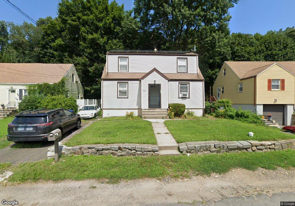
970 Platt St Bridgeport, CT 06606
North End NeighborhoodEstimated Value: $427,450 - $488,000
4
Beds
2
Baths
1,524
Sq Ft
$298/Sq Ft
Est. Value
About This Home
This home is located at 970 Platt St, Bridgeport, CT 06606 and is currently estimated at $453,863, approximately $297 per square foot. 970 Platt St is a home located in Fairfield County with nearby schools including Wilbur L. Cross Elementary School, Central High School, and St Andrew School.
Ownership History
Date
Name
Owned For
Owner Type
Purchase Details
Closed on
Feb 20, 1979
Bought by
Bolling Linda S
Current Estimated Value
Create a Home Valuation Report for This Property
The Home Valuation Report is an in-depth analysis detailing your home's value as well as a comparison with similar homes in the area
Home Values in the Area
Average Home Value in this Area
Purchase History
| Date | Buyer | Sale Price | Title Company |
|---|---|---|---|
| Bolling Linda S | -- | -- |
Source: Public Records
Mortgage History
| Date | Status | Borrower | Loan Amount |
|---|---|---|---|
| Open | Bolling Linda S | $205,000 | |
| Closed | Bolling Linda S | $144,000 | |
| Closed | Bolling Linda S | $75,600 |
Source: Public Records
Tax History
| Year | Tax Paid | Tax Assessment Tax Assessment Total Assessment is a certain percentage of the fair market value that is determined by local assessors to be the total taxable value of land and additions on the property. | Land | Improvement |
|---|---|---|---|---|
| 2025 | $6,175 | $142,110 | $70,060 | $72,050 |
| 2024 | $6,175 | $142,110 | $70,060 | $72,050 |
| 2023 | $6,175 | $142,110 | $70,060 | $72,050 |
| 2022 | $6,175 | $142,110 | $70,060 | $72,050 |
| 2021 | $6,175 | $142,110 | $70,060 | $72,050 |
| 2020 | $5,625 | $104,180 | $42,450 | $61,730 |
| 2019 | $5,625 | $104,180 | $42,450 | $61,730 |
| 2018 | $5,664 | $104,180 | $42,450 | $61,730 |
| 2017 | $5,664 | $104,180 | $42,450 | $61,730 |
| 2016 | $5,664 | $104,180 | $42,450 | $61,730 |
| 2015 | $5,347 | $126,700 | $42,810 | $83,890 |
| 2014 | $5,347 | $126,700 | $42,810 | $83,890 |
Source: Public Records
Map
Nearby Homes
- 578 Beechmont Ave
- 315 Tesiny Ave
- 240 Valley Ave
- 26 Victory St
- 355 Exeter St
- 213 Exeter St
- 219 Exeter St
- 675 Platt St
- 3461 Main St
- 1095 Wayne St
- 75 Fleet St
- 120 Clark St
- 420 Greenwood St
- 45 Stevens St Unit 3L
- 936 Chopsey Hill Rd
- 495 Alba Ave
- 235 Burnsford Ave
- 475 Alba Ave
- 500 Woodlawn Avenue Extension
- 316 Goldenrod Ave
- 958 Platt St
- 980 Platt St
- 948 Platt St
- 8 Wing St
- 940 Platt St
- 957 Platt St
- 269 Pleasantview Ave
- 14 Wing St
- 301 Pleasantview Ave
- 930 Platt St
- 291 Pleasantview Ave
- 937 Platt St
- 293 Pleasantview Ave
- 24 Wing St
- 251 Pleasantview Ave
- 524 Beechmont Ave
- 927 Platt St
- 920 Platt St
- 540 Beechmont Ave Unit 542
- 319 Pleasantview Ave
Your Personal Tour Guide
Ask me questions while you tour the home.