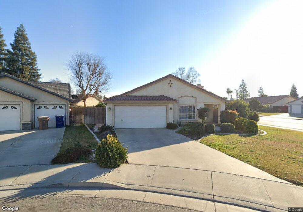
9711 Copper Ct Bakersfield, CA 93311
Tevis Ranch NeighborhoodEstimated Value: $344,000 - $403,000
3
Beds
2
Baths
1,227
Sq Ft
$302/Sq Ft
Est. Value
About This Home
This home is located at 9711 Copper Ct, Bakersfield, CA 93311 and is currently estimated at $370,896, approximately $302 per square foot. 9711 Copper Ct is a home located in Kern County with nearby schools including Old River Elementary School, Earl Warren Junior High School, and Stockdale High School.
Ownership History
Date
Name
Owned For
Owner Type
Purchase Details
Closed on
Jun 14, 2007
Sold by
Stone Michael D
Bought by
Preston Todd
Current Estimated Value
Home Financials for this Owner
Home Financials are based on the most recent Mortgage that was taken out on this home.
Original Mortgage
$211,050
Outstanding Balance
$130,672
Interest Rate
6.41%
Mortgage Type
Purchase Money Mortgage
Estimated Equity
$240,224
Purchase Details
Closed on
Jul 1, 1994
Sold by
Tevis Ranch Lp
Bought by
Stone Michael D
Home Financials for this Owner
Home Financials are based on the most recent Mortgage that was taken out on this home.
Original Mortgage
$91,207
Interest Rate
8.6%
Mortgage Type
FHA
Create a Home Valuation Report for This Property
The Home Valuation Report is an in-depth analysis detailing your home's value as well as a comparison with similar homes in the area
Home Values in the Area
Average Home Value in this Area
Purchase History
| Date | Buyer | Sale Price | Title Company |
|---|---|---|---|
| Preston Todd | $234,500 | Fidelity National Title Co | |
| Stone Michael D | $92,000 | Chicago Title Company |
Source: Public Records
Mortgage History
| Date | Status | Borrower | Loan Amount |
|---|---|---|---|
| Open | Preston Todd | $211,050 | |
| Previous Owner | Stone Michael D | $91,207 |
Source: Public Records
Tax History
| Year | Tax Paid | Tax Assessment Tax Assessment Total Assessment is a certain percentage of the fair market value that is determined by local assessors to be the total taxable value of land and additions on the property. | Land | Improvement |
|---|---|---|---|---|
| 2025 | $4,409 | $308,003 | $98,505 | $209,498 |
| 2024 | $4,348 | $301,965 | $96,574 | $205,391 |
| 2023 | $4,348 | $296,045 | $94,681 | $201,364 |
| 2022 | $4,009 | $276,000 | $69,000 | $207,000 |
| 2021 | $3,477 | $237,000 | $59,000 | $178,000 |
| 2020 | $3,320 | $222,000 | $56,000 | $166,000 |
| 2019 | $3,108 | $212,000 | $53,000 | $159,000 |
| 2018 | $2,746 | $189,000 | $47,000 | $142,000 |
| 2017 | $2,730 | $183,000 | $46,000 | $137,000 |
| 2016 | $2,567 | $180,000 | $45,000 | $135,000 |
| 2015 | $2,406 | $165,000 | $41,000 | $124,000 |
| 2014 | $2,282 | $160,000 | $40,000 | $120,000 |
Source: Public Records
Map
Nearby Homes
- 9703 Touchstone Dr
- 9711 Touchstone Dr
- 9400 Hemingway Place
- 3105 Whisper Oak Way
- 9902 Rancho Verde Dr
- 10011 Rosebud Ave
- 10103 Wentworth Ct
- 10204 Sunset Canyon Dr
- 3513 Running Springs Way
- 9800 Cabbage Rose Ave
- 12639 Camino Glorieta
- 12611 Camino Fruteria
- 12603 Camino Fruteria
- 12625 Camino Glorieta
- 12651 Camino Glorieta
- 9814 Cabbage Rose Ave
- 10213 Single Oak Dr
- 2904 Blackjack Oak Ln
- 9408 Nickam Ct
- 9508 Bard Ct
- 9707 Copper Ct
- 9710 Whitehead Ct
- 9706 Whitehead Ct
- 9703 Copper Ct
- 3523 Rancho Santa fe St
- 3515 Rancho Santa fe St
- 9702 Whitehead Ct
- 3527 Rancho Santa fe St
- 9710 Copper Ct
- 9702 Copper Ct
- 3511 Rancho Santa fe St
- 9706 Copper Ct
- 3601 Rancho Santa fe St
- 3507 Rancho Santa fe St
- 3600 Bedrock Dr
- 3604 Bedrock Dr
- 9703 Whitehead Ct
- 3608 Bedrock Dr
- 3605 Rancho Santa fe St
- 9711 Whitehead Ct
Your Personal Tour Guide
Ask me questions while you tour the home.