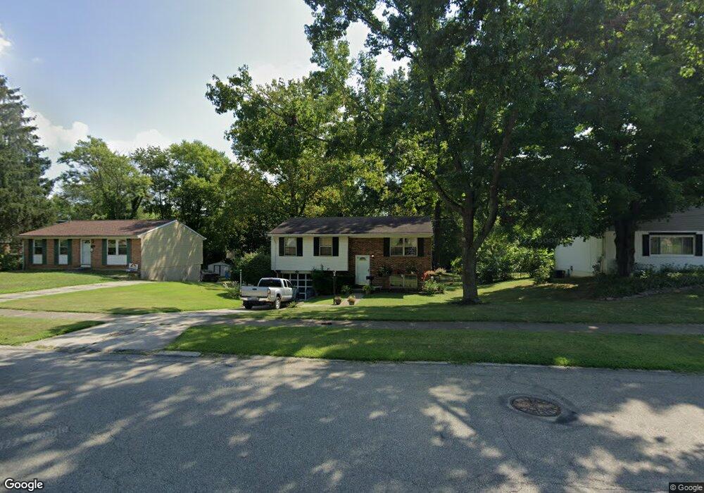
9726 Gertrude Ln Cincinnati, OH 45231
New Burlington NeighborhoodEstimated Value: $196,412 - $227,000
3
Beds
2
Baths
1,476
Sq Ft
$147/Sq Ft
Est. Value
About This Home
This home is located at 9726 Gertrude Ln, Cincinnati, OH 45231 and is currently estimated at $216,853, approximately $146 per square foot. 9726 Gertrude Ln is a home located in Hamilton County with nearby schools including Mt Healthy High School, Hamilton County Mathematics and Science Academy, and Central Montessori Academy.
Ownership History
Date
Name
Owned For
Owner Type
Purchase Details
Closed on
May 19, 2004
Sold by
Allen Joan and Overholt Joan
Bought by
Allen John and Allen Joan
Current Estimated Value
Home Financials for this Owner
Home Financials are based on the most recent Mortgage that was taken out on this home.
Original Mortgage
$103,500
Interest Rate
9.39%
Mortgage Type
New Conventional
Purchase Details
Closed on
Oct 29, 1994
Sold by
Leonard Barbara A
Bought by
Overholts Joan
Home Financials for this Owner
Home Financials are based on the most recent Mortgage that was taken out on this home.
Original Mortgage
$62,000
Interest Rate
8.75%
Create a Home Valuation Report for This Property
The Home Valuation Report is an in-depth analysis detailing your home's value as well as a comparison with similar homes in the area
Home Values in the Area
Average Home Value in this Area
Purchase History
| Date | Buyer | Sale Price | Title Company |
|---|---|---|---|
| Allen John | -- | Jets Title Agency Llc | |
| Overholts Joan | -- | -- |
Source: Public Records
Mortgage History
| Date | Status | Borrower | Loan Amount |
|---|---|---|---|
| Open | Allen John | $103,500 | |
| Closed | Overholts Joan | $62,000 |
Source: Public Records
Tax History Compared to Growth
Tax History
| Year | Tax Paid | Tax Assessment Tax Assessment Total Assessment is a certain percentage of the fair market value that is determined by local assessors to be the total taxable value of land and additions on the property. | Land | Improvement |
|---|---|---|---|---|
| 2024 | $2,809 | $48,797 | $9,275 | $39,522 |
| 2023 | $2,669 | $48,797 | $9,275 | $39,522 |
| 2022 | $2,779 | $36,600 | $9,023 | $27,577 |
| 2021 | $2,704 | $36,600 | $9,023 | $27,577 |
| 2020 | $2,745 | $36,600 | $9,023 | $27,577 |
| 2019 | $2,312 | $28,819 | $7,105 | $21,714 |
| 2018 | $2,325 | $28,819 | $7,105 | $21,714 |
| 2017 | $2,206 | $28,819 | $7,105 | $21,714 |
| 2016 | $2,065 | $26,586 | $6,566 | $20,020 |
| 2015 | $2,081 | $26,586 | $6,566 | $20,020 |
| 2014 | $2,072 | $26,586 | $6,566 | $20,020 |
| 2013 | $2,303 | $30,212 | $7,462 | $22,750 |
Source: Public Records
Map
Nearby Homes
- 9733 Gertrude Ln
- 2317 Magdalena Dr
- 2204 Woodacre Dr
- 2542 Ontario St
- 9810 Norcrest Dr
- 9648 Fallshill Cir
- 9453 Coogan Dr
- 9933 Grasscreek Ct
- 2592 Wenning Rd
- 9949 Grasscreek Ct
- 2317 Garrison Dr
- 9484 Ridgemoor Ave
- 2358 Woodbluff Ct
- 2697 Wenning Rd
- 2702 Niagara St
- 9329 Comstock Dr
- 9737 Dunraven Dr
- 9224 Comstock Dr
- 9738 Gibralter Dr
- 2788 Hazelton Ct
- 9716 Gertrude Ln
- 9736 Gertrude Ln
- 2347 Roxanna Dr
- 2355 Roxanna Dr
- 2358 Magdalena Dr
- 2352 Magdalena Dr
- 2341 Roxanna Dr
- 2346 Magdalena Dr
- 2369 Lynnfork Ave
- 2340 Magdalena Dr
- 2335 Roxanna Dr
- 2334 Magdalena Dr
- 9745 Gertrude Ln
- 2378 Lynnfork Ave
- 2329 Roxanna Dr
- 2379 Lynnfork Ave
- 9701 Gertrude Ln
- 2328 Magdalena Dr
- 2356 Roxanna Dr
- 2352 Roxanna Dr