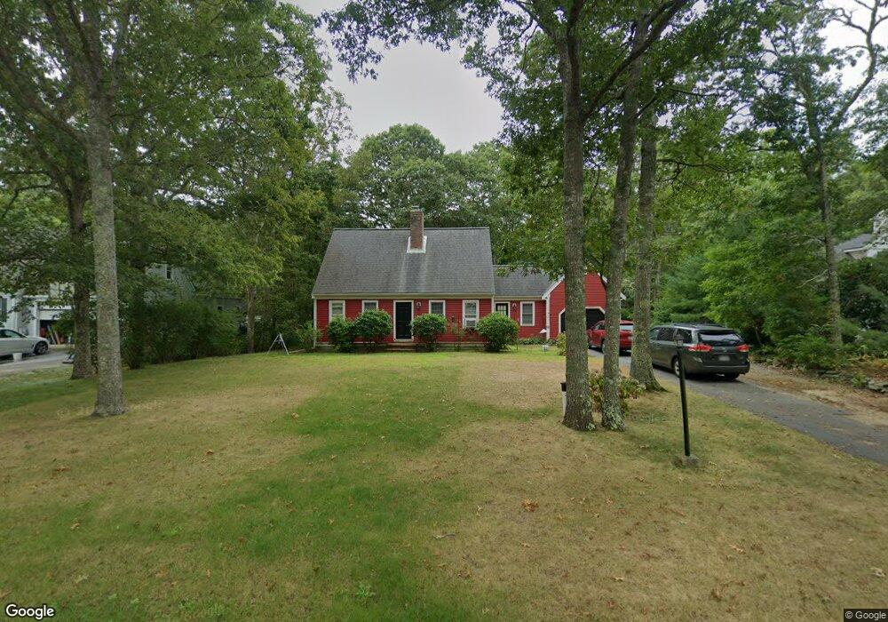
98 Bog River Bend Mashpee, MA 02649
Estimated Value: $615,000 - $796,000
3
Beds
2
Baths
1,501
Sq Ft
$454/Sq Ft
Est. Value
About This Home
This home is located at 98 Bog River Bend, Mashpee, MA 02649 and is currently estimated at $681,046, approximately $453 per square foot. 98 Bog River Bend is a home located in Barnstable County with nearby schools including Kenneth C. Coombs School, Quashnet School, and Mashpee Middle School.
Ownership History
Date
Name
Owned For
Owner Type
Purchase Details
Closed on
Aug 30, 2001
Sold by
Krefter Marco
Bought by
Ware Jonathan D and Jensen Laura C
Current Estimated Value
Home Financials for this Owner
Home Financials are based on the most recent Mortgage that was taken out on this home.
Original Mortgage
$193,600
Outstanding Balance
$72,450
Interest Rate
7.06%
Mortgage Type
Purchase Money Mortgage
Estimated Equity
$608,596
Purchase Details
Closed on
Feb 28, 1997
Sold by
Richard Michael E and Meehan-Richard Lori
Bought by
Krefter Marco
Create a Home Valuation Report for This Property
The Home Valuation Report is an in-depth analysis detailing your home's value as well as a comparison with similar homes in the area
Purchase History
| Date | Buyer | Sale Price | Title Company |
|---|---|---|---|
| Ware Jonathan D | $242,000 | -- | |
| Krefter Marco | $142,000 | -- |
Source: Public Records
Mortgage History
| Date | Status | Borrower | Loan Amount |
|---|---|---|---|
| Open | Ware Jonathan D | $193,600 |
Source: Public Records
Tax History
| Year | Tax Paid | Tax Assessment Tax Assessment Total Assessment is a certain percentage of the fair market value that is determined by local assessors to be the total taxable value of land and additions on the property. | Land | Improvement |
|---|---|---|---|---|
| 2025 | $3,658 | $552,600 | $233,000 | $319,600 |
| 2024 | $3,320 | $516,400 | $211,800 | $304,600 |
| 2023 | $3,166 | $451,600 | $201,700 | $249,900 |
| 2022 | $3,009 | $368,300 | $164,000 | $204,300 |
| 2021 | $215 | $317,900 | $141,600 | $176,300 |
| 2020 | $2,801 | $308,100 | $136,100 | $172,000 |
| 2019 | $206 | $295,600 | $136,100 | $159,500 |
| 2018 | $2,535 | $284,200 | $136,100 | $148,100 |
| 2017 | $197 | $288,200 | $153,900 | $134,300 |
| 2016 | $2,575 | $278,700 | $153,900 | $124,800 |
| 2015 | $2,477 | $271,900 | $153,900 | $118,000 |
| 2014 | $2,510 | $267,300 | $149,400 | $117,900 |
Source: Public Records
Map
Nearby Homes
- 64 Ashton Ave
- 300 Nathan Ellis Hwy Unit 50
- 54 Sassacus Rd
- 211 James Cir
- 20 Twin Oaks Dr
- 20 Twin Oaks Dr Unit 20
- 17 Twin Oaks Dr Unit 17
- 33 Twin Oaks Dr Unit 33
- 44 Twin Oaks Dr Unit 44
- 44 Twin Oaks Dr
- 114 Doran Dr
- 22 Grey Hawk Dr Unit 645
- 23 Sea Spray Ave Unit 563
- 23 Sea Spray Ave
- 16 Grey Hawk Dr Unit 16
- 160 Algonquin Ave
- 168 Ninigret Ave
- 30 Grant Breen Dr
- 10 Kettle Ln
- S 121 Shellback Way Unit 121
- 94 Bog River Bend
- 104 Bog River Bend
- 90 Bog River Bend
- 112 Bog River Bend
- 84 Leather Leaf Ln
- 122 Bog River Bend
- 93 Bog River Bend
- 85 Leather Leaf Ln
- 84 Bog River Bend
- 89 Bog River Bend
- 126 Bog River Bend
- 81 Bog River Bend
- 111 Bog River Bend
- 75 Bog River Bend
- 74 Bog River Bend
- 66 Leather Leaf Ln
- 71 Bog River Bend
- 70 Bog River Bend
- 67 Leather Leaf Ln
- 60 Leather Leaf Ln
Your Personal Tour Guide
Ask me questions while you tour the home.