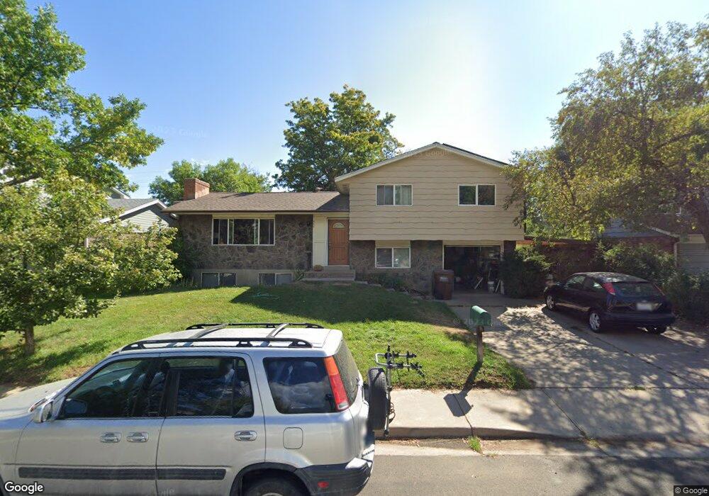
980 Mcintire St Boulder, CO 80303
Southeast Boulder NeighborhoodEstimated Value: $777,391 - $836,000
2
Beds
3
Baths
1,150
Sq Ft
$702/Sq Ft
Est. Value
About This Home
This home is located at 980 Mcintire St, Boulder, CO 80303 and is currently estimated at $806,848, approximately $701 per square foot. 980 Mcintire St is a home located in Boulder County with nearby schools including Eisenhower Elementary School, Manhattan Middle School of the Arts & Academics, and Fairview High School.
Ownership History
Date
Name
Owned For
Owner Type
Purchase Details
Closed on
Mar 17, 1998
Sold by
Lewin Leonard and Lewin Daphne D
Bought by
Self George Edison
Current Estimated Value
Home Financials for this Owner
Home Financials are based on the most recent Mortgage that was taken out on this home.
Original Mortgage
$159,200
Outstanding Balance
$29,098
Interest Rate
7.01%
Estimated Equity
$777,750
Purchase Details
Closed on
Mar 5, 1998
Sold by
Lewin Leonard and Lewin Daphne D
Bought by
Self George Edison
Home Financials for this Owner
Home Financials are based on the most recent Mortgage that was taken out on this home.
Original Mortgage
$159,200
Outstanding Balance
$29,098
Interest Rate
7.01%
Estimated Equity
$777,750
Purchase Details
Closed on
Feb 6, 1969
Bought by
Self George Edison
Create a Home Valuation Report for This Property
The Home Valuation Report is an in-depth analysis detailing your home's value as well as a comparison with similar homes in the area
Home Values in the Area
Average Home Value in this Area
Purchase History
| Date | Buyer | Sale Price | Title Company |
|---|---|---|---|
| Self George Edison | -- | -- | |
| Self George Edison | $199,000 | -- | |
| Self George Edison | $21,900 | -- |
Source: Public Records
Mortgage History
| Date | Status | Borrower | Loan Amount |
|---|---|---|---|
| Open | Self George Edison | $159,200 |
Source: Public Records
Tax History
| Year | Tax Paid | Tax Assessment Tax Assessment Total Assessment is a certain percentage of the fair market value that is determined by local assessors to be the total taxable value of land and additions on the property. | Land | Improvement |
|---|---|---|---|---|
| 2025 | $4,911 | $50,444 | $31,131 | $19,313 |
| 2024 | $4,911 | $50,444 | $31,131 | $19,313 |
| 2023 | $4,826 | $55,885 | $36,508 | $23,061 |
| 2022 | $4,334 | $46,669 | $26,208 | $20,461 |
| 2021 | $4,133 | $48,013 | $26,963 | $21,050 |
| 2020 | $3,752 | $43,107 | $23,595 | $19,512 |
| 2019 | $3,695 | $43,107 | $23,595 | $19,512 |
| 2018 | $3,591 | $41,422 | $22,176 | $19,246 |
| 2017 | $3,479 | $45,794 | $24,517 | $21,277 |
| 2016 | $3,197 | $36,935 | $16,398 | $20,537 |
| 2015 | $3,028 | $30,725 | $17,273 | $13,452 |
| 2014 | $2,583 | $30,725 | $17,273 | $13,452 |
Source: Public Records
Map
Nearby Homes
- 5016 Forsythe Place
- 875 Orman Dr
- 4222 Monroe Dr Unit C
- 1180 Monroe Dr Unit B
- 695 Manhattan Dr Unit 109
- 695 Manhattan Dr Unit 116
- 695 Manhattan Dr Unit 219
- 4500 Baseline Rd Unit 1208
- 816 Sycamore Ave
- 4415 Laguna Place Unit 201
- 665 Manhattan Dr Unit 9
- 4475 Laguna Place Unit 206
- 4475 Laguna Place Unit 201
- 625 Manhattan Place Unit 308
- 655 Cree Cir
- 600 Manhattan Dr Unit A7
- 600 Manhattan Dr Unit C7
- 5550 Stonewall Place Unit 33
- 4195 Chippewa Dr
- 905 36th St
- 976 Mcintire St
- 986 Mcintire St
- 970 Mcintire St
- 990 Mcintire St
- 4795 Shoup Place
- 975 Mcintire St
- 907 Brooklawn Dr
- 965 Mcintire St
- 960 Mcintire St
- 909 Brooklawn Dr
- 4785 Shoup Place
- 995 Mcintire St
- 4780 Shoup Place
- 905 Brooklawn Dr
- 955 Mcintire St
- 950 Mcintire St
- 4820 Pennsylvania Ave
- 4775 Shoup Place
- 945 Teller Cir
- 4770 Shoup Place
Your Personal Tour Guide
Ask me questions while you tour the home.