99 Pelican Shores Dr Hampton, VA 23666
Coliseum Central NeighborhoodEstimated payment $475/month
Highlights
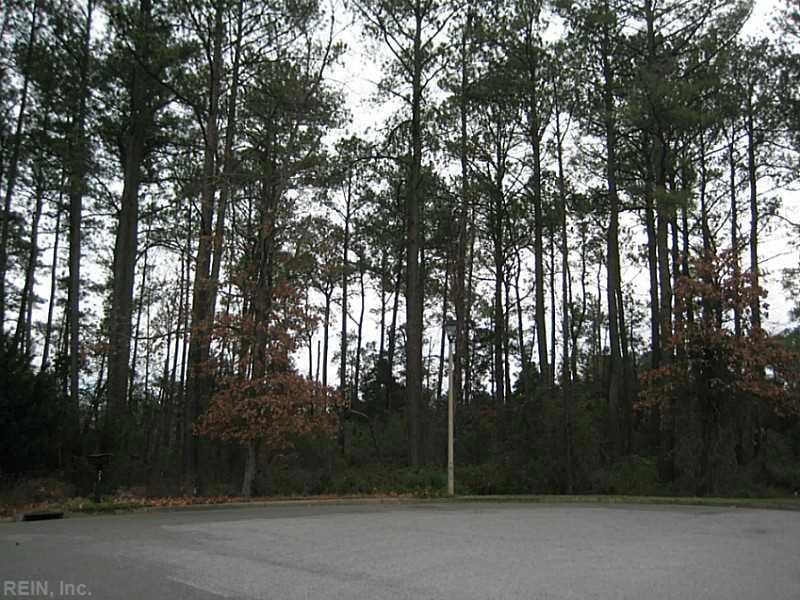
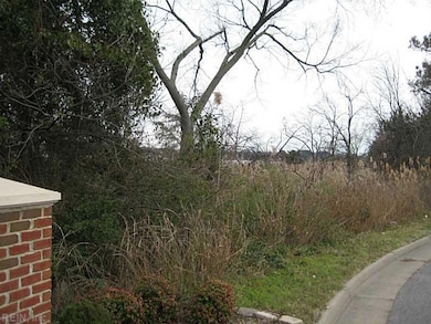
- Home fronts navigable water
- Cul-De-Sac
- Level Lot
- 5.8 Acre Lot
- Riparian rights to water flowing past the property
About This Lot
Hampton Waterfront! Estate Size Lot! Approx 5.8 Acres in Pelican Shores on Back River. Close to Langley Air Force Base! Buy now, Build later! Outstanding view, finish subdivision, close to all the Peninsula has to offer!
Property Details
Property Type
- Land
Est. Annual Taxes
- $1,531
Lot Details
- 5.8 Acre Lot
- Home fronts navigable water
- River Front
- Cul-De-Sac
- Level Lot
- Few Trees
- Property is zoned R15
Home Design
- Cluster Home
Schools
- Paul Burbank Elementary School
- C. Alton Lindsay Middle School
- Hampton High School
Utilities
- Phone Available
Community Details
Overview
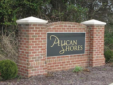
- All Others Area 103 Subdivision
Recreation
- Riparian rights to water flowing past the property
Map
Home Values in the Area
Average Home Value in this Area
Tax History
| Year | Tax Paid | Tax Assessment Tax Assessment Total Assessment is a certain percentage of the fair market value that is determined by local assessors to be the total taxable value of land and additions on the property. | Land | Improvement |
|---|---|---|---|---|
| 2025 | $1,566 | $136,800 | $136,800 | $0 |
| 2024 | $1,573 | $136,800 | $136,800 | $0 |
| 2023 | $1,587 | $136,800 | $136,800 | $0 |
| 2022 | $1,514 | $128,300 | $128,300 | $0 |
| 2021 | $1,591 | $128,300 | $128,300 | $0 |
| 2020 | $1,591 | $128,300 | $128,300 | $0 |
| 2019 | $1,591 | $128,300 | $128,300 | $0 |
| 2018 | $1,500 | $128,300 | $128,300 | $0 |
| 2017 | $1,591 | $0 | $0 | $0 |
| 2016 | $1,591 | $128,300 | $0 | $0 |
| 2015 | $1,409 | $0 | $0 | $0 |
| 2014 | $1,612 | $123,500 | $123,500 | $0 |
Property History
| Date | Event | Price | List to Sale | Price per Sq Ft |
|---|---|---|---|---|
| 03/19/2026 03/19/26 | Price Changed | $65,000 | -27.8% | -- |
| 06/23/2023 06/23/23 | Price Changed | $90,000 | +12.5% | -- |
| 03/03/2022 03/03/22 | Price Changed | $80,000 | -5.9% | -- |
| 11/06/2020 11/06/20 | Price Changed | $85,000 | -10.5% | -- |
| 08/31/2018 08/31/18 | Price Changed | $95,000 | -24.0% | -- |
| 10/27/2017 10/27/17 | Price Changed | $125,000 | -16.7% | -- |
| 01/06/2016 01/06/16 | For Sale | $150,000 | -- | -- |
Source: Real Estate Information Network (REIN)
MLS Number: 1601066
APN: 13002904
Disclaimer: Certain information contained herein is derived from information provided by parties other than Homes.com. All information provided is deemed reliable, but is not guaranteed to be accurate and should be independently verified.
![]() The listings data displayed on this medium comes in part from the Real Estate Information Network, Inc. (REIN) and has been authorized by participating listing Broker Members of REIN for display. REIN's listings are based upon Data submitted by its Broker Members, and REIN therefore makes no representation or warranty regarding the accuracy of the Data. All users of REIN's listings database should confirm the accuracy of the listing information directly with the listing agent.
The listings data displayed on this medium comes in part from the Real Estate Information Network, Inc. (REIN) and has been authorized by participating listing Broker Members of REIN for display. REIN's listings are based upon Data submitted by its Broker Members, and REIN therefore makes no representation or warranty regarding the accuracy of the Data. All users of REIN's listings database should confirm the accuracy of the listing information directly with the listing agent.
Copyright 2026 REIN. REIN's listings Data and information is protected under federal copyright laws. Federal law prohibits, among other acts, the unauthorized copying or alteration of, or preparation of derivative works from, all or any part of copyrighted materials, including certain compilations of Data and information. COPYRIGHT VIOLATORS MAY BE SUBJECT TO SEVERE FINES AND PENALTIES UNDER FEDERAL LAW.
REIN updates its listings on a daily basis.
Some listings may be duplicated in the search results due to the co-mingling of listings from more than one multiple listing service. Should there be different listing information between the duplicated listings; user is advised to verify the accuracy of the listing information before making any financial decisions.
Some or all of the listings (or listings Data) represented in this application have been enhanced with Data not provided by REIN. The enhancements are as follows: mapping, demographics, and economics. The source of these enhancements are: GreatSchools, CoStar, Google, Walk Score, How Loud, Collateral Analytics, Black Knight, First American, and Quantarium.
This application does not include information on all of the properties available for sale at this time.
- 77 Tide Mill Ln
- 100 Bramston Dr
- 14 Eagle Point Rd
- 408 Roane Dr
- 102 Diggs Dr
- 319 Pasture Ln
- 135 Raymond Dr
- 30 Meadowbrook Dr
- 15 King Kove Ln
- 32 Meadowbrook Dr
- 11 N Greenfield Ave
- 16 S Greenfield Ave
- 18 Brookfield Dr
- 135 Roland Dr
- 3 Hillcrest Cir
- 35 Westover St
- 56 Banister Dr
- 215 Courtney Dr
- 115 Deerfield Blvd
- 43 Hampshire Dr
- 132 Tide Mill Ln
- 115 Tide Mill Ln
- 2 Polaris St Unit A
- 232 W Gilbert St
- 225 W Gilbert St
- 217 W Gilbert St
- 2024 N Seldendale Dr
- 106 Santa Barbara Dr
- 130 Doolittle Rd
- 1563 N King St Unit 105
- 1563 N King St Unit 101
- 13 E Lamington Rd
- 1568 N King St
- 2013 N Armistead Ave
- 102 Tyburn Ct
- 2018 Cunningham Dr
- 1220 N King St
- 70 Riverchase Dr
- 2012-2014 Cunningham Dr
- 2 Abbott Dr

Ask me questions while you tour the home.