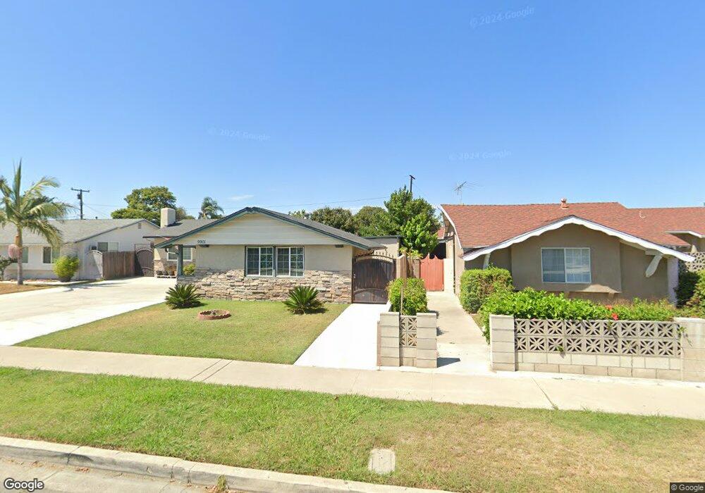
9911 Oasis Ave Garden Grove, CA 92844
Little Saigon NeighborhoodEstimated Value: $1,082,000 - $1,147,000
3
Beds
2
Baths
1,883
Sq Ft
$588/Sq Ft
Est. Value
About This Home
This home is located at 9911 Oasis Ave, Garden Grove, CA 92844 and is currently estimated at $1,107,123, approximately $587 per square foot. 9911 Oasis Ave is a home located in Orange County with nearby schools including Merton E. Hill Elementary School, Donald S. Jordan Intermediate School, and Bolsa Grande High School.
Ownership History
Date
Name
Owned For
Owner Type
Purchase Details
Closed on
Dec 6, 1996
Sold by
Barbero Gregorio B and Wenefrida Barbero Wenefrida
Bought by
Lactaoen Jaime and Lactaoen Evangeline
Current Estimated Value
Home Financials for this Owner
Home Financials are based on the most recent Mortgage that was taken out on this home.
Original Mortgage
$156,749
Interest Rate
7.63%
Mortgage Type
FHA
Create a Home Valuation Report for This Property
The Home Valuation Report is an in-depth analysis detailing your home's value as well as a comparison with similar homes in the area
Home Values in the Area
Average Home Value in this Area
Purchase History
| Date | Buyer | Sale Price | Title Company |
|---|---|---|---|
| Lactaoen Jaime | $160,000 | Fidelity National Title |
Source: Public Records
Mortgage History
| Date | Status | Borrower | Loan Amount |
|---|---|---|---|
| Previous Owner | Lactaoen Jaime | $156,749 |
Source: Public Records
Tax History Compared to Growth
Tax History
| Year | Tax Paid | Tax Assessment Tax Assessment Total Assessment is a certain percentage of the fair market value that is determined by local assessors to be the total taxable value of land and additions on the property. | Land | Improvement |
|---|---|---|---|---|
| 2025 | $3,358 | $260,575 | $163,085 | $97,490 |
| 2024 | $3,358 | $255,466 | $159,887 | $95,579 |
| 2023 | $3,292 | $250,457 | $156,752 | $93,705 |
| 2022 | $3,219 | $245,547 | $153,679 | $91,868 |
| 2021 | $3,184 | $240,733 | $150,666 | $90,067 |
| 2020 | $3,141 | $238,265 | $149,121 | $89,144 |
| 2019 | $3,083 | $233,594 | $146,197 | $87,397 |
| 2018 | $3,022 | $229,014 | $143,330 | $85,684 |
| 2017 | $2,980 | $224,524 | $140,520 | $84,004 |
| 2016 | $2,838 | $220,122 | $137,765 | $82,357 |
| 2015 | $2,797 | $216,816 | $135,696 | $81,120 |
| 2014 | $2,730 | $212,569 | $133,038 | $79,531 |
Source: Public Records
Map
Nearby Homes
- 9906 13th St
- 10061 15th St
- 14171 Flower St
- 9884 11th St
- 14362 Bushard St Unit 39
- 14362 Bushard St Unit 109
- 14151 Lake St
- 9936 Pear Dr
- 9851 Bolsa Ave Unit 198
- 9851 Bolsa Ave Unit 196
- 9200 Westminster Blvd Unit 25
- 9141 Jennrich Ave
- 14356 Taft St
- 9175 Sabre Ln
- 9800 Bolsa Ave Unit 14
- 13262 Verde St
- 10002 Central Ave Unit 26
- 10002 Central Ave Unit 27
- 10002 Central Ave
- 10002 Central Ave Unit 25
- 9901 Oasis Ave
- 9912 Reading Ave
- 9881 Oasis Ave
- 9902 Reading Ave
- 14182 Forsyth Ln
- 14192 Forsyth Ln
- 14172 Forsyth Ln
- 9882 Reading Ave
- 9902 Oasis Ave
- 9912 Oasis Ave
- 9871 Oasis Ave
- 14222 Forsyth Ln
- 9882 Oasis Ave
- 9872 Reading Ave
- 9922 Oasis Ave
- 9872 Oasis Ave
- 9861 Oasis Ave
- 14181 Brookhurst St
- 14201 Brookhurst St
- 9862 Reading Ave