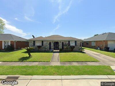
9966 E Rockton Cir New Orleans, LA 70127
Little Woods NeighborhoodEstimated Value: $153,903 - $214,000
3
Beds
2
Baths
1,560
Sq Ft
$122/Sq Ft
Est. Value
About This Home
This home is located at 9966 E Rockton Cir, New Orleans, LA 70127 and is currently estimated at $190,726, approximately $122 per square foot. 9966 E Rockton Cir is a home located in Orleans Parish with nearby schools including ReNEW Dolores T. Aaron Academy, Robert Russa Moton Charter School, and Renew Schaumburg Elementary School.
Ownership History
Date
Name
Owned For
Owner Type
Purchase Details
Closed on
May 3, 2005
Sold by
Fitzsimons Nancy
Bought by
Mcgill Audrey
Current Estimated Value
Home Financials for this Owner
Home Financials are based on the most recent Mortgage that was taken out on this home.
Original Mortgage
$109,600
Interest Rate
6.06%
Create a Home Valuation Report for This Property
The Home Valuation Report is an in-depth analysis detailing your home's value as well as a comparison with similar homes in the area
Home Values in the Area
Average Home Value in this Area
Purchase History
| Date | Buyer | Sale Price | Title Company |
|---|---|---|---|
| Mcgill Audrey | $137,000 | -- |
Source: Public Records
Mortgage History
| Date | Status | Borrower | Loan Amount |
|---|---|---|---|
| Open | Mcgill Audrey | $100,000 | |
| Closed | Mcgill Audrey | $27,900 | |
| Closed | Mcgill Audrey | $109,600 |
Source: Public Records
Tax History Compared to Growth
Tax History
| Year | Tax Paid | Tax Assessment Tax Assessment Total Assessment is a certain percentage of the fair market value that is determined by local assessors to be the total taxable value of land and additions on the property. | Land | Improvement |
|---|---|---|---|---|
| 2025 | $979 | $14,260 | $1,980 | $12,280 |
| 2024 | $992 | $14,260 | $1,980 | $12,280 |
| 2023 | $617 | $11,710 | $1,320 | $10,390 |
| 2022 | $617 | $11,190 | $1,320 | $9,870 |
| 2021 | $703 | $11,710 | $1,320 | $10,390 |
| 2020 | $709 | $11,710 | $1,320 | $10,390 |
| 2019 | $733 | $11,710 | $1,980 | $9,730 |
| 2018 | $746 | $11,710 | $1,980 | $9,730 |
| 2017 | $698 | $11,710 | $1,980 | $9,730 |
| 2016 | $717 | $11,710 | $1,980 | $9,730 |
| 2015 | $794 | $12,310 | $1,980 | $10,330 |
| 2014 | -- | $12,310 | $1,980 | $10,330 |
| 2013 | -- | $12,310 | $1,980 | $10,330 |
Source: Public Records
Map
Nearby Homes
- 9869 E Wheaton Cir
- 9751 Andover Dr
- 10860 Morrison Rd
- 7100 Hanover Rd
- 7060 Read Ln Unit B
- 10130 Brookfield Dr
- 10210 Heritage Dr
- 7574 Avalon Way
- 10331 Brookfield Dr
- 7521 Symmes Ave
- 7531 Forest Glen Rd
- 10800 Morrison Rd Unit 118
- 7595 Forest Glen Rd
- 10701 Roger Dr Unit B
- 7240 Bundy Rd
- 7250 52 Bundy Rd
- 7741 Weaver Ave
- 9966 E Rockton Cir
- 9962 E Rockton Cir
- 9878 E Wheaton Cir
- 9956 E Rockton Cir
- 9972 E Rockton Cir
- 9882 E Wheaton Cir
- 9870 E Wheaton Cir
- 9898 E Rockton Cir
- 9950 E Rockton Cir
- 9978 E Rockton Cir
- 9862 E Wheaton Cir
- 9901 E Rockton Cir
- 9894 E Rockton Cir
- 9942 E Rockton Cir
- 9886 E Wheaton Cir
- 9984 E Rockton Cir
- 9852 E Wheaton Cir
- 9911 E Rockton Cir
- 9890 E Rockton Cir
- 7280 Read Blvd