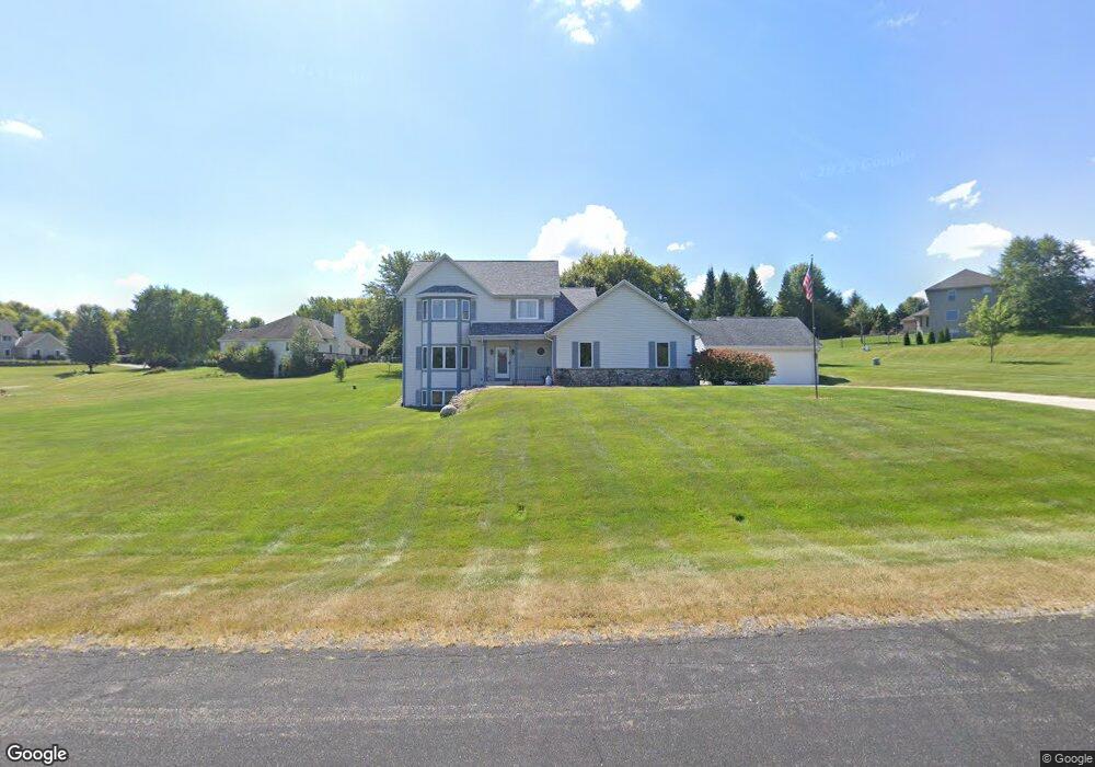
S25W29499 Jamie Ct Waukesha, WI 53188
Estimated Value: $591,570 - $878,000
--
Bed
--
Bath
--
Sq Ft
1.04
Acres
About This Home
This home is located at S25W29499 Jamie Ct, Waukesha, WI 53188 and is currently estimated at $694,893. S25W29499 Jamie Ct is a home located in Waukesha County with nearby schools including Summit View Elementary School, Butler Middle School, and West High School.
Ownership History
Date
Name
Owned For
Owner Type
Purchase Details
Closed on
Oct 28, 2014
Sold by
Williams Neil M and Williams Mary F
Bought by
Neil M And Mary F Williams Trust
Current Estimated Value
Purchase Details
Closed on
Dec 31, 1999
Sold by
X L T Ltd
Bought by
Williams Neil M and Williams Mary F
Home Financials for this Owner
Home Financials are based on the most recent Mortgage that was taken out on this home.
Original Mortgage
$33,900
Interest Rate
7.81%
Mortgage Type
Purchase Money Mortgage
Create a Home Valuation Report for This Property
The Home Valuation Report is an in-depth analysis detailing your home's value as well as a comparison with similar homes in the area
Home Values in the Area
Average Home Value in this Area
Purchase History
| Date | Buyer | Sale Price | Title Company |
|---|---|---|---|
| Neil M And Mary F Williams Trust | -- | None Available | |
| Williams Neil M | $47,900 | -- |
Source: Public Records
Mortgage History
| Date | Status | Borrower | Loan Amount |
|---|---|---|---|
| Closed | Williams Neil M | $33,900 |
Source: Public Records
Tax History Compared to Growth
Tax History
| Year | Tax Paid | Tax Assessment Tax Assessment Total Assessment is a certain percentage of the fair market value that is determined by local assessors to be the total taxable value of land and additions on the property. | Land | Improvement |
|---|---|---|---|---|
| 2024 | $4,417 | $540,500 | $141,000 | $399,500 |
| 2023 | $4,175 | $535,500 | $136,000 | $399,500 |
| 2022 | $4,544 | $499,000 | $116,000 | $383,000 |
| 2021 | $4,651 | $376,000 | $80,000 | $296,000 |
| 2020 | $4,780 | $376,000 | $80,000 | $296,000 |
| 2019 | $4,504 | $376,000 | $80,000 | $296,000 |
| 2018 | $4,310 | $376,000 | $80,000 | $296,000 |
| 2017 | $4,293 | $376,000 | $80,000 | $296,000 |
| 2016 | $4,498 | $376,000 | $80,000 | $296,000 |
| 2015 | $4,617 | $376,000 | $80,000 | $296,000 |
| 2014 | $4,436 | $365,000 | $80,000 | $285,000 |
| 2013 | $4,436 | $365,000 | $80,000 | $285,000 |
Source: Public Records
Map
Nearby Homes
- S25W29201 Cambrian Ridge
- S27W30015 N Bethesda Cir
- 105 Legend Way
- S23W30709 Brecon Way
- S17W28902 Price Ct
- W304S1779 Pinehurst Ct
- 447 Dugan Rd
- 715 Lochtyn Ridge
- 205 Kummrow Ct
- 329 Breck Rd
- 224 N Elias St
- 3741 Howell Oaks Dr
- 440 S Brandybrook Rd
- 156 Olde Howell Ct
- 3645 Olde Howell Rd
- 3637 Olde Howell Rd
- 115 Retzer View Ct
- Lt14 Merrimac Trail
- 116 W Main St
- 3558 Howell Oaks Dr
- W295S2592 Jamie Ct
- W294S2595 Cambrian Ridge
- W295S2590 Jamie Ct
- S25W29480 Jamie Ct
- S25W29532 Jamie Ct
- W294S2623 Cambrian Ridge
- W295S2577 Jamie Ct
- W295S2628 Jamie Ct
- W295S2593 Jamie Ct
- W295S2609 Jamie Ct
- W295S2646 Jamie Ct
- W294S2598 Cambrian Ridge
- W294S2649 Cambrian Ridge
- W295S2633 Jamie Ct
- S25W29393 Cambrian Ridge
- S25W29210 Cambrian Ridge
- W294S2652 Cambrian Ridge
- W295S2656 Jamie Ct
- W294S2673 Cambrian Ridge
- W295S2651 Jamie Ct